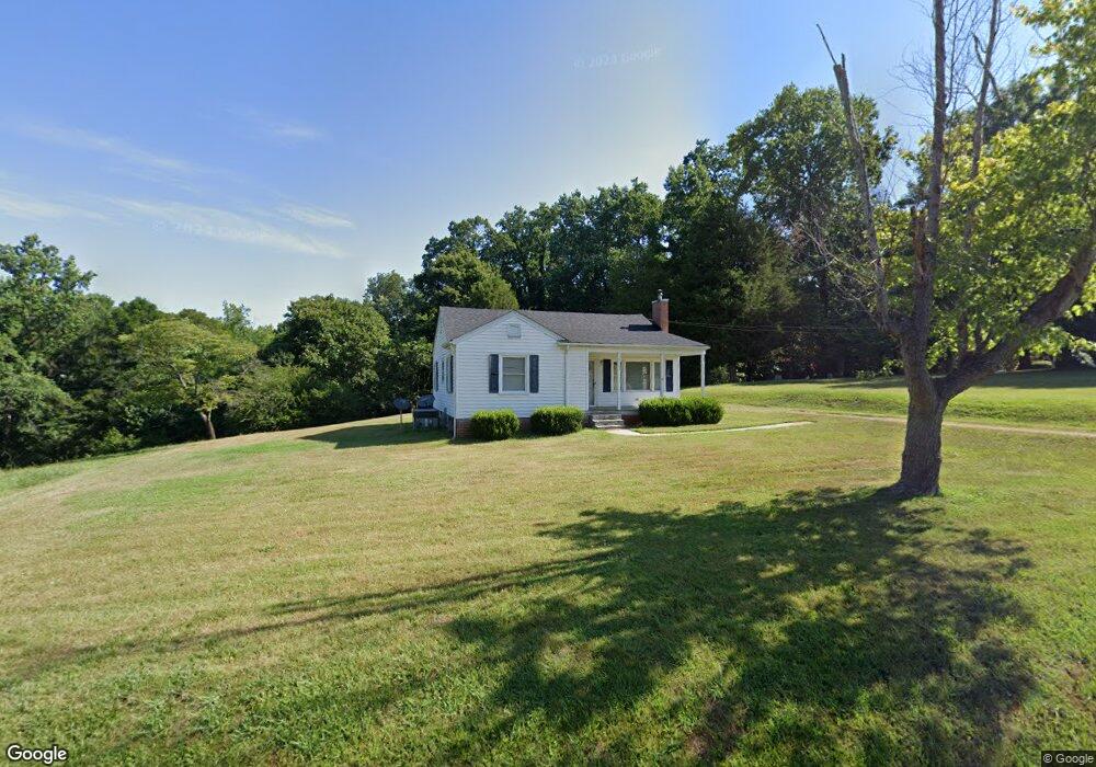
5167 Foushee Rd Ramseur, NC 27316
Estimated Value: $174,000 - $237,000
--
Bed
1
Bath
1,118
Sq Ft
$180/Sq Ft
Est. Value
About This Home
This home is located at 5167 Foushee Rd, Ramseur, NC 27316 and is currently estimated at $201,549, approximately $180 per square foot. 5167 Foushee Rd is a home located in Randolph County with nearby schools including Ramseur Elementary School, Southeastern Randolph Middle School, and Eastern Randolph High School.
Ownership History
Date
Name
Owned For
Owner Type
Purchase Details
Closed on
May 10, 2023
Sold by
Sheffield Staley Terri Ann
Bought by
Sheffiel Staley Terri Ann and Lacy Staley Bryan
Current Estimated Value
Purchase Details
Closed on
Jul 9, 2007
Sold by
Sheffield Staley George David and Sheffield Staley Terri Ann
Bought by
Sheffield Staley George David and Sheffield Staley Terri Ann
Purchase Details
Closed on
Aug 9, 1989
Bought by
Staley Terri S
Create a Home Valuation Report for This Property
The Home Valuation Report is an in-depth analysis detailing your home's value as well as a comparison with similar homes in the area
Home Values in the Area
Average Home Value in this Area
Purchase History
| Date | Buyer | Sale Price | Title Company |
|---|---|---|---|
| Sheffiel Staley Terri Ann | -- | None Listed On Document | |
| Sheffield Staley George David | -- | None Available | |
| Staley Terri S | -- | -- |
Source: Public Records
Tax History Compared to Growth
Tax History
| Year | Tax Paid | Tax Assessment Tax Assessment Total Assessment is a certain percentage of the fair market value that is determined by local assessors to be the total taxable value of land and additions on the property. | Land | Improvement |
|---|---|---|---|---|
| 2025 | $866 | $135,260 | $55,800 | $79,460 |
| 2024 | $866 | $135,260 | $55,800 | $79,460 |
| 2023 | $866 | $135,260 | $55,800 | $79,460 |
| 2022 | $623 | $80,590 | $26,000 | $54,590 |
| 2021 | $623 | $80,590 | $26,000 | $54,590 |
| 2020 | $607 | $80,590 | $26,000 | $54,590 |
| 2019 | $1,174 | $80,590 | $26,000 | $54,590 |
| 2018 | $508 | $65,710 | $19,610 | $46,100 |
| 2016 | $508 | $65,707 | $19,610 | $46,097 |
| 2015 | $496 | $65,707 | $19,610 | $46,097 |
| 2014 | -- | $65,707 | $19,610 | $46,097 |
Source: Public Records
Map
Nearby Homes
- 5182 Foushee Rd
- 324 Elam Ave
- 1001 Meadowood Dr
- 545 Coleridge Rd
- 309 Elam Ave
- 507 Columbia Ave
- 7187 Jordan Rd
- 715 Liberty St
- 321 Coleridge Rd
- 0 State Highway 49
- 4737 Huntingwood Rd
- 4650 Huntingwood Rd
- 2050 Welborn Cir
- 4659 Huntingwood Rd
- 2110 Newell St
- 5713 Us Highway 64 E
- 8521 Us Highway 64 E
- 0 Mulberry Academy St Unit 1198788
- 518 E Main St
- 4242 Lake Ridge Ct
- 5191 Foushee Rd
- 5158 Foushee Rd
- 447 Parksfield Trail
- 5128 Foushee Rd
- 5045 Reed Creek Ct
- 451 Parksfield Trail
- 00 Parksfield Trail
- 00 Parksfield Trail Unit Lot 10
- 5041 Reed Creek Ct
- 0 Parksfield Trail Unit 532521
- 0 Parksfield Trail Unit 532518
- 0 Parksfield Trail Unit 532514
- 0 Parksfield Trail Unit 532506
- 0 Parksfield Trail Unit 532502
- 0 Parksfield Trail Unit 551229
- 0 Parksfield Trail Unit 618782
- 0 Parksfield Trail Unit 919527
- 0 Parksfield Trail Unit 919528
- 0 Parksfield Trail Unit 919523
- 0 Parksfield Trail Unit 956202