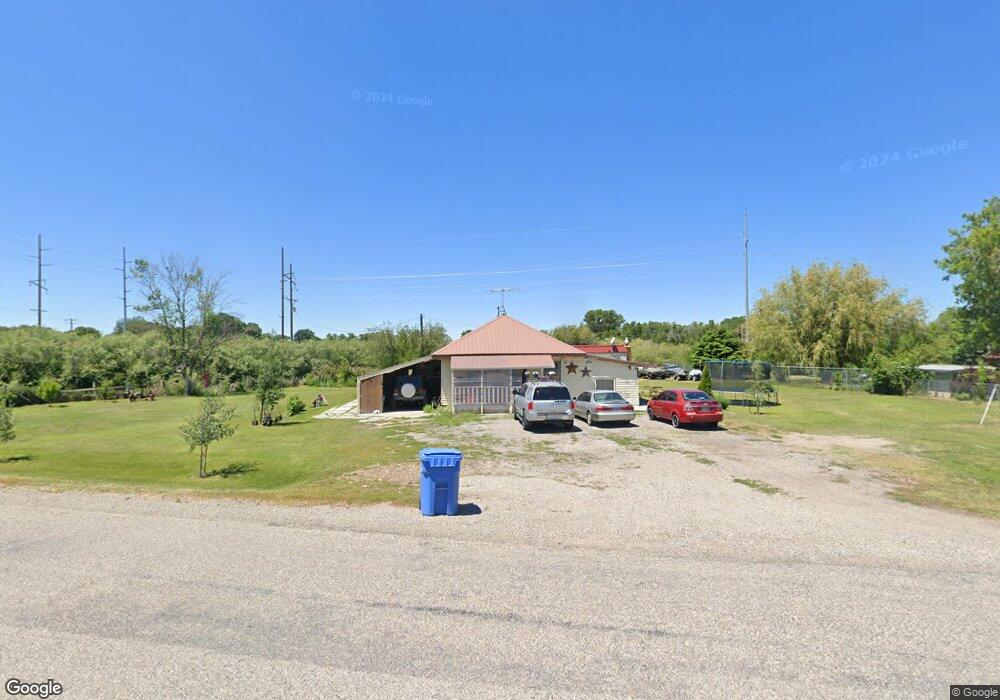
5167 S Highway 191 Rexburg, ID 83440
Estimated Value: $255,000 - $375,000
3
Beds
2
Baths
1,915
Sq Ft
$165/Sq Ft
Est. Value
About This Home
This home is located at 5167 S Highway 191, Rexburg, ID 83440 and is currently estimated at $315,114, approximately $164 per square foot. 5167 S Highway 191 is a home with nearby schools including South Fork Elementary School, Madison Junior High School, and Madison Senior High School.
Ownership History
Date
Name
Owned For
Owner Type
Purchase Details
Closed on
Jan 30, 2013
Sold by
Sutherland Harry L and Sutherland Carma
Bought by
Perez Ceh Martin Armando and Bautista Veronica Flores
Current Estimated Value
Home Financials for this Owner
Home Financials are based on the most recent Mortgage that was taken out on this home.
Original Mortgage
$143,650
Interest Rate
3.7%
Mortgage Type
New Conventional
Create a Home Valuation Report for This Property
The Home Valuation Report is an in-depth analysis detailing your home's value as well as a comparison with similar homes in the area
Home Values in the Area
Average Home Value in this Area
Purchase History
| Date | Buyer | Sale Price | Title Company |
|---|---|---|---|
| Perez Ceh Martin Armando | -- | Amerititle Idaho Falls |
Source: Public Records
Mortgage History
| Date | Status | Borrower | Loan Amount |
|---|---|---|---|
| Previous Owner | Perez Ceh Martin Armando | $143,650 |
Source: Public Records
Tax History Compared to Growth
Tax History
| Year | Tax Paid | Tax Assessment Tax Assessment Total Assessment is a certain percentage of the fair market value that is determined by local assessors to be the total taxable value of land and additions on the property. | Land | Improvement |
|---|---|---|---|---|
| 2025 | $832 | $239,238 | $60,000 | $179,238 |
| 2024 | $832 | $229,238 | $50,000 | $179,238 |
| 2023 | $832 | $219,243 | $47,733 | $171,510 |
| 2022 | $1,011 | $194,254 | $35,000 | $159,254 |
| 2021 | $1,014 | $163,319 | $27,500 | $135,819 |
| 2020 | $862 | $133,623 | $22,500 | $111,123 |
| 2019 | $1,686 | $121,871 | $22,500 | $99,371 |
| 2018 | $1,572 | $113,015 | $22,500 | $90,515 |
| 2017 | $1,554 | $111,244 | $22,500 | $88,744 |
| 2016 | $1,483 | $106,587 | $20,500 | $86,087 |
| 2013 | -- | $101,558 | $0 | $0 |
Source: Public Records
Map
Nearby Homes
- 3324 W 5200 S
- 5378 S 3100 W
- 4521 S 4300 W
- TBD Sequoia Ct
- 3800 Sequoia Ct
- 6553 Lasso Ln
- TBD Bronco Ct
- 2072 W 4700 S
- Lot 5 W 3800 S
- 4986 S 2000 W Unit 28
- 4986 S 2000 W Unit 48
- 4986 S 2000 W Unit 41
- TBD Glacier View Dr
- Ashland Plan at Harvest Estates
- Westbrook Plan at Harvest Estates
- Berrington Plan at Harvest Estates
- Denford Plan at Harvest Estates
- Milton Plan at Harvest Estates
- Foxhill Plan at Harvest Estates
- Edgeworth Plan at Harvest Estates
- 5167 S Yellowstone Hwy
- 5137 S Highway 191
- 3426 W 5200 S
- 3398 W 5200 S
- 4898 W 5200 S
- 5289 S Yellowstone Hwy
- 5289 S Highway 191
- 5245 S Yellowstone Hwy
- 5245 S Highway 191 Unit 1
- 5245 S Highway 191
- 3365 W 5200 S
- 5264 S 3450 W
- 5369 S 3450 W
- 3364 W 5200 S
- 5088 S Highway 191
- 5084 S Highway 191
- 5043 S Highway 191
- 5043 S Yellowstone Hwy
- 5385 S 3450 W
- 5236 S Highway 191