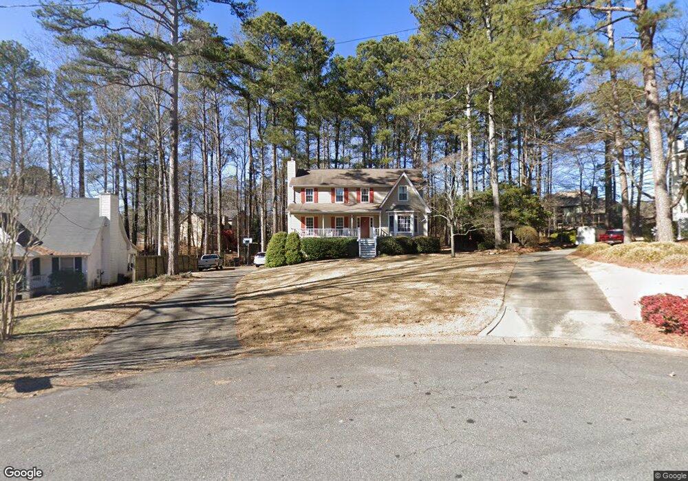
5168 Marsden Trace Powder Springs, GA 30127
West Cobb NeighborhoodEstimated Value: $377,235 - $488,000
3
Beds
3
Baths
2,041
Sq Ft
$221/Sq Ft
Est. Value
About This Home
This home is located at 5168 Marsden Trace, Powder Springs, GA 30127 and is currently estimated at $450,059, approximately $220 per square foot. 5168 Marsden Trace is a home located in Cobb County with nearby schools including Ford Elementary School, Lost Mountain Middle School, and Harrison High School.
Ownership History
Date
Name
Owned For
Owner Type
Purchase Details
Closed on
Feb 28, 1994
Sold by
Arndt Alan R
Bought by
Purser Raymond D Martha
Current Estimated Value
Home Financials for this Owner
Home Financials are based on the most recent Mortgage that was taken out on this home.
Original Mortgage
$109,250
Interest Rate
7.04%
Create a Home Valuation Report for This Property
The Home Valuation Report is an in-depth analysis detailing your home's value as well as a comparison with similar homes in the area
Home Values in the Area
Average Home Value in this Area
Purchase History
| Date | Buyer | Sale Price | Title Company |
|---|---|---|---|
| Purser Raymond D Martha | $115,500 | -- |
Source: Public Records
Mortgage History
| Date | Status | Borrower | Loan Amount |
|---|---|---|---|
| Closed | Purser Raymond D Martha | $109,250 |
Source: Public Records
Tax History Compared to Growth
Tax History
| Year | Tax Paid | Tax Assessment Tax Assessment Total Assessment is a certain percentage of the fair market value that is determined by local assessors to be the total taxable value of land and additions on the property. | Land | Improvement |
|---|---|---|---|---|
| 2025 | $935 | $181,916 | $50,000 | $131,916 |
| 2024 | $937 | $181,672 | $40,000 | $141,672 |
| 2023 | $479 | $97,168 | $24,000 | $73,168 |
| 2022 | $685 | $97,168 | $24,000 | $73,168 |
| 2021 | $685 | $97,168 | $24,000 | $73,168 |
| 2020 | $685 | $97,168 | $24,000 | $73,168 |
| 2019 | $674 | $93,632 | $24,000 | $69,632 |
| 2018 | $645 | $83,800 | $14,700 | $69,100 |
| 2017 | $574 | $83,800 | $14,700 | $69,100 |
| 2016 | $531 | $69,108 | $14,700 | $54,408 |
| 2015 | $530 | $57,612 | $14,700 | $42,912 |
| 2014 | $542 | $57,612 | $0 | $0 |
Source: Public Records
Map
Nearby Homes
- 776 Amos Ln
- 826 Omaha Place
- 265 Holland Rd
- The Sadie Plan at Livingstone Park
- The Carie Plan at Livingstone Park
- The Cameron Plan at Livingstone Park
- The Melissa Plan at Livingstone Park
- The Whitney Plan at Livingstone Park
- 952 Thousand Oaks Bend NW Unit 6
- 5567 Forest Edge Ln NW
- 632 Owl Creek Dr
- 390 Scott Farm Dr
- 718 1st Cotton Dr
- 5570 Fords Crossing Ct NW
- 1303 Cobblemill Way NW
- 403 Wild Iris Ln Unit 6
- 870 Fairwood Pointe NW
- 725 Holland Rd
- 5519 Hurstcliffe Dr NW
- 5167 Marsden Trace
- 707 Oak Mountain Rd NW
- 711 Oak Mountain Rd NW
- 5520 Hurstcliffe Dr NW
- 5172 Marsden Trace
- 5521 Hurstcliffe Dr NW Unit 15
- 5521 Hurstcliffe Dr NW
- 703 Oak Mountain Rd NW
- 5169 Marsden Trace
- 5522 Hurstcliffe Dr NW
- 5523 Hurstcliffe Dr NW
- 719 Oak Mountain Rd NW
- 0 Oak Mountain Rd NW Unit 7326973
- 0 Oak Mountain Rd NW Unit 7096014
- 0 Oak Mountain Rd NW Unit 3210013
- 0 Oak Mountain Rd NW Unit 8606253
- 0 Oak Mountain Rd NW Unit 8337005
- 0 Oak Mountain Rd NW Unit 8243599
- 0 Oak Mountain Rd NW Unit 8030943