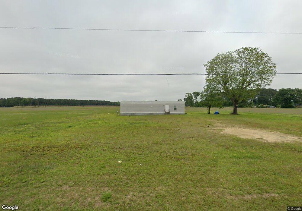
5168 Pauls Path Rd La Grange, NC 28551
Estimated Value: $309,000 - $751,739
4
Beds
3
Baths
3,372
Sq Ft
$139/Sq Ft
Est. Value
About This Home
This home is located at 5168 Pauls Path Rd, La Grange, NC 28551 and is currently estimated at $468,935, approximately $139 per square foot. 5168 Pauls Path Rd is a home located in Lenoir County with nearby schools including La Grange Elementary School, E.B. Frink Middle School, and North Lenoir High School.
Ownership History
Date
Name
Owned For
Owner Type
Purchase Details
Closed on
Nov 17, 2017
Sold by
Griffin Clifton Lee and Griffin Jeana Deann
Bought by
Cash Bryan Henderson and Cash Casey Miller
Current Estimated Value
Purchase Details
Closed on
Jun 30, 2014
Sold by
Herring Garrison Judy Carol and Herring Franklin Allen
Bought by
Griffin Clifton Lee and Griffin Jeana Deann
Home Financials for this Owner
Home Financials are based on the most recent Mortgage that was taken out on this home.
Original Mortgage
$120,000
Interest Rate
4.23%
Mortgage Type
Future Advance Clause Open End Mortgage
Create a Home Valuation Report for This Property
The Home Valuation Report is an in-depth analysis detailing your home's value as well as a comparison with similar homes in the area
Home Values in the Area
Average Home Value in this Area
Purchase History
| Date | Buyer | Sale Price | Title Company |
|---|---|---|---|
| Cash Bryan Henderson | $170,000 | None Available | |
| Griffin Clifton Lee | $140,000 | None Available |
Source: Public Records
Mortgage History
| Date | Status | Borrower | Loan Amount |
|---|---|---|---|
| Previous Owner | Griffin Clifton Lee | $120,000 |
Source: Public Records
Tax History Compared to Growth
Tax History
| Year | Tax Paid | Tax Assessment Tax Assessment Total Assessment is a certain percentage of the fair market value that is determined by local assessors to be the total taxable value of land and additions on the property. | Land | Improvement |
|---|---|---|---|---|
| 2025 | $5,895 | $791,850 | $241,535 | $550,315 |
| 2024 | $3,779 | $398,758 | $133,470 | $265,288 |
| 2023 | $2,003 | $398,758 | $133,470 | $265,288 |
| 2022 | $2,003 | $226,321 | $133,470 | $92,851 |
| 2021 | $1,181 | $133,470 | $133,470 | $0 |
| 2020 | $1,181 | $133,470 | $133,470 | $0 |
| 2019 | $1,181 | $133,470 | $133,470 | $0 |
| 2018 | $1,161 | $133,470 | $133,470 | $0 |
| 2017 | $1,168 | $133,470 | $133,470 | $0 |
| 2014 | $1,101 | $125,800 | $125,800 | $0 |
| 2013 | -- | $125,800 | $125,800 | $0 |
| 2011 | -- | $138,108 | $137,600 | $508 |
Source: Public Records
Map
Nearby Homes
- 5130 Aldridge Store Rd
- 3796 Pecan Grove Cir
- 4310 Colie Rd
- 3821 Lindsey Ln
- 5024 Gladys Owens St
- 3777 Waters Mill Rd
- 3803 Huntcliff Dr
- 3766 Huntcliff Dr
- 3730 Huntcliff Dr
- 3740 Huntcliff Dr
- 3725 Huntcliff Dr
- 3696 Drew Farmer Rd
- 3684 Drew Farmer Rd
- 3711 Drew Farmer Rd
- 113 Institute
- 109 Institute
- 107 Institute
- 603 N Caswell St
- 5211 Pauls Path Rd
- 5224 Pauls Path Rd
- 5116 Pauls Path Rd
- 5106 Pauls Path Rd
- 5239 Pauls Path Rd
- 5113 Pauls Path Rd
- 5089 Pauls Path Rd
- 5089 Pauls Path Rd
- 5074 Pauls Path Rd
- 5057 Pauls Path Rd
- 5293 Pauls Path Rd
- 5045 Pauls Path Rd
- 5323 Pauls Path Rd
- 5335 Pauls Path Rd
- 5337 Pauls Path Rd
- 5350 Pauls Path Rd
- 3973 Brothers Rd
- 4019 Brothers Rd
- 5349 Pauls Path Rd
- 3947 Brothers Rd