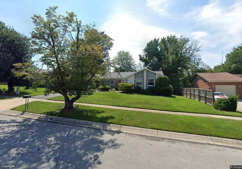
517 Cannon Rd Silver Spring, MD 20904
Estimated Value: $489,473 - $602,000
Studio
3
Baths
1,470
Sq Ft
$375/Sq Ft
Est. Value
About This Home
This home is located at 517 Cannon Rd, Silver Spring, MD 20904 and is currently estimated at $551,868, approximately $375 per square foot. 517 Cannon Rd is a home located in Montgomery County with nearby schools including Cannon Road Elementary School, Francis Scott Key Middle School, and Springbrook High School.
Ownership History
Date
Name
Owned For
Owner Type
Purchase Details
Closed on
Oct 19, 2012
Sold by
Barker Sandra B and Barker Alexis
Bought by
Barker Sandra B
Current Estimated Value
Home Financials for this Owner
Home Financials are based on the most recent Mortgage that was taken out on this home.
Original Mortgage
$100,000
Outstanding Balance
$68,821
Interest Rate
3.38%
Mortgage Type
New Conventional
Estimated Equity
$483,047
Purchase Details
Closed on
Oct 3, 2006
Sold by
Barker S S and Barker Ra B
Bought by
Barker Sandra
Purchase Details
Closed on
Oct 2, 2006
Sold by
Barker S S and Barker Ra B
Bought by
Barker Sandra
Create a Home Valuation Report for This Property
The Home Valuation Report is an in-depth analysis detailing your home's value as well as a comparison with similar homes in the area
Home Values in the Area
Average Home Value in this Area
Purchase History
| Date | Buyer | Sale Price | Title Company |
|---|---|---|---|
| Barker Sandra B | -- | Pinnacle Title & Escrow Inc | |
| Barker Sandra | -- | -- | |
| Barker Sandra | -- | -- |
Source: Public Records
Mortgage History
| Date | Status | Borrower | Loan Amount |
|---|---|---|---|
| Open | Barker Sandra B | $100,000 |
Source: Public Records
Tax History
| Year | Tax Paid | Tax Assessment Tax Assessment Total Assessment is a certain percentage of the fair market value that is determined by local assessors to be the total taxable value of land and additions on the property. | Land | Improvement |
|---|---|---|---|---|
| 2025 | $5,309 | $427,067 | -- | -- |
| 2024 | $5,309 | $408,433 | $0 | $0 |
| 2023 | $4,379 | $389,800 | $217,000 | $172,800 |
| 2022 | $4,043 | $380,633 | $0 | $0 |
| 2021 | $3,742 | $371,467 | $0 | $0 |
| 2020 | $3,742 | $362,300 | $217,000 | $145,300 |
| 2019 | $3,590 | $350,900 | $0 | $0 |
| 2018 | $3,445 | $339,500 | $0 | $0 |
| 2017 | $3,378 | $328,100 | $0 | $0 |
| 2016 | $3,407 | $316,433 | $0 | $0 |
| 2015 | $3,407 | $304,767 | $0 | $0 |
| 2014 | $3,407 | $293,100 | $0 | $0 |
Source: Public Records
Map
Nearby Homes
- 7 Shaw Ave
- 605 Rosemere Ave
- 12916 Shaw Place
- 816 Rosemere Ave
- 606 Winhall Way
- 13137 Broadmore Rd
- 906 Venice Dr
- 1306 Leister Dr
- 13707 Notley Rd
- 13704 New Hampshire Ave
- 13711 Notley Rd
- 13719 Notley Rd
- 13715 Notley Rd
- 12624 Billington Rd
- 115 Lillian Ln
- 1407 Northcrest Dr
- 600 Seminole Creek Way
- 3 Shannon Ct
- 421 Beaumont Rd
- 609 Seminole Creek Way
- 601 Cannon Rd
- 515 Cannon Rd
- 604 Chichester Ln
- 606 Chichester Ln
- 602 Chichester Ln
- 513 Cannon Rd
- 603 Cannon Rd
- 600 Cannon Rd
- 608 Chichester Ln
- 516 Cannon Rd
- 13009 Autumn Dr
- 13011 Autumn Dr
- 511 Cannon Rd
- 602 Cannon Rd
- 605 Cannon Rd
- 13100 Venetian Rd
- 13005 Autumn Dr
- 610 Chichester Ln
- 514 Cannon Rd
- 603 Chichester Ln
Your Personal Tour Guide
Ask me questions while you tour the home.