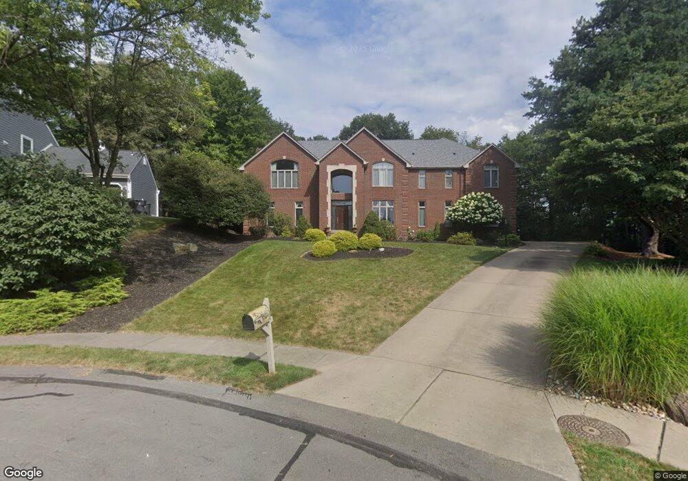
517 Colony Ct Gibsonia, PA 15044
Pine Township NeighborhoodEstimated Value: $622,000 - $869,878
4
Beds
4
Baths
4,591
Sq Ft
$171/Sq Ft
Est. Value
About This Home
This home is located at 517 Colony Ct, Gibsonia, PA 15044 and is currently estimated at $783,470, approximately $170 per square foot. 517 Colony Ct is a home located in Allegheny County with nearby schools including Hance Elementary School, Eden Hall Upper Elementary, and Pine-Richland Middle School.
Ownership History
Date
Name
Owned For
Owner Type
Purchase Details
Closed on
Dec 10, 2020
Sold by
Massucci David M and Massucci Melinda A
Bought by
Newingham Christopher M and Newingham Meredith A
Current Estimated Value
Home Financials for this Owner
Home Financials are based on the most recent Mortgage that was taken out on this home.
Original Mortgage
$250,000
Outstanding Balance
$222,971
Interest Rate
2.8%
Mortgage Type
New Conventional
Estimated Equity
$560,499
Create a Home Valuation Report for This Property
The Home Valuation Report is an in-depth analysis detailing your home's value as well as a comparison with similar homes in the area
Home Values in the Area
Average Home Value in this Area
Purchase History
| Date | Buyer | Sale Price | Title Company |
|---|---|---|---|
| Newingham Christopher M | $450,000 | None Available |
Source: Public Records
Mortgage History
| Date | Status | Borrower | Loan Amount |
|---|---|---|---|
| Open | Newingham Christopher M | $250,000 |
Source: Public Records
Tax History Compared to Growth
Tax History
| Year | Tax Paid | Tax Assessment Tax Assessment Total Assessment is a certain percentage of the fair market value that is determined by local assessors to be the total taxable value of land and additions on the property. | Land | Improvement |
|---|---|---|---|---|
| 2025 | $12,007 | $474,300 | $95,600 | $378,700 |
| 2024 | $12,007 | $474,300 | $95,600 | $378,700 |
| 2023 | $12,007 | $474,300 | $95,600 | $378,700 |
| 2022 | $12,007 | $474,300 | $95,600 | $378,700 |
| 2021 | $12,000 | $474,300 | $95,600 | $378,700 |
| 2020 | $12,007 | $492,300 | $95,600 | $396,700 |
| 2019 | $12,007 | $474,300 | $95,600 | $378,700 |
| 2018 | $2,243 | $474,300 | $95,600 | $378,700 |
| 2017 | $11,827 | $474,300 | $95,600 | $378,700 |
| 2016 | $2,243 | $474,300 | $95,600 | $378,700 |
| 2015 | $2,243 | $474,300 | $95,600 | $378,700 |
| 2014 | $11,829 | $474,300 | $95,600 | $378,700 |
Source: Public Records
Map
Nearby Homes
- 514 Colony Ct
- 505 Colony Ct
- 532 Salem Heights Dr
- 527 Salem Heights Dr
- 305 Ivy Dr
- 210 Scotch Pine Ct
- 3650 Gibsonia Rd
- 1803 N Villa Dr
- 5517 Gibson Rd
- 115 Lyndhurst Cir
- 00 Gibson Rd
- 2109 Chablis Ct
- 4104 Ben Miller Rd
- 690 Pearce Mill Rd
- 5454 Gibson Rd
- 5418 Hamilton Rd
- 2167 S Villa Dr
- 2573 Elgro Rd
- 2379 Delo Dr
- 416 Freedom Dr
- 515 Colony Ct
- 520 Colony Ct
- 513 Colony Ct
- 516 Colony Ct
- 607 Stone Haven Ct
- 511 Colony Ct
- 607 Stonehaven Ct
- 512 Colony Ct
- 605 Stonehaven Ct
- 609 Stone Haven Ct
- 609 Stonehaven Ct
- 603 Stonehaven Ct
- 508 Colony Ct
- 509 Colony Ct
- 5240 Karrington Dr
- 5242 Karrington Dr
- 3225 Deer Path Ln
- 612 Stonehaven Ct
- 5238 Karrington Dr
- 604 Karrastyn Ct