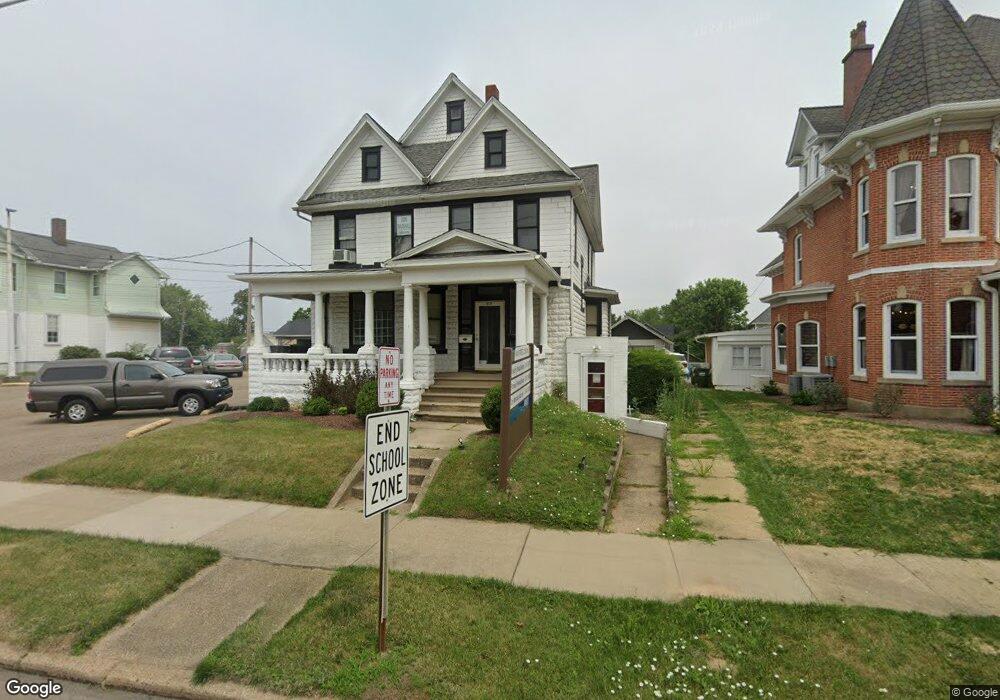
517 E Main St Louisville, OH 44641
Estimated Value: $176,000 - $225,000
Studio
2
Baths
2,308
Sq Ft
$88/Sq Ft
Est. Value
About This Home
This home is located at 517 E Main St, Louisville, OH 44641 and is currently estimated at $202,513, approximately $87 per square foot. 517 E Main St is a home with nearby schools including Louisville High School, Canton Harbor High School, and St. Thomas Aquinas High School & Middle School.
Ownership History
Date
Name
Owned For
Owner Type
Purchase Details
Closed on
Oct 3, 2019
Sold by
Marks Dale W
Bought by
Main Street Commons Llc
Current Estimated Value
Home Financials for this Owner
Home Financials are based on the most recent Mortgage that was taken out on this home.
Original Mortgage
$100,000
Outstanding Balance
$87,960
Interest Rate
3.7%
Mortgage Type
Seller Take Back
Estimated Equity
$114,553
Purchase Details
Closed on
Jul 27, 2007
Sold by
Dale W Marks Inc
Bought by
Marks Dale W
Create a Home Valuation Report for This Property
The Home Valuation Report is an in-depth analysis detailing your home's value as well as a comparison with similar homes in the area
Home Values in the Area
Average Home Value in this Area
Purchase History
| Date | Buyer | Sale Price | Title Company |
|---|---|---|---|
| Main Street Commons Llc | $105,000 | None Available | |
| Marks Dale W | -- | Attorney |
Source: Public Records
Mortgage History
| Date | Status | Borrower | Loan Amount |
|---|---|---|---|
| Open | Main Street Commons Llc | $100,000 |
Source: Public Records
Tax History
| Year | Tax Paid | Tax Assessment Tax Assessment Total Assessment is a certain percentage of the fair market value that is determined by local assessors to be the total taxable value of land and additions on the property. | Land | Improvement |
|---|---|---|---|---|
| 2025 | -- | $25,560 | $11,100 | $14,460 |
| 2024 | -- | $25,560 | $11,100 | $14,460 |
| 2023 | $1,204 | $23,210 | $10,080 | $13,130 |
| 2022 | $1,212 | $23,210 | $10,080 | $13,130 |
| 2021 | $1,196 | $23,210 | $10,080 | $13,130 |
| 2020 | $1,084 | $22,090 | $9,590 | $12,500 |
| 2019 | $1,094 | $22,090 | $9,590 | $12,500 |
Source: Public Records
Map
Nearby Homes
- 408 E Gorgas St
- 1010 Washington Ave
- 313 Ickes Ct
- 319 Superior St
- 230 Superior St
- 304 South St
- 0 Michigan Blvd
- 1431 High St
- 280 Kennedy St
- 435 Honeycrisp Dr NE
- 901 N Marion Ave
- 1402 S Chapel St
- 316 E Reno Dr
- 514 Reno Dr
- 704 Reno Dr
- 1830 Airpark Dr
- 1709 Edmar St
- 161 Beau Chemin Ave Unit 6B
- 907 Park Village Dr
- 0 Menegay Rd
- 523 E Main St
- 507 E Main St
- 528 E Main St
- 203 N Walnut St
- 520 E Main St
- 600 E Main St
- 112 Orchard Ave
- 215 N Walnut St
- 140 Church St
- 518 Washington Ave
- 612 E Main St
- 510 Washington Ave
- 407 E Main St
- 209 Orchard Ave
- 506 Washington Ave
- 118 S Walnut St
- 219 N Walnut St
- 602 Washington Ave
- 502 Washington Ave
- 119 Church St
Your Personal Tour Guide
Ask me questions while you tour the home.