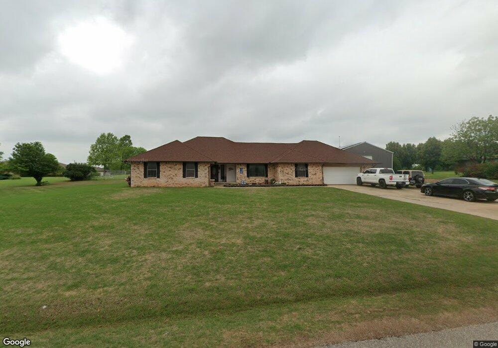
517 S Lariat Dr Mustang, OK 73064
Estimated Value: $386,000 - $506,000
4
Beds
3
Baths
2,807
Sq Ft
$159/Sq Ft
Est. Value
About This Home
This home is located at 517 S Lariat Dr, Mustang, OK 73064 and is currently estimated at $446,667, approximately $159 per square foot. 517 S Lariat Dr is a home located in Canadian County with nearby schools including Mustang Centennial Elementary School, Mustang Horizon Intermediate School, and Mustang Middle School.
Ownership History
Date
Name
Owned For
Owner Type
Purchase Details
Closed on
Jun 17, 2013
Sold by
Doubleday Joseph F and Pal M Doubleday O
Bought by
Kirby Andy Allen and Kirby Amy Dawn
Current Estimated Value
Home Financials for this Owner
Home Financials are based on the most recent Mortgage that was taken out on this home.
Original Mortgage
$171,000
Outstanding Balance
$121,910
Interest Rate
3.54%
Mortgage Type
New Conventional
Estimated Equity
$324,757
Purchase Details
Closed on
Oct 31, 1994
Sold by
Whittern Rex D and Whittern Paula L
Purchase Details
Closed on
Nov 28, 1990
Purchase Details
Closed on
Jul 9, 1987
Create a Home Valuation Report for This Property
The Home Valuation Report is an in-depth analysis detailing your home's value as well as a comparison with similar homes in the area
Home Values in the Area
Average Home Value in this Area
Purchase History
| Date | Buyer | Sale Price | Title Company |
|---|---|---|---|
| Kirby Andy Allen | $180,000 | Ort | |
| -- | $146,500 | -- | |
| -- | -- | -- | |
| -- | -- | -- |
Source: Public Records
Mortgage History
| Date | Status | Borrower | Loan Amount |
|---|---|---|---|
| Open | Kirby Andy Allen | $171,000 |
Source: Public Records
Tax History Compared to Growth
Tax History
| Year | Tax Paid | Tax Assessment Tax Assessment Total Assessment is a certain percentage of the fair market value that is determined by local assessors to be the total taxable value of land and additions on the property. | Land | Improvement |
|---|---|---|---|---|
| 2024 | $3,116 | $33,503 | $5,575 | $27,928 |
| 2023 | $3,116 | $32,236 | $5,544 | $26,692 |
| 2022 | $3,059 | $31,298 | $5,516 | $25,782 |
| 2021 | $2,592 | $26,567 | $5,219 | $21,348 |
| 2020 | $2,529 | $25,793 | $5,059 | $20,734 |
| 2019 | $2,453 | $25,042 | $4,904 | $20,138 |
| 2018 | $2,430 | $24,313 | $4,671 | $19,642 |
| 2017 | $2,329 | $23,605 | $4,281 | $19,324 |
| 2016 | $2,263 | $23,605 | $4,327 | $19,278 |
| 2015 | $2,139 | $22,250 | $3,554 | $18,696 |
| 2014 | $2,139 | $21,602 | $3,000 | $18,602 |
Source: Public Records
Map
Nearby Homes
- 520 S Owen Dr
- 10009 SW 39th St
- 10013 SW 39th St
- 850 W Forest Dr
- 313 N Shannon Way
- 844 W Forest Dr
- 1035 W Windsor Way
- 400 N Amethyst Way
- 309 N Topaz Way
- 401 N Topaz Way
- 1405 S Dean Dr
- 1315 S Grace Dr
- 11617 SW 56th St
- 716 N Cottontail Way
- 513 N Shannon Way
- 320 N Jasper Way
- 609 N Centennial Way
- 508 N Caddell Way
- 635 W Hillcrest Dr
- 1809 W Aqua Clear Dr
- 415 S Lariat Dr
- 520 S Lariat Dr
- 533 S Lariat Dr
- 418 S Lariat Dr
- 401 S Lariat Dr
- 1320 W Rose Hill Dr
- 612 S Lariat Dr
- 615 S Lariat Dr
- 1250 W Rancho Dr
- 1148 W Rancho Dr
- 1319 W Rose Hill Dr
- 1319 W Hillcrest Dr
- 628 S Lariat Dr
- 1239 W Rancho Dr
- 1231 W Rancho Dr
- 1231 W Rancho Dr
- 631 S Lariat Dr
- 1247 W Rancho Dr
- 1255 W Rancho Dr
- 1320 W Hillcrest Dr