Estimated Value: $225,000 - $264,000
4
Beds
3
Baths
2,400
Sq Ft
$103/Sq Ft
Est. Value
About This Home
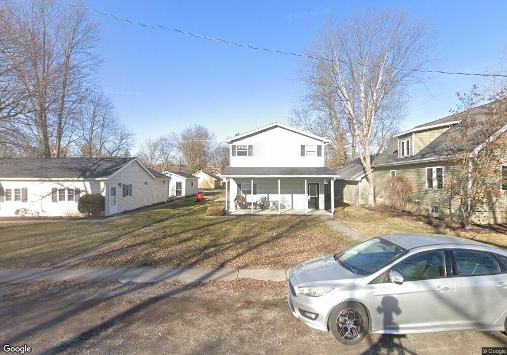
This home is located at 517 S Simon St, Ada, OH 45810 and is currently estimated at $246,908, approximately $102 per square foot. 517 S Simon St is a home located in Hardin County with nearby schools including Ada Elementary School and Ada High School.
Ownership History
Date
Name
Owned For
Owner Type
Purchase Details
Closed on
Mar 10, 2016
Bought by
Brougher Ventures Llc
Current Estimated Value
Purchase Details
Closed on
May 5, 2006
Sold by
Peelman Max E and Peelman Shannon M
Bought by
Brougher Dale R and Brougher Radell E
Purchase Details
Closed on
Apr 27, 2000
Bought by
Peelman Max E and Peelman Shannon
Purchase Details
Closed on
Nov 18, 1999
Bought by
Peelman Michael R and Peelman Carl
Purchase Details
Closed on
Apr 5, 1989
Purchase Details
Closed on
Sep 10, 1987
Create a Home Valuation Report for This Property
The Home Valuation Report is an in-depth analysis detailing your home's value as well as a comparison with similar homes in the area
Home Values in the Area
Average Home Value in this Area
Purchase History
| Date | Buyer | Sale Price | Title Company |
|---|---|---|---|
| Brougher Ventures Llc | -- | -- | |
| Brougher Dale R | -- | None Available | |
| Peelman Max E | -- | -- | |
| Peelman Michael R | $42,000 | -- | |
| -- | $24,000 | -- | |
| -- | -- | -- |
Source: Public Records
Tax History Compared to Growth
Tax History
| Year | Tax Paid | Tax Assessment Tax Assessment Total Assessment is a certain percentage of the fair market value that is determined by local assessors to be the total taxable value of land and additions on the property. | Land | Improvement |
|---|---|---|---|---|
| 2024 | $2,708 | $68,620 | $2,280 | $66,340 |
| 2023 | $2,708 | $68,620 | $2,280 | $66,340 |
| 2022 | $2,629 | $58,300 | $2,210 | $56,090 |
| 2021 | $2,889 | $58,300 | $2,210 | $56,090 |
| 2020 | $2,929 | $58,300 | $2,210 | $56,090 |
| 2019 | $2,598 | $52,270 | $2,100 | $50,170 |
| 2018 | $2,543 | $52,270 | $2,100 | $50,170 |
| 2017 | $2,578 | $52,270 | $2,100 | $50,170 |
| 2016 | $2,669 | $59,140 | $2,030 | $57,110 |
| 2015 | $2,584 | $59,140 | $2,030 | $57,110 |
| 2014 | $2,579 | $59,140 | $2,030 | $57,110 |
| 2013 | $2,899 | $62,520 | $2,030 | $60,490 |
Source: Public Records
Map
Nearby Homes
- 314 E University Ave
- 308-310 S Simon St
- 710 S Main St
- 301 S Main St
- 613 S Gilbert St
- 617 S Gilbert St
- 623 S Gilbert St
- 212 N Simon St
- 118 W Buckeye Ave
- 211 S Main St
- 211 W Buckeye Ave Unit 211 1/2
- 210 N Gilbert St
- 442 Edwards St
- 444 Edwards St Unit A, B
- 444 Edwards St Unit 2
- 128 W North Ave
- 629 N Main St
- 4071 Township Road 35
- 2864 Ohio 309
- 3931 County Road 80
- 515 S Simon St
- 521 S Simon St
- 518 S Simon St
- 510 S Simon St
- 221 E University Ave
- 216 E College Ave
- 219 E University Ave
- 522 S Johnson St
- 301 E University Ave
- 213 E University Ave
- 510 S Johnson St
- 224 E University Ave
- 218 E University Ave
- 215 E College Ave
- 534 S Johnson St
- 520 S Johnson St
- 514 S Johnson St
- 214 E University Ave
- 306 E University Ave