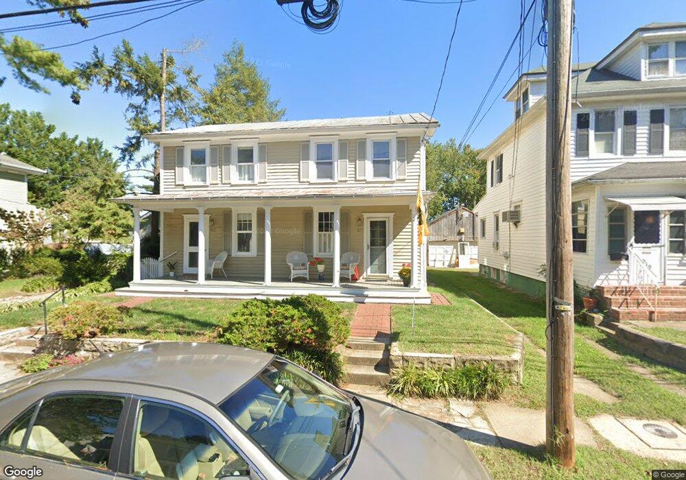
517 Sixth St Annapolis, MD 21403
Eastport NeighborhoodEstimated Value: $596,534 - $896,000
Studio
1
Bath
1,316
Sq Ft
$570/Sq Ft
Est. Value
About This Home
This home is located at 517 Sixth St, Annapolis, MD 21403 and is currently estimated at $749,884, approximately $569 per square foot. 517 Sixth St is a home located in Anne Arundel County with nearby schools including Eastport Elementary School, Annapolis Middle School, and Annapolis High School.
Ownership History
Date
Name
Owned For
Owner Type
Purchase Details
Closed on
Apr 19, 2002
Sold by
Hosler Jeffrey C
Bought by
Peterson Dick D and Peterson Dretta A
Current Estimated Value
Purchase Details
Closed on
Jun 25, 1993
Sold by
Sauders Elizabeth R
Bought by
Hosler Jeffrey C
Home Financials for this Owner
Home Financials are based on the most recent Mortgage that was taken out on this home.
Original Mortgage
$143,100
Interest Rate
7.34%
Create a Home Valuation Report for This Property
The Home Valuation Report is an in-depth analysis detailing your home's value as well as a comparison with similar homes in the area
Home Values in the Area
Average Home Value in this Area
Purchase History
| Date | Buyer | Sale Price | Title Company |
|---|---|---|---|
| Peterson Dick D | $317,500 | -- | |
| Hosler Jeffrey C | $159,000 | -- |
Source: Public Records
Mortgage History
| Date | Status | Borrower | Loan Amount |
|---|---|---|---|
| Previous Owner | Hosler Jeffrey C | $143,100 | |
| Closed | Peterson Dick D | -- |
Source: Public Records
Tax History
| Year | Tax Paid | Tax Assessment Tax Assessment Total Assessment is a certain percentage of the fair market value that is determined by local assessors to be the total taxable value of land and additions on the property. | Land | Improvement |
|---|---|---|---|---|
| 2025 | $5,795 | $617,933 | -- | -- |
| 2024 | $5,795 | $549,967 | $0 | $0 |
| 2023 | $5,358 | $482,000 | $420,000 | $62,000 |
| 2022 | $6,681 | $474,200 | $0 | $0 |
| 2020 | $10,067 | $458,600 | $395,000 | $63,600 |
| 2019 | $9,670 | $446,300 | $0 | $0 |
| 2018 | $6,037 | $434,000 | $0 | $0 |
| 2017 | $4,236 | $421,700 | $0 | $0 |
| 2016 | -- | $421,700 | $0 | $0 |
| 2015 | -- | $421,700 | $0 | $0 |
| 2014 | -- | $443,200 | $0 | $0 |
Source: Public Records
Map
Nearby Homes
- 400 Chesapeake Ave Unit 2-101
- 320 Chester Ave
- 422 Third St
- 312 Severn Ave
- 312 Severn Ave Unit W-401
- 312 Severn Ave
- 301 Burnside St
- 200 Chesapeake Ave
- 289 State St Unit 4
- 287 State St Unit 2
- 120 Chesapeake Ave
- 936 Bay Ridge Ave Unit 306
- 148 Jefferson St
- 3 Klakring Ct
- 9 Shipwright St
- 790 Fairview Ave Unit 790 C
- 513 Horn Point Dr
- 1 Shipwright Harbor
- 1106 Brashears St
- 755 Fairview Ave Unit 755 D
Your Personal Tour Guide
Ask me questions while you tour the home.