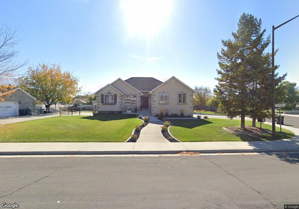
517 W 100 S Springville, UT 84663
Westfields North NeighborhoodEstimated Value: $516,000 - $597,496
3
Beds
2
Baths
3,266
Sq Ft
$169/Sq Ft
Est. Value
About This Home
This home is located at 517 W 100 S, Springville, UT 84663 and is currently estimated at $551,624, approximately $168 per square foot. 517 W 100 S is a home located in Utah County with nearby schools including Westside Elementary School, Springville Junior High School, and Springville High School.
Ownership History
Date
Name
Owned For
Owner Type
Purchase Details
Closed on
May 14, 2002
Sold by
Bank One National Assn
Bought by
Armstrong Samuel C and Armstrong Cheryl A
Current Estimated Value
Home Financials for this Owner
Home Financials are based on the most recent Mortgage that was taken out on this home.
Original Mortgage
$141,600
Outstanding Balance
$60,633
Interest Rate
7.13%
Estimated Equity
$490,991
Purchase Details
Closed on
Nov 7, 2001
Sold by
Henry Scott R and Henry Jill L
Bought by
Bank One Na
Purchase Details
Closed on
Jul 14, 1998
Sold by
Pheasant Meadows L C
Bought by
Henry Scott R and Henry Jill L
Home Financials for this Owner
Home Financials are based on the most recent Mortgage that was taken out on this home.
Original Mortgage
$128,000
Interest Rate
7%
Mortgage Type
Construction
Create a Home Valuation Report for This Property
The Home Valuation Report is an in-depth analysis detailing your home's value as well as a comparison with similar homes in the area
Home Values in the Area
Average Home Value in this Area
Purchase History
| Date | Buyer | Sale Price | Title Company |
|---|---|---|---|
| Armstrong Samuel C | -- | Sundance Title Ins Agency | |
| Bank One Na | $164,900 | -- | |
| Henry Scott R | -- | -- |
Source: Public Records
Mortgage History
| Date | Status | Borrower | Loan Amount |
|---|---|---|---|
| Open | Armstrong Samuel C | $141,600 | |
| Previous Owner | Henry Scott R | $128,000 | |
| Closed | Armstrong Samuel C | $35,400 |
Source: Public Records
Tax History
| Year | Tax Paid | Tax Assessment Tax Assessment Total Assessment is a certain percentage of the fair market value that is determined by local assessors to be the total taxable value of land and additions on the property. | Land | Improvement |
|---|---|---|---|---|
| 2025 | $2,661 | $289,410 | -- | -- |
| 2024 | $2,661 | $264,110 | $0 | $0 |
| 2023 | $2,609 | $261,360 | $0 | $0 |
| 2022 | $2,559 | $251,735 | $0 | $0 |
| 2021 | $2,177 | $332,900 | $124,300 | $208,600 |
| 2020 | $2,028 | $300,700 | $92,100 | $208,600 |
| 2019 | $1,933 | $291,400 | $88,100 | $203,300 |
| 2018 | $1,915 | $275,300 | $84,100 | $191,200 |
| 2017 | $1,865 | $142,230 | $0 | $0 |
| 2016 | $1,697 | $126,830 | $0 | $0 |
| 2015 | $1,653 | $125,950 | $0 | $0 |
| 2014 | $1,475 | $111,375 | $0 | $0 |
Source: Public Records
Map
Nearby Homes
- 224 S 550 W Unit B-2
- 293 S 450 W Unit B
- 311 W Center St
- 476 W 200 N Unit 108
- 89 N 800 W
- 550 S 400 W
- 156 N 600 W
- 249 W 300 N
- 606 S 800 W
- 758 W 375 N
- 231 N 100 W
- 572 S 100 W Unit E 210
- 234 W 700 S
- 776 S Harrison Dr Unit 78
- 743 S Harrison Dr W Unit 36
- 751 S Harrison Dr Unit 28
- 735 S Harrison Dr Unit 26
- 731 S Harrison Dr Unit 25
- 745 S Harrison Dr W Unit 37
- 618 S 100 W Unit 302