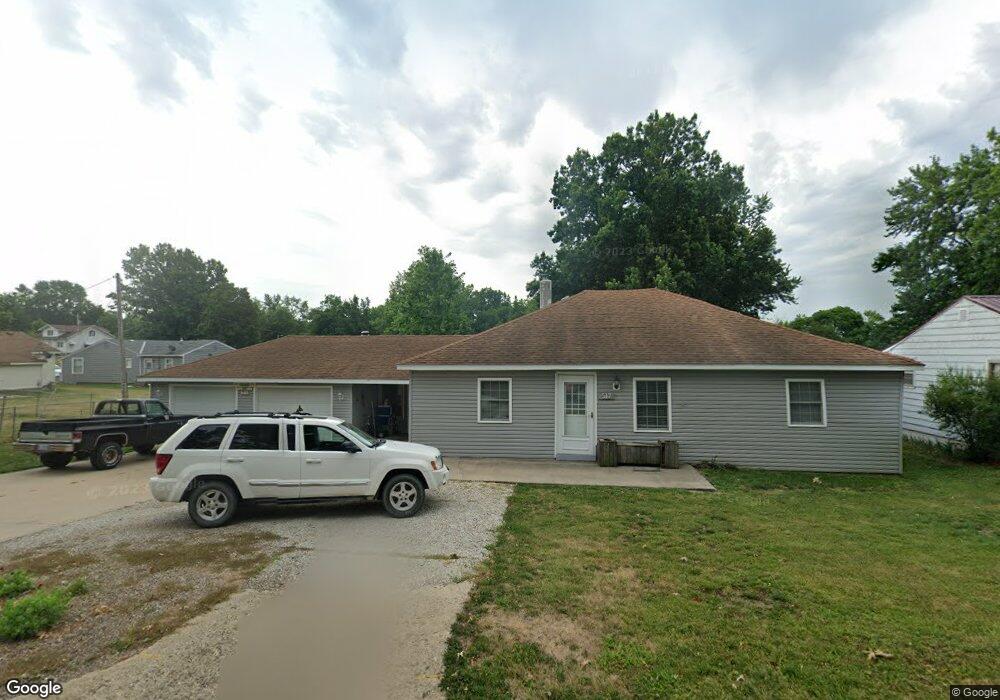
517 W Pratt St Brookfield, MO 64628
Estimated Value: $129,000 - $160,000
3
Beds
2
Baths
1,552
Sq Ft
$90/Sq Ft
Est. Value
About This Home
This home is located at 517 W Pratt St, Brookfield, MO 64628 and is currently estimated at $139,287, approximately $89 per square foot. 517 W Pratt St is a home located in Linn County with nearby schools including Brookfield Elementary School, Brookfield Middle School, and Brookfield High School.
Ownership History
Date
Name
Owned For
Owner Type
Purchase Details
Closed on
Sep 6, 2024
Sold by
Head Joseph and Head Stacy
Bought by
Simons Amanda R
Current Estimated Value
Home Financials for this Owner
Home Financials are based on the most recent Mortgage that was taken out on this home.
Original Mortgage
$128,528
Outstanding Balance
$123,957
Interest Rate
0.61%
Mortgage Type
Construction
Estimated Equity
$15,330
Purchase Details
Closed on
Apr 13, 2009
Bought by
Head Joseph E and Head Stacy R
Create a Home Valuation Report for This Property
The Home Valuation Report is an in-depth analysis detailing your home's value as well as a comparison with similar homes in the area
Home Values in the Area
Average Home Value in this Area
Purchase History
| Date | Buyer | Sale Price | Title Company |
|---|---|---|---|
| Simons Amanda R | $129,813 | Professional Land Title Co | |
| Head Joseph E | $15,000 | -- |
Source: Public Records
Mortgage History
| Date | Status | Borrower | Loan Amount |
|---|---|---|---|
| Open | Simons Amanda R | $128,528 |
Source: Public Records
Tax History
| Year | Tax Paid | Tax Assessment Tax Assessment Total Assessment is a certain percentage of the fair market value that is determined by local assessors to be the total taxable value of land and additions on the property. | Land | Improvement |
|---|---|---|---|---|
| 2025 | $502 | $8,343 | $1,520 | $6,823 |
| 2024 | $5 | $8,018 | $1,520 | $6,498 |
| 2023 | $500 | $8,018 | $1,520 | $6,498 |
| 2022 | $416 | $6,631 | $1,520 | $5,111 |
| 2021 | $401 | $6,631 | $1,520 | $5,111 |
| 2020 | $416 | $6,631 | $1,520 | $5,111 |
| 2019 | $416 | $6,631 | $1,520 | $5,111 |
| 2018 | $410 | $6,555 | $1,520 | $5,035 |
| 2015 | -- | $5,833 | $1,216 | $4,617 |
| 2011 | -- | $24,500 | $6,400 | $18,100 |
Source: Public Records
Map
Nearby Homes
- 519 W Pratt St
- 516 W Pratt St
- 516 West Ave
- 1021 Strawbridge St
- 1019 Strawbridge St
- 1101 Sunset Hill Rd
- 1017 Strawbridge St
- 1016 Pettijohn St
- 1015 Strawbridge St
- 518 Mcgowan St
- 1105 Sunset Hill Rd
- 522 Mcgowan St
- 1013 Strawbridge St
- 1022 Strawbridge St
- 1020 Strawbridge St
- 1102 Sunset Hill Rd
- 1011 Pettijohn St
- 1114 Sunset Hill Rd
- 523 Mcgowan St
- 608 Mcgowan St
Your Personal Tour Guide
Ask me questions while you tour the home.