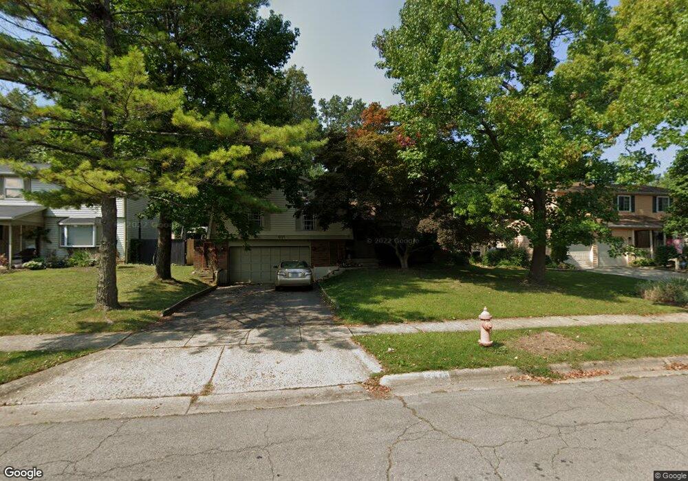
5171 Paw Paw Rd Columbus, OH 43229
Forest Park East NeighborhoodEstimated Value: $288,000 - $319,000
3
Beds
3
Baths
1,516
Sq Ft
$201/Sq Ft
Est. Value
About This Home
This home is located at 5171 Paw Paw Rd, Columbus, OH 43229 and is currently estimated at $304,750, approximately $201 per square foot. 5171 Paw Paw Rd is a home located in Franklin County with nearby schools including Avalon Elementary School, Northgate Intermediate, and Woodward Park Middle School.
Ownership History
Date
Name
Owned For
Owner Type
Purchase Details
Closed on
Oct 13, 2023
Sold by
Freniere Joel and Freniere Julie
Bought by
Freniere Julie
Current Estimated Value
Purchase Details
Closed on
Feb 28, 2020
Sold by
Rogers Dan and Rogers Mary Elizabeth
Bought by
Freniere Joel and Freniere Julie
Home Financials for this Owner
Home Financials are based on the most recent Mortgage that was taken out on this home.
Original Mortgage
$191,468
Interest Rate
2.9%
Mortgage Type
FHA
Purchase Details
Closed on
May 29, 1990
Bought by
Rogers Dan E
Purchase Details
Closed on
May 1, 1984
Create a Home Valuation Report for This Property
The Home Valuation Report is an in-depth analysis detailing your home's value as well as a comparison with similar homes in the area
Home Values in the Area
Average Home Value in this Area
Purchase History
| Date | Buyer | Sale Price | Title Company |
|---|---|---|---|
| Freniere Julie | -- | None Listed On Document | |
| Freniere Joel | $195,000 | Chicago Title Company Llc | |
| Rogers Dan E | $87,500 | -- | |
| -- | $63,900 | -- |
Source: Public Records
Mortgage History
| Date | Status | Borrower | Loan Amount |
|---|---|---|---|
| Previous Owner | Freniere Joel | $191,468 |
Source: Public Records
Tax History Compared to Growth
Tax History
| Year | Tax Paid | Tax Assessment Tax Assessment Total Assessment is a certain percentage of the fair market value that is determined by local assessors to be the total taxable value of land and additions on the property. | Land | Improvement |
|---|---|---|---|---|
| 2024 | $3,577 | $79,700 | $19,640 | $60,060 |
| 2023 | $3,531 | $79,700 | $19,640 | $60,060 |
| 2022 | $3,132 | $60,380 | $12,530 | $47,850 |
| 2021 | $3,182 | $60,380 | $12,530 | $47,850 |
| 2020 | $3,109 | $58,310 | $12,530 | $45,780 |
| 2019 | $2,124 | $43,760 | $9,280 | $34,480 |
| 2018 | $1,931 | $43,760 | $9,280 | $34,480 |
| 2017 | $2,021 | $43,760 | $9,280 | $34,480 |
| 2016 | $1,920 | $37,740 | $8,720 | $29,020 |
| 2015 | $1,743 | $37,740 | $8,720 | $29,020 |
| 2014 | $1,748 | $37,740 | $8,720 | $29,020 |
| 2013 | $921 | $39,725 | $9,170 | $30,555 |
Source: Public Records
Map
Nearby Homes
- 5204 Honeytree Loop W
- 5056 Northtowne Blvd Unit 5054
- 2058 Northcliff Dr
- 2158 Kilbourne Ave
- 2294 Teakwood Dr
- 2550 Minerva Ave
- 5124 Northcliff Loop W
- 4885 Northtowne Blvd
- 2500 Maplewood Dr
- 2134 Trent Rd
- 4849 Heatherton Dr
- 1914 Walden Dr
- 2033 Brittany Rd
- 2084 Brookfield Rd
- 5522 Parkshire Dr Unit 5522
- 5556 Parkshire Dr Unit 5556
- 5485 Tamarack Blvd
- 5578 Parkshire Dr Unit 5578
- 2244 Balmoral Rd
- 1704 Riverbirch Dr
- 5171 Paw Rd
- 5179 Paw Rd
- 5161 Paw Paw Rd
- 5179 Paw Paw Rd
- 5161 Paw Rd
- 5187 Paw Paw Rd
- 5187 Paw Paw Rd
- 2160 Maplewood Dr
- 2146 Maplewood Dr
- 5170 Paw Paw Rd
- 5170 Paw Rd
- 2131 Honeytree Ct
- 5160 Paw Paw Rd
- 5195 Paw Rd
- 5176 Paw Paw Rd
- 5160 Paw Rd
- 5195 Paw Paw Rd
- 2138 Maplewood Dr
- 2123 Honeytree Ct
- 5186 Paw Paw Rd