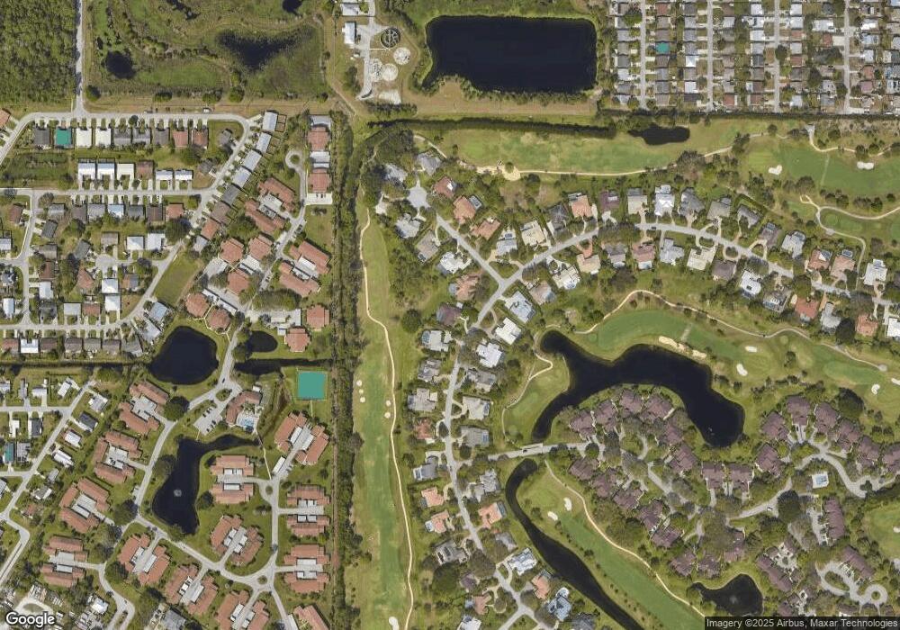
5171 SE Burning Tree Cir Stuart, FL 34997
Estimated Value: $637,055 - $758,000
3
Beds
3
Baths
2,849
Sq Ft
$242/Sq Ft
Est. Value
About This Home
This home is located at 5171 SE Burning Tree Cir, Stuart, FL 34997 and is currently estimated at $689,514, approximately $242 per square foot. 5171 SE Burning Tree Cir is a home located in Martin County with nearby schools including Sea Wind Elementary School, Murray Middle School, and South Fork High School.
Ownership History
Date
Name
Owned For
Owner Type
Purchase Details
Closed on
Feb 24, 2004
Sold by
Barrieau Lorraine L and Barrieau Gerard
Bought by
Delicio Louis S and Suzanne Delicio V
Current Estimated Value
Home Financials for this Owner
Home Financials are based on the most recent Mortgage that was taken out on this home.
Original Mortgage
$140,000
Outstanding Balance
$65,246
Interest Rate
5.63%
Mortgage Type
Unknown
Estimated Equity
$624,268
Purchase Details
Closed on
Apr 26, 1999
Sold by
Barrieau Gerard P and Barrieau L
Bought by
Barrieau Lorraine L
Purchase Details
Closed on
Apr 22, 1999
Sold by
Barrieau Gerard P and Barrieau Lorraine
Bought by
D'Elicio Louis S and D'Elicio Suzanne V
Purchase Details
Closed on
Jan 1, 1986
Bought by
D'Elicio Louis S and D'Elicio Suzanne V
Create a Home Valuation Report for This Property
The Home Valuation Report is an in-depth analysis detailing your home's value as well as a comparison with similar homes in the area
Home Values in the Area
Average Home Value in this Area
Purchase History
| Date | Buyer | Sale Price | Title Company |
|---|---|---|---|
| Delicio Louis S | $340,000 | Atlantic Title Inc | |
| Barrieau Lorraine L | $100 | -- | |
| D'Elicio Louis S | -- | -- | |
| D'Elicio Louis S | $265,000 | -- |
Source: Public Records
Mortgage History
| Date | Status | Borrower | Loan Amount |
|---|---|---|---|
| Open | Delicio Louis S | $140,000 |
Source: Public Records
Tax History
| Year | Tax Paid | Tax Assessment Tax Assessment Total Assessment is a certain percentage of the fair market value that is determined by local assessors to be the total taxable value of land and additions on the property. | Land | Improvement |
|---|---|---|---|---|
| 2025 | $3,974 | $263,725 | -- | -- |
| 2024 | $3,885 | $256,293 | -- | -- |
| 2023 | $3,885 | $248,829 | $0 | $0 |
| 2022 | $3,743 | $241,582 | $0 | $0 |
| 2021 | $3,741 | $234,546 | $0 | $0 |
| 2020 | $3,640 | $231,308 | $0 | $0 |
| 2019 | $3,580 | $226,108 | $0 | $0 |
| 2018 | $3,490 | $221,892 | $0 | $0 |
| 2017 | $2,978 | $217,329 | $0 | $0 |
| 2016 | $3,245 | $212,859 | $0 | $0 |
| 2015 | $3,085 | $211,379 | $0 | $0 |
| 2014 | $3,085 | $209,961 | $0 | $0 |
Source: Public Records
Map
Nearby Homes
- 5151 SE Burning Tree Cir
- 5101 SE Burning Tree Cir
- 5201 SE Burning Tree Cir
- 6061 SE Medinah Ln
- 6531 SE Federal Hwy Unit K-202
- 6531 SE Federal Hwy Unit 101
- 6531 SE Federal Hwy Unit N106
- 6531 SE Federal Hwy Unit Q 107
- 6531 SE Federal Hwy Unit F-107
- 6531 SE Federal Hwy Unit J202
- 6531 SE Federal Hwy Unit S201
- 6531 SE Federal Hwy Unit M111
- 6531 SE Federal Hwy Unit D112
- 5081 SE Burning Tree Cir
- 5220 SE Burning Tree Cir
- 5011 SE Brandywine Way
- 5071 SE Brandywine Way Unit 8
- 5061 SE Burning Tree Cir
- 4550 SE Salvatori Rd
- 4548 SE Salvatori Rd
- 5161 SE Burning Tree Cir
- 5170 SE Burning Tree Cir
- 6082 SE Medinah Ln
- 5180 SE Burning Tree Cir
- 6072 SE Medinah Ln
- 5150 SE Burning Tree Cir
- 5191 SE Burning Tree Cir
- 6081 SE Medinah Ln
- 5141 SE Burning Tree Cir
- 5190 SE Burning Tree Cir
- 5140 SE Burning Tree Cir
- 6071 SE Medinah Ln
- 5200 SE Burning Tree Cir
- 5131 SE Burning Tree Cir
- 5205 SE Burning Tree Cir
- 5210 SE Burning Tree Cir
- 6051 SE Medinah Ln
- 6050 SE Medinah Ln
Your Personal Tour Guide
Ask me questions while you tour the home.
