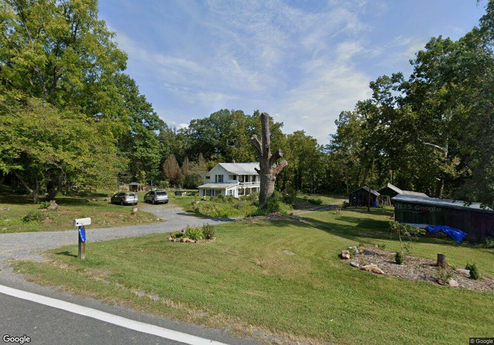
5172 Maury River Rd Rockbridge Baths, VA 24473
Estimated Value: $189,000 - $391,000
4
Beds
2
Baths
2,400
Sq Ft
$132/Sq Ft
Est. Value
About This Home
This home is located at 5172 Maury River Rd, Rockbridge Baths, VA 24473 and is currently estimated at $317,289, approximately $132 per square foot. 5172 Maury River Rd is a home located in Rockbridge County with nearby schools including Rockbridge County High School.
Ownership History
Date
Name
Owned For
Owner Type
Purchase Details
Closed on
Mar 13, 2017
Sold by
Lyle Royster Cochran
Bought by
Smith Michael M and Smith Mercedes R
Current Estimated Value
Home Financials for this Owner
Home Financials are based on the most recent Mortgage that was taken out on this home.
Original Mortgage
$114,750
Outstanding Balance
$95,210
Interest Rate
4.19%
Mortgage Type
Commercial
Estimated Equity
$222,079
Create a Home Valuation Report for This Property
The Home Valuation Report is an in-depth analysis detailing your home's value as well as a comparison with similar homes in the area
Home Values in the Area
Average Home Value in this Area
Purchase History
| Date | Buyer | Sale Price | Title Company |
|---|---|---|---|
| Smith Michael M | $135,000 | None Available |
Source: Public Records
Mortgage History
| Date | Status | Borrower | Loan Amount |
|---|---|---|---|
| Open | Smith Michael M | $114,750 |
Source: Public Records
Tax History Compared to Growth
Tax History
| Year | Tax Paid | Tax Assessment Tax Assessment Total Assessment is a certain percentage of the fair market value that is determined by local assessors to be the total taxable value of land and additions on the property. | Land | Improvement |
|---|---|---|---|---|
| 2025 | $1,313 | $205,200 | $71,400 | $133,800 |
| 2024 | $1,252 | $205,200 | $71,400 | $133,800 |
| 2023 | $1,252 | $205,200 | $71,400 | $133,800 |
| 2022 | $1,253 | $169,300 | $68,600 | $100,700 |
| 2021 | $1,253 | $169,300 | $68,600 | $100,700 |
| 2020 | $1,253 | $169,300 | $68,600 | $100,700 |
| 2019 | $1,236 | $169,300 | $68,600 | $100,700 |
| 2018 | $1,185 | $169,300 | $68,600 | $100,700 |
| 2017 | $1,185 | $169,300 | $68,600 | $100,700 |
| 2016 | $1,395 | $196,500 | $78,600 | $117,900 |
| 2015 | -- | $0 | $0 | $0 |
| 2014 | -- | $0 | $0 | $0 |
| 2013 | -- | $0 | $0 | $0 |
Source: Public Records
Map
Nearby Homes
- 69 Farmhouse Rd
- TBD Anderson Farm Rd
- 842 Adair Hill Dr
- 599 Lindsay Ln
- 621 Adair Hill Dr
- 2.02 Acres Smokey Row Rd
- 1111 Bethany Rd
- 71 Triple Crown Dr
- Lot 7 - Ridgeline Way
- TBD Mount Atlas Rd
- 0 Saddle Ridge Rd Unit 11 Reid Rd
- 4acs Reid Rd
- 370 Old Chapel Rd
- 4.12 Ac. Boundary Line Ln
- 0 Boundary Line Ln
- .45 acres Boundary Line Ln
- 3111 N Lee Hwy
- Lot 9 Skyhigh Ln
- 11 Southfork Ln
- 3441 W Midland Trail
- 5172 Maury River Rd Unit 39
- 5146 Maury River Rd
- 5146 Maury River Rd Unit 39
- 15 Maury Hills Dr Unit Rd
- 15 Maury Hills Dr
- 5238 Maury River Rd
- 99 Mccurdy Ln
- 5153 Maury River Rd
- 4129 Turkey Hill Rd
- 73 Mccurdy Ln
- 5281 Maury River Rd
- 5271 Maury River Rd
- 623 Maury Hills Dr
- 4101 Turkey Hill Rd
- 4091 Turkey Hill Rd
- 85 Meadow Ln
- 48 Meadow Ln
- 4079 Turkey Hill Rd
- 125 Rick Mast Loop
- 16 Mccurdy Ln