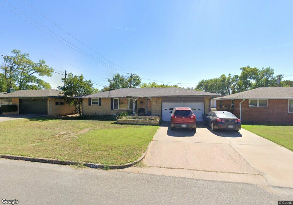
5173 Harvard Dr Bartlesville, OK 74006
Estimated Value: $123,000 - $132,000
3
Beds
2
Baths
1,230
Sq Ft
$104/Sq Ft
Est. Value
About This Home
This home is located at 5173 Harvard Dr, Bartlesville, OK 74006 and is currently estimated at $127,661, approximately $103 per square foot. 5173 Harvard Dr is a home located in Washington County with nearby schools including Hoover Elementary School, Madison Middle School, and Bartlesville High School.
Ownership History
Date
Name
Owned For
Owner Type
Purchase Details
Closed on
Jun 30, 2009
Sold by
Lohman Aldeen N
Bought by
Peters Ronnie
Current Estimated Value
Home Financials for this Owner
Home Financials are based on the most recent Mortgage that was taken out on this home.
Original Mortgage
$70,244
Outstanding Balance
$44,548
Interest Rate
4.84%
Mortgage Type
VA
Estimated Equity
$83,113
Purchase Details
Closed on
Aug 26, 2008
Sold by
Lohman Aldeen N
Bought by
Lohman Aldeen N
Purchase Details
Closed on
Feb 15, 1995
Sold by
Lohman Aldeen M
Create a Home Valuation Report for This Property
The Home Valuation Report is an in-depth analysis detailing your home's value as well as a comparison with similar homes in the area
Home Values in the Area
Average Home Value in this Area
Purchase History
| Date | Buyer | Sale Price | Title Company |
|---|---|---|---|
| Peters Ronnie | $68,000 | -- | |
| Lohman Aldeen N | -- | None Available | |
| -- | -- | -- |
Source: Public Records
Mortgage History
| Date | Status | Borrower | Loan Amount |
|---|---|---|---|
| Open | Peters Ronnie | $70,244 |
Source: Public Records
Tax History Compared to Growth
Tax History
| Year | Tax Paid | Tax Assessment Tax Assessment Total Assessment is a certain percentage of the fair market value that is determined by local assessors to be the total taxable value of land and additions on the property. | Land | Improvement |
|---|---|---|---|---|
| 2025 | $1,298 | $11,351 | $1,293 | $10,058 |
| 2024 | $1,298 | $10,811 | $1,130 | $9,681 |
| 2023 | $1,298 | $10,296 | $1,020 | $9,276 |
| 2022 | $1,233 | $10,296 | $1,020 | $9,276 |
| 2021 | $1,209 | $10,296 | $1,020 | $9,276 |
| 2020 | $1,236 | $10,296 | $1,020 | $9,276 |
| 2019 | $1,222 | $10,169 | $1,020 | $9,149 |
| 2018 | $1,216 | $10,169 | $1,020 | $9,149 |
| 2017 | $1,244 | $10,169 | $1,020 | $9,149 |
| 2016 | $1,168 | $10,169 | $1,020 | $9,149 |
| 2015 | $1,143 | $9,800 | $542 | $9,258 |
| 2014 | $860 | $8,407 | $542 | $7,865 |
Source: Public Records
Map
Nearby Homes
- 4944 Cornell Dr
- 5608 Harvard Dr
- 4917 Amherst Dr
- 4800 E Frank Phillips Blvd
- 953 Yale Dr
- 5610 Baylor Dr
- 4732 Cornell Dr
- 332 Brookline Place
- 4709 Amherst Dr
- 4701 Dartmouth Dr
- 644 SE Elmhurst Ave
- 5012 Allen Ct
- 4816 Carole Ct
- 1058 Renick Ln
- 1030 East Dr
- 4507 E Frank Phillips Blvd
- 397 Fleetwood Dr
- 616 SE Greystone Ave
- 1206 Saddle Ln
- 1000 Meadow Dr
- 5169 Harvard Dr
- 5177 Harvard Dr
- 805 S Madison Blvd
- 5165 Harvard Dr
- 5172 Harvard Dr
- 5178 Harvard Dr
- 5168 Harvard Dr
- 5161 Harvard Dr
- 5164 Harvard Dr
- 5401 Harvard Dr
- 5157 Harvard Dr
- 5160 Harvard Dr
- 5400 Harvard Dr
- 4949 Cornell Dr
- 4953 Cornell Dr
- 4945 Cornell Dr
- 5409 Harvard Dr
- 5156 Harvard Dr
- 4941 Cornell Dr
- 5408 Harvard Dr