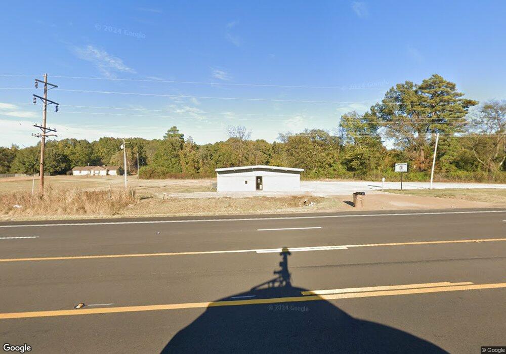
5176 N Washington St N Forrest City, AR 72335
Estimated Value: $150,914 - $172,000
--
Bed
1
Bath
1,736
Sq Ft
$92/Sq Ft
Est. Value
About This Home
This home is located at 5176 N Washington St N, Forrest City, AR 72335 and is currently estimated at $159,729, approximately $92 per square foot. 5176 N Washington St N is a home with nearby schools including Central Elementary School, Stewart Elementary School, and Forrest City Junior High School.
Ownership History
Date
Name
Owned For
Owner Type
Purchase Details
Closed on
Apr 30, 2025
Sold by
Commissioner Of State Lands
Bought by
Williford Randy and Watkins David
Current Estimated Value
Purchase Details
Closed on
Feb 24, 2023
Sold by
Commissioner Of State Lands
Bought by
Williford Randy
Purchase Details
Closed on
Jan 11, 2018
Sold by
Williford Randy
Bought by
Watkins David and Fisher Nancy
Purchase Details
Closed on
Jun 11, 1997
Sold by
Not Provided
Bought by
Williford Randy
Purchase Details
Closed on
Sep 1, 1987
Bought by
Barnett
Purchase Details
Closed on
Aug 1, 1986
Bought by
First South
Purchase Details
Closed on
Jan 1, 1983
Bought by
Prichard
Purchase Details
Closed on
Aug 1, 1980
Bought by
Holland
Create a Home Valuation Report for This Property
The Home Valuation Report is an in-depth analysis detailing your home's value as well as a comparison with similar homes in the area
Home Values in the Area
Average Home Value in this Area
Purchase History
| Date | Buyer | Sale Price | Title Company |
|---|---|---|---|
| Williford Randy | $1,726 | None Listed On Document | |
| Williford Randy | $3,179 | -- | |
| Watkins David | -- | -- | |
| Williford Randy | $30,000 | -- | |
| Barnett | $24,000 | -- | |
| First South | -- | -- | |
| Prichard | $30,000 | -- | |
| Holland | -- | -- |
Source: Public Records
Tax History Compared to Growth
Tax History
| Year | Tax Paid | Tax Assessment Tax Assessment Total Assessment is a certain percentage of the fair market value that is determined by local assessors to be the total taxable value of land and additions on the property. | Land | Improvement |
|---|---|---|---|---|
| 2024 | $1,238 | $28,330 | $2,400 | $25,930 |
| 2023 | $1,079 | $28,330 | $2,400 | $25,930 |
| 2022 | $704 | $28,330 | $2,400 | $25,930 |
| 2021 | $622 | $26,380 | $2,400 | $23,980 |
| 2020 | $596 | $26,380 | $2,400 | $23,980 |
| 2019 | $591 | $26,380 | $2,400 | $23,980 |
| 2018 | $574 | $26,380 | $2,400 | $23,980 |
| 2017 | $869 | $26,380 | $2,400 | $23,980 |
| 2016 | $792 | $18,130 | $1,400 | $16,730 |
| 2015 | $770 | $17,620 | $1,400 | $16,220 |
| 2014 | $748 | $17,110 | $1,400 | $15,710 |
Source: Public Records
Map
Nearby Homes
- 211 Woods Rd
- 0 Good Hope Rd
- 192 Sfc 322
- 0 Sfc 355
- 533 Sfc 311
- 30+\- Acres Sfc 328
- 481 Sfc 333
- 802 Sfc 328
- 0 N Washington St
- 4.59 Acres N Washington St
- 136 Sfc 224
- 423 Laughrun Dr
- 424 Beech Grove Dr
- 717 Laughrun Dr
- 361 Yorktown Dr
- 308 Trenton Rd
- 220 Lexington Dr
- 296 Old Military Rd E
- 1255 Chestnut St
- 917 Calvert Cove
- 5215 N Washington St N
- 28 Highway 261
- 5112 Highway 1 S
- 5235 Highway 1 S
- 94 Highway 261
- 87 Highway 261
- 5235 Arkansas 1
- 100 Brown St
- 211 Woodard St
- 0 Na Unit 19017225
- 156 Highway 261
- 5351 Highway 1 N
- 188 Highway 261
- 5369 Highway 1 S
- 5391 Highway 1 S
- 4885 Ar 1 Hwy N
- 282 Highway 261
- 119 Evans Rd
- 210 Woodard St
- 4845 Arkansas 1