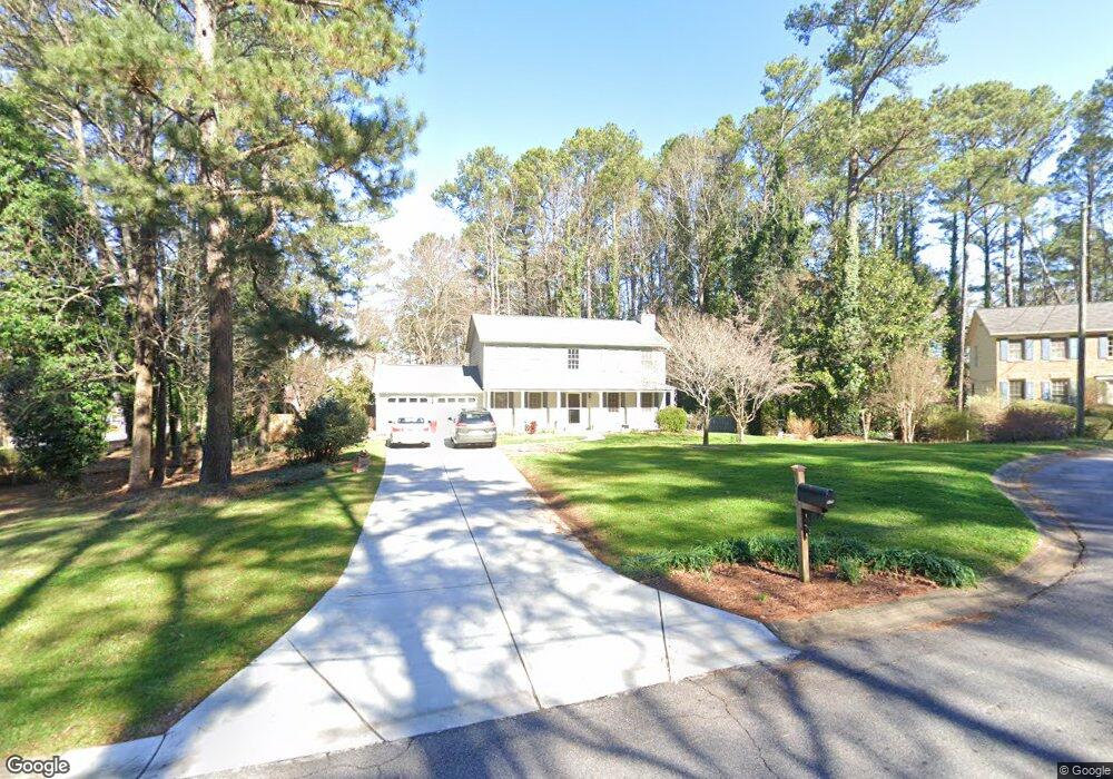
5179 Ashland Ct SW Unit 1 Lilburn, GA 30047
Estimated Value: $363,952 - $375,000
3
Beds
3
Baths
1,976
Sq Ft
$187/Sq Ft
Est. Value
About This Home
This home is located at 5179 Ashland Ct SW Unit 1, Lilburn, GA 30047 and is currently estimated at $368,988, approximately $186 per square foot. 5179 Ashland Ct SW Unit 1 is a home located in Gwinnett County with nearby schools including Camp Creek Elementary School, Trickum Middle School, and Parkview High School.
Ownership History
Date
Name
Owned For
Owner Type
Purchase Details
Closed on
Jul 5, 2006
Sold by
Bailey Phyllis V
Bought by
Cwabs Inc Loan Trust 2004-15
Current Estimated Value
Purchase Details
Closed on
Aug 25, 1999
Sold by
Couget Charles D and Couget Yvonne P
Bought by
Bailey Michael P and Bailey Phyllis V
Home Financials for this Owner
Home Financials are based on the most recent Mortgage that was taken out on this home.
Original Mortgage
$146,473
Interest Rate
7.58%
Mortgage Type
FHA
Create a Home Valuation Report for This Property
The Home Valuation Report is an in-depth analysis detailing your home's value as well as a comparison with similar homes in the area
Home Values in the Area
Average Home Value in this Area
Purchase History
| Date | Buyer | Sale Price | Title Company |
|---|---|---|---|
| Cwabs Inc Loan Trust 2004-15 | $175,747 | -- | |
| Bailey Michael P | $147,700 | -- |
Source: Public Records
Mortgage History
| Date | Status | Borrower | Loan Amount |
|---|---|---|---|
| Previous Owner | Bailey Michael P | $146,473 |
Source: Public Records
Tax History Compared to Growth
Tax History
| Year | Tax Paid | Tax Assessment Tax Assessment Total Assessment is a certain percentage of the fair market value that is determined by local assessors to be the total taxable value of land and additions on the property. | Land | Improvement |
|---|---|---|---|---|
| 2025 | $3,722 | $130,240 | $30,000 | $100,240 |
| 2024 | $3,708 | $123,840 | $30,000 | $93,840 |
| 2023 | $3,708 | $120,360 | $25,600 | $94,760 |
| 2022 | $3,594 | $120,360 | $25,600 | $94,760 |
| 2021 | $3,086 | $93,840 | $20,000 | $73,840 |
| 2020 | $2,954 | $86,760 | $17,600 | $69,160 |
| 2019 | $2,773 | $82,240 | $17,600 | $64,640 |
| 2018 | $2,773 | $82,240 | $17,600 | $64,640 |
| 2016 | $2,464 | $67,000 | $13,600 | $53,400 |
| 2015 | $2,371 | $62,720 | $9,600 | $53,120 |
| 2014 | $2,382 | $62,720 | $9,600 | $53,120 |
Source: Public Records
Map
Nearby Homes
- 5125 Ophelia Ct SW
- 1054 Morgan Garner Dr SW
- 5104 Onawa Ct SW
- 5002 Abbey Ln SW
- 1075 Westchester Dr SW
- 5145 Apollo Ln SW
- 5033 Charlemagne Way SW
- 5176 Ashford Ct SW
- 954 Camp Creek Dr SW
- 888 Castle Walk Cove SW
- 1334 Jennie Ln SW
- 881 Rockbridge Rd SW
- 730 Wisteria Vine Ln
- 5000 Bainbridge Ct SW
- 450 Rockfern Ct
- 460 Rockfern Ct Unit 14A
- 5041 Bainbridge Ct SW Unit 3
- 5189 Ashland Ct SW
- 5169 Ashland Ct SW
- 1037 Spring Mill Dr SW Unit 1
- 5158 Ashland Ct SW
- 5178 Ashland Ct SW Unit 13
- 5178 Ashland Ct SW
- 5188 Ashland Ct SW Unit 1
- 5168 Ashland Ct SW Unit 1
- 1046 Spring Mill Dr SW
- 1017 Spring Mill Dr SW
- 1036 Spring Mill Dr SW
- 1064 Garner Rd SW
- 1056 Spring Mill Dr SW Unit 1
- 1077 Spring Mill Dr SW Unit 15
- 1077 Spring Mill Dr SW
- 1054 Garner Rd SW
- 1006 Spring Mill Dr SW Unit 1
- 1066 Spring Mill Dr SW
- 5157 Parkview Ct SW
- 1026 Spring Mill Dr SW Unit 1