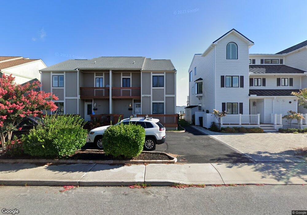
518 32nd St Ocean City, MD 21842
Estimated Value: $622,000 - $1,111,000
--
Bed
2
Baths
1,504
Sq Ft
$539/Sq Ft
Est. Value
About This Home
This home is located at 518 32nd St, Ocean City, MD 21842 and is currently estimated at $810,804, approximately $539 per square foot. 518 32nd St is a home located in Worcester County with nearby schools including Ocean City Elementary School, Stephen Decatur Middle School, and Berlin Intermediate School.
Ownership History
Date
Name
Owned For
Owner Type
Purchase Details
Closed on
Apr 22, 1998
Sold by
Arcilesi Richard D and Arcilesi Patricia M
Bought by
Arcilesi Richard D
Current Estimated Value
Purchase Details
Closed on
May 7, 1982
Sold by
Bridge Development Company
Bought by
Arcilesi Richard D and Arcilesi Patricia M
Home Financials for this Owner
Home Financials are based on the most recent Mortgage that was taken out on this home.
Original Mortgage
$77,200
Interest Rate
16.78%
Create a Home Valuation Report for This Property
The Home Valuation Report is an in-depth analysis detailing your home's value as well as a comparison with similar homes in the area
Home Values in the Area
Average Home Value in this Area
Purchase History
| Date | Buyer | Sale Price | Title Company |
|---|---|---|---|
| Arcilesi Richard D | $62,000 | -- | |
| Arcilesi Richard D | $103,000 | -- |
Source: Public Records
Mortgage History
| Date | Status | Borrower | Loan Amount |
|---|---|---|---|
| Previous Owner | Arcilesi Richard D | $77,200 |
Source: Public Records
Tax History Compared to Growth
Tax History
| Year | Tax Paid | Tax Assessment Tax Assessment Total Assessment is a certain percentage of the fair market value that is determined by local assessors to be the total taxable value of land and additions on the property. | Land | Improvement |
|---|---|---|---|---|
| 2025 | $7,898 | $612,200 | $0 | $0 |
| 2024 | $7,898 | $566,000 | $0 | $0 |
| 2023 | $7,305 | $519,800 | $340,000 | $179,800 |
| 2022 | $7,259 | $516,500 | $0 | $0 |
| 2021 | $7,252 | $513,200 | $0 | $0 |
| 2020 | $7,204 | $509,900 | $340,000 | $169,900 |
| 2019 | $7,048 | $495,400 | $0 | $0 |
| 2018 | $6,773 | $480,900 | $0 | $0 |
| 2017 | $6,588 | $466,400 | $0 | $0 |
| 2016 | -- | $451,967 | $0 | $0 |
| 2015 | $6,518 | $437,533 | $0 | $0 |
| 2014 | $6,518 | $423,100 | $0 | $0 |
Source: Public Records
Map
Nearby Homes
- 510 Penguin Dr Unit 302B
- 608 Bayshore Ct
- 2838 Gull Way
- 607 Bayshore Dr Unit 2
- 500 32nd St Unit A
- 617 Bayshore Ct Unit B
- 639 Bayshore Dr Unit 10
- 607 Osprey Rd Unit 4
- 2803 Gull Way Unit B01
- 504 Robin Dr Unit 69
- 512 Robin Dr Unit 7
- 504 Robin Dr Unit 50
- 504 Robin Dr Unit 70
- 508 Robin Dr Unit 44
- 512 Robin Dr Unit 14
- 508 Robin Dr Unit 47
- 508 Robin Dr Unit 42
- 2818 Tern Dr Unit 10
- 2807D Plover Dr Unit 4
- 2802 Tern Dr Unit 17
- 520 32nd St
- 516 32nd St
- 522 32nd St
- 514 32nd St
- 514 32nd St Unit 13 & 14 RUNAWAY BAY
- 524 32nd St
- 512 32nd St
- 526 32nd St
- 510 32nd St
- 519 32nd St
- 521 32nd St
- 528 32nd St
- 600 32nd St
- 55 Anchorage Way
- 0 Anchorage Way
- 508 32nd St Unit 301A
- 508 32nd St Unit 303A
- 508 32nd St Unit A101
- 508 32nd St Unit 302
- 508 32nd St Unit 102 A