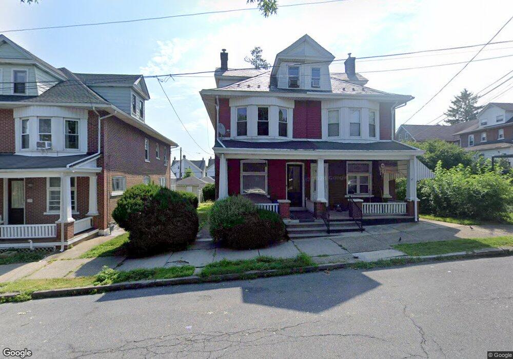
518 6th Ave Bethlehem, PA 18018
West Bethlehem NeighborhoodEstimated Value: $220,000 - $319,000
4
Beds
1
Bath
1,944
Sq Ft
$144/Sq Ft
Est. Value
About This Home
This home is located at 518 6th Ave, Bethlehem, PA 18018 and is currently estimated at $279,961, approximately $144 per square foot. 518 6th Ave is a home located in Lehigh County with nearby schools including James Buchanan Elementary School, Nitschmann Middle School, and Liberty High School.
Ownership History
Date
Name
Owned For
Owner Type
Purchase Details
Closed on
Aug 21, 2019
Sold by
Keffer David
Bought by
Keffer David J and David J Keffer Revocable Trust
Current Estimated Value
Purchase Details
Closed on
Jan 15, 2004
Sold by
Miles Andrea J and Miles Ursula
Bought by
Keffer David
Home Financials for this Owner
Home Financials are based on the most recent Mortgage that was taken out on this home.
Original Mortgage
$68,000
Outstanding Balance
$29,514
Interest Rate
4.87%
Mortgage Type
Purchase Money Mortgage
Estimated Equity
$250,447
Purchase Details
Closed on
Aug 3, 1976
Bought by
Miles Phyllis E
Create a Home Valuation Report for This Property
The Home Valuation Report is an in-depth analysis detailing your home's value as well as a comparison with similar homes in the area
Home Values in the Area
Average Home Value in this Area
Purchase History
| Date | Buyer | Sale Price | Title Company |
|---|---|---|---|
| Keffer David J | -- | None Available | |
| Keffer David | $86,000 | -- | |
| Miles Phyllis E | $23,500 | -- |
Source: Public Records
Mortgage History
| Date | Status | Borrower | Loan Amount |
|---|---|---|---|
| Open | Keffer David | $68,000 |
Source: Public Records
Tax History
| Year | Tax Paid | Tax Assessment Tax Assessment Total Assessment is a certain percentage of the fair market value that is determined by local assessors to be the total taxable value of land and additions on the property. | Land | Improvement |
|---|---|---|---|---|
| 2025 | $4,169 | $145,100 | $13,900 | $131,200 |
| 2024 | $4,121 | $145,100 | $13,900 | $131,200 |
| 2023 | $4,085 | $145,100 | $13,900 | $131,200 |
| 2022 | $4,151 | $145,100 | $131,200 | $13,900 |
| 2021 | $4,132 | $145,100 | $13,900 | $131,200 |
| 2020 | $4,000 | $145,100 | $13,900 | $131,200 |
| 2019 | $4,029 | $145,100 | $13,900 | $131,200 |
| 2018 | $3,951 | $145,100 | $13,900 | $131,200 |
| 2017 | $3,776 | $145,100 | $13,900 | $131,200 |
| 2016 | -- | $145,100 | $13,900 | $131,200 |
| 2015 | -- | $145,100 | $13,900 | $131,200 |
| 2014 | -- | $145,100 | $13,900 | $131,200 |
Source: Public Records
Map
Nearby Homes
Your Personal Tour Guide
Ask me questions while you tour the home.