Estimated Value: $132,604 - $208,000
3
Beds
2
Baths
1,232
Sq Ft
$146/Sq Ft
Est. Value
About This Home
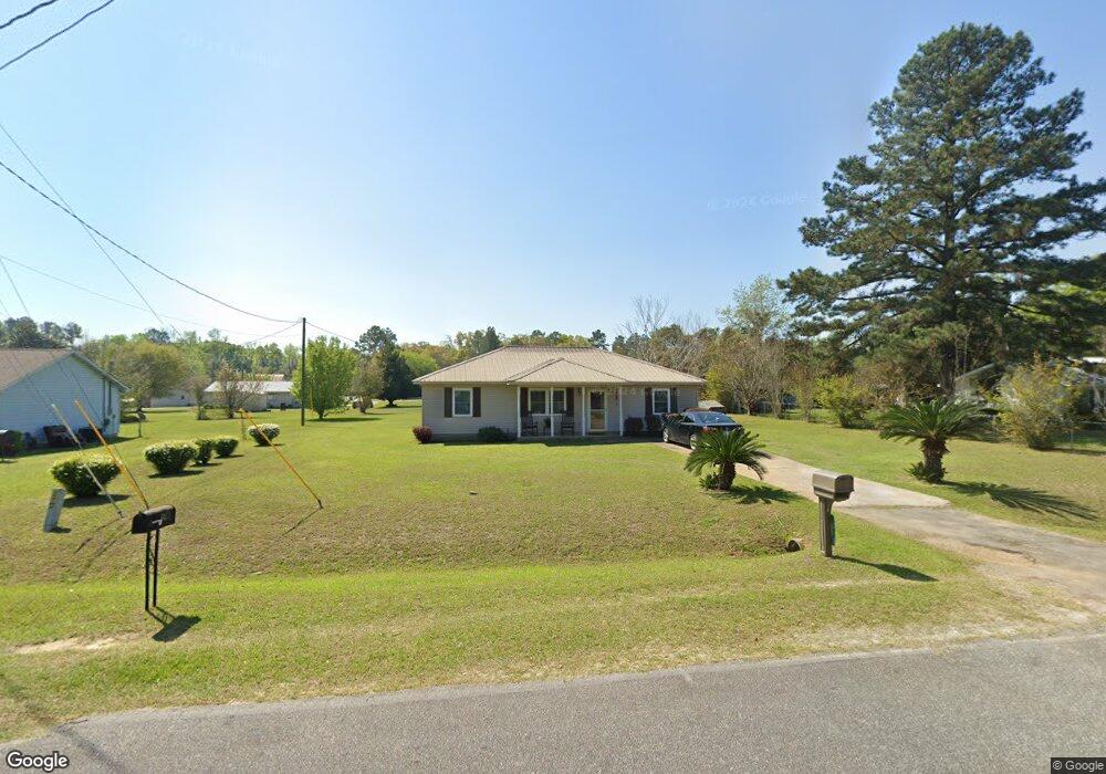
This home is located at 518 Bay Tree Rd, Cairo, GA 39828 and is currently estimated at $180,401, approximately $146 per square foot. 518 Bay Tree Rd is a home located in Grady County with nearby schools including Cairo High School.
Ownership History
Date
Name
Owned For
Owner Type
Purchase Details
Closed on
Jul 22, 2005
Sold by
Davis Latonya M
Bought by
Hudson Latonya M
Current Estimated Value
Home Financials for this Owner
Home Financials are based on the most recent Mortgage that was taken out on this home.
Original Mortgage
$66,400
Outstanding Balance
$43,934
Interest Rate
10.75%
Mortgage Type
New Conventional
Estimated Equity
$136,467
Purchase Details
Closed on
May 21, 2002
Sold by
Brannon John J
Bought by
Davis Latonya M
Purchase Details
Closed on
Jul 12, 2001
Sold by
Prince Terry
Bought by
Brannon John J
Purchase Details
Closed on
Jul 5, 2000
Sold by
Brown Connie P
Bought by
Prince Terry
Purchase Details
Closed on
Jun 6, 1996
Sold by
Hardwick Carolyn B
Bought by
Brown Connie P
Purchase Details
Closed on
May 16, 1996
Sold by
Folds Lillian E
Bought by
Hardwick Carolyn B
Purchase Details
Closed on
Nov 16, 1994
Bought by
Folds Lillian E
Create a Home Valuation Report for This Property
The Home Valuation Report is an in-depth analysis detailing your home's value as well as a comparison with similar homes in the area
Purchase History
| Date | Buyer | Sale Price | Title Company |
|---|---|---|---|
| Hudson Latonya M | -- | -- | |
| Davis Latonya M | $67,000 | -- | |
| Brannon John J | $42,000 | -- | |
| Prince Terry | $3,000 | -- | |
| Brown Connie P | -- | -- | |
| Hardwick Carolyn B | -- | -- | |
| Folds Lillian E | $54,000 | -- |
Source: Public Records
Mortgage History
| Date | Status | Borrower | Loan Amount |
|---|---|---|---|
| Open | Hudson Latonya M | $66,400 |
Source: Public Records
Tax History
| Year | Tax Paid | Tax Assessment Tax Assessment Total Assessment is a certain percentage of the fair market value that is determined by local assessors to be the total taxable value of land and additions on the property. | Land | Improvement |
|---|---|---|---|---|
| 2025 | $1,211 | $46,678 | $2,220 | $44,458 |
| 2024 | $1,211 | $41,842 | $2,220 | $39,622 |
| 2023 | $1,293 | $36,589 | $4,800 | $31,789 |
| 2022 | $1,347 | $36,589 | $4,800 | $31,789 |
| 2021 | $1,351 | $36,589 | $4,800 | $31,789 |
| 2020 | $1,354 | $36,589 | $4,800 | $31,789 |
| 2019 | $1,354 | $36,589 | $4,800 | $31,789 |
| 2018 | $1,288 | $36,589 | $4,800 | $31,789 |
| 2017 | $1,239 | $36,589 | $4,800 | $31,789 |
| 2016 | $1,059 | $30,820 | $4,800 | $26,020 |
| 2015 | $1,049 | $30,820 | $4,800 | $26,020 |
| 2014 | $1,049 | $30,820 | $4,800 | $26,020 |
| 2013 | -- | $26,316 | $4,800 | $21,516 |
Source: Public Records
Map
Nearby Homes
- 408 Bay Tree Rd NE
- 0 20th St NE
- 00 20th St NE
- 0 State Route 188
- 00 State Route 188
- 711 2nd Ave NE
- 66 22nd St NE
- 00 Blackberry Ln
- 00 Meridian Rd
- 00 Cuffhead Rd
- 00 Union Hill Rd
- 2690 U S 84
- 2975 U S 84
- 79 27th St NE
- 21 24th St NE
- 78.6 Ac Strickland Rd
- 4761 Hadley Ferry Rd
- 592 20th St SE
- 309 3rd St SE
- 112 9th Ave NW
- 514 Bay Tree Rd
- 422 Bay Tree Rd
- lot 9 Bay Tree Rd NE
- 1951 Oak Dr
- 1961 Oak Dr
- 516 Bay Tree Rd
- 510 Bay Tree Rd
- 520 Bay Tree Rd
- 520 Bay Tree Rd NE
- 425 Bay Tree Rd
- 1965 Oak Dr
- 495 Bay Tree Rd
- 421 Bay Tree Rd
- 506 Bay Tree Rd
- 443 Bay Tree Rd
- 1971 Oak Dr
- 417 Bay Tree Rd
- 411 Hickory Cir
- 491 Bay Tree Rd
- 412 Bay Tree Rd
Your Personal Tour Guide
Ask me questions while you tour the home.