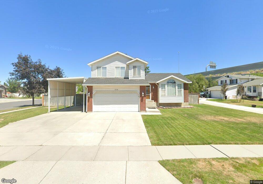
518 Daniel Way Salt Lake City, UT 84123
Estimated Value: $535,000 - $572,000
4
Beds
3
Baths
1,432
Sq Ft
$384/Sq Ft
Est. Value
About This Home
This home is located at 518 Daniel Way, Salt Lake City, UT 84123 and is currently estimated at $550,071, approximately $384 per square foot. 518 Daniel Way is a home located in Salt Lake County with nearby schools including Grant Elementary School, Riverview Junior High School, and Murray High School.
Ownership History
Date
Name
Owned For
Owner Type
Purchase Details
Closed on
Sep 15, 2010
Sold by
Davis Stann W and Davis Jan A
Bought by
Davis Stann W and Davis Jan L
Current Estimated Value
Home Financials for this Owner
Home Financials are based on the most recent Mortgage that was taken out on this home.
Original Mortgage
$223,777
Outstanding Balance
$147,842
Interest Rate
4.45%
Mortgage Type
FHA
Estimated Equity
$402,229
Purchase Details
Closed on
Jul 11, 1996
Sold by
Denning R Quinn and Denning Lindalee
Bought by
Davis Stann W and Davis Jan A
Home Financials for this Owner
Home Financials are based on the most recent Mortgage that was taken out on this home.
Original Mortgage
$134,150
Interest Rate
8.3%
Mortgage Type
Purchase Money Mortgage
Purchase Details
Closed on
Aug 9, 1995
Sold by
Winchester Llc
Bought by
Denning R Quinn and Denning Lindalee
Create a Home Valuation Report for This Property
The Home Valuation Report is an in-depth analysis detailing your home's value as well as a comparison with similar homes in the area
Home Values in the Area
Average Home Value in this Area
Purchase History
| Date | Buyer | Sale Price | Title Company |
|---|---|---|---|
| Davis Stann W | -- | Inwest Title Services | |
| Davis Stann W | -- | -- | |
| Denning R Quinn | -- | First American Title |
Source: Public Records
Mortgage History
| Date | Status | Borrower | Loan Amount |
|---|---|---|---|
| Open | Davis Stann W | $223,777 | |
| Closed | Davis Stann W | $134,150 |
Source: Public Records
Tax History Compared to Growth
Tax History
| Year | Tax Paid | Tax Assessment Tax Assessment Total Assessment is a certain percentage of the fair market value that is determined by local assessors to be the total taxable value of land and additions on the property. | Land | Improvement |
|---|---|---|---|---|
| 2025 | $2,222 | $504,800 | $149,800 | $355,000 |
| 2024 | $2,222 | $492,800 | $140,000 | $352,800 |
| 2023 | $2,199 | $467,100 | $133,100 | $334,000 |
| 2022 | $2,335 | $471,500 | $130,500 | $341,000 |
| 2021 | $2,019 | $359,600 | $121,200 | $238,400 |
| 2020 | $1,915 | $322,800 | $85,700 | $237,100 |
| 2019 | $1,844 | $300,300 | $85,700 | $214,600 |
| 2018 | $1,645 | $273,400 | $68,600 | $204,800 |
| 2017 | $1,563 | $261,800 | $62,600 | $199,200 |
| 2016 | $1,558 | $252,000 | $62,600 | $189,400 |
| 2015 | $1,426 | $209,500 | $60,800 | $148,700 |
| 2014 | $1,373 | $200,100 | $58,900 | $141,200 |
Source: Public Records
Map
Nearby Homes
- 1216 W Winchester St
- 6433 S 790 W
- 234 Waterstone Cir Unit 9
- 6438 S 840 W
- 649 Bulldog Cir
- 6556 S Jefferson St Unit 15
- Crawford Plan at Waterstone
- Matisse Plan at Waterstone
- Bellows Plan at Waterstone
- Sargent Plan at Waterstone
- 6816 S Snickers Ln
- 267 Noah Cir
- 165 W Winchester St
- 6938 S Zandi Dr
- 6571 S Jefferson St
- 145 W Winchester St
- 6556 S 130 W Unit LOT 8
- 6558 S 130 W Unit LOT 7
- 6564 S 130 W Unit LOT 6
- 868 W Wynwood Park Dr
- 512 Daniel Way
- 512 W Daniel Way
- 508 Daniel Way
- 6528 S 520 W
- 517 Daniel Way
- 6512 S 520 W
- 6544 S 520 W
- 6553 S Daniel Way Unit 118
- 6553 S Daniel Way
- 499 W Winchester St
- 545 W Winchester St
- 6496 S 520 W
- 6558 S 520 W
- 6569 S 520 W
- 6568 Daniel Way
- 6568 S Daniel Way
- 558 W 6570 S
- 6482 S 520 W
- 6539 Alfred Cir
- 6531 S Alfred Cir