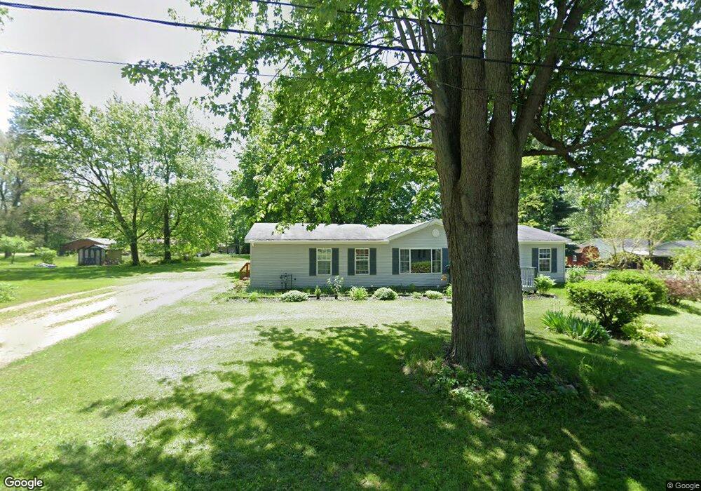
518 E Main St Maple Rapids, MI 48853
Estimated Value: $172,000 - $185,774
4
Beds
2
Baths
1,680
Sq Ft
$107/Sq Ft
Est. Value
About This Home
This home is located at 518 E Main St, Maple Rapids, MI 48853 and is currently estimated at $179,944, approximately $107 per square foot. 518 E Main St is a home located in Clinton County with nearby schools including Fulton Elementary School, Fulton Middle School, and Fulton High School.
Ownership History
Date
Name
Owned For
Owner Type
Purchase Details
Closed on
May 10, 2019
Sold by
Vanderstow Joshua
Bought by
Niemi Jackson
Current Estimated Value
Home Financials for this Owner
Home Financials are based on the most recent Mortgage that was taken out on this home.
Original Mortgage
$47,500
Outstanding Balance
$41,592
Interest Rate
4%
Mortgage Type
New Conventional
Estimated Equity
$138,352
Purchase Details
Closed on
Sep 1, 2006
Sold by
Mortgage Electronic Registration Systems
Bought by
The Bank Of New York
Purchase Details
Closed on
Aug 17, 2006
Sold by
Litwiller Kirk and Litwiller Rose M
Bought by
Mortgage Electronic Registration Systems
Create a Home Valuation Report for This Property
The Home Valuation Report is an in-depth analysis detailing your home's value as well as a comparison with similar homes in the area
Purchase History
| Date | Buyer | Sale Price | Title Company |
|---|---|---|---|
| Niemi Jackson | $50,000 | Ata National Title Group Llc | |
| The Bank Of New York | -- | E Title Agency | |
| Mortgage Electronic Registration Systems | $68,000 | None Available |
Source: Public Records
Mortgage History
| Date | Status | Borrower | Loan Amount |
|---|---|---|---|
| Open | Niemi Jackson | $47,500 |
Source: Public Records
Tax History
| Year | Tax Paid | Tax Assessment Tax Assessment Total Assessment is a certain percentage of the fair market value that is determined by local assessors to be the total taxable value of land and additions on the property. | Land | Improvement |
|---|---|---|---|---|
| 2025 | $1,353 | $75,800 | $9,500 | $66,300 |
| 2024 | $6 | $67,400 | $8,700 | $58,700 |
| 2023 | $607 | $63,000 | $0 | $0 |
| 2022 | $1,258 | $57,600 | $7,800 | $49,800 |
| 2021 | $1,225 | $50,700 | $7,600 | $43,100 |
| 2020 | $1,070 | $46,600 | $7,300 | $39,300 |
| 2019 | $696 | $40,300 | $7,300 | $33,000 |
| 2018 | $0 | $38,100 | $7,300 | $30,800 |
| 2017 | -- | $40,500 | $7,300 | $33,200 |
| 2016 | $659 | $38,200 | $7,300 | $30,900 |
| 2015 | -- | $36,000 | $0 | $0 |
| 2011 | -- | $36,100 | $0 | $0 |
Source: Public Records
Map
Nearby Homes
- TBD E Main St
- 129 E Main St
- 132 E Washington St
- 220 N Maple Ave
- 8095 Mcintosh Rd
- 8150 Idared Rd
- 7240 Empire Rd
- 9515 W Moss Rd
- 00 S Skyline
- 4941 Skyline Dr
- 7150 W Mead Rd
- 005 Skyline Dr
- 159 Hardwood Trail
- TBD Hardwood Trail
- TBD Oakridge Trail
- Lot 355 Oakridge Trail
- 04 Lakeview Ct
- 05 Lakeview Ct
- 00 W Ranger Rd
- 0 Lakeside Dr Unit LOT 1 3520630
- 500 W Main St
- 524 E Main St
- 517 E Adelaide St
- 529 E Adelaide St
- 434 E Main St
- 509 E Main St
- 503 E Adelaide St
- 433 E Adelaide St
- 525 E Main St
- 426 E Main St
- 437 E Main St
- 535 E Main St
- 612 E Main St
- 605 E Main St
- 416 E Main St
- 214 S Ashland St
- 121 N Garfield St
- 434 E Adelaide St
- 417 E Adelaide St
- 508 E Adelaide St
Your Personal Tour Guide
Ask me questions while you tour the home.