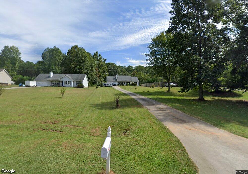
518 Thomas Rd Cleveland, GA 30528
Estimated Value: $312,933 - $462,000
3
Beds
2
Baths
1,168
Sq Ft
$306/Sq Ft
Est. Value
About This Home
This home is located at 518 Thomas Rd, Cleveland, GA 30528 and is currently estimated at $357,483, approximately $306 per square foot. 518 Thomas Rd is a home located in White County with nearby schools including Tesnatee Gap Elementary (Old White County Intermediate), White County 9th Grade Academy, and Jack P. Nix Elementary School.
Ownership History
Date
Name
Owned For
Owner Type
Purchase Details
Closed on
Sep 5, 2008
Sold by
Myers Michael
Bought by
Myers Michael and Myers Sherry Lynn
Current Estimated Value
Home Financials for this Owner
Home Financials are based on the most recent Mortgage that was taken out on this home.
Original Mortgage
$137,245
Outstanding Balance
$90,782
Interest Rate
6.49%
Mortgage Type
New Conventional
Estimated Equity
$266,701
Purchase Details
Closed on
Nov 14, 2005
Sold by
Parks Livestock & Fencing
Bought by
Pomes Robert J
Create a Home Valuation Report for This Property
The Home Valuation Report is an in-depth analysis detailing your home's value as well as a comparison with similar homes in the area
Home Values in the Area
Average Home Value in this Area
Purchase History
| Date | Buyer | Sale Price | Title Company |
|---|---|---|---|
| Myers Michael | -- | -- | |
| Myers Michael | $129,900 | -- | |
| Pomes Robert J | $122,000 | -- |
Source: Public Records
Mortgage History
| Date | Status | Borrower | Loan Amount |
|---|---|---|---|
| Open | Myers Michael | $137,245 |
Source: Public Records
Tax History Compared to Growth
Tax History
| Year | Tax Paid | Tax Assessment Tax Assessment Total Assessment is a certain percentage of the fair market value that is determined by local assessors to be the total taxable value of land and additions on the property. | Land | Improvement |
|---|---|---|---|---|
| 2025 | $1,483 | $89,364 | $13,436 | $75,928 |
| 2024 | $1,483 | $88,020 | $12,092 | $75,928 |
| 2023 | $1,059 | $76,260 | $10,748 | $65,512 |
| 2022 | $1,411 | $66,812 | $10,076 | $56,736 |
| 2021 | $1,348 | $52,292 | $7,396 | $44,896 |
| 2020 | $1,286 | $47,708 | $6,868 | $40,840 |
| 2019 | $1,290 | $47,708 | $6,868 | $40,840 |
| 2018 | $1,290 | $47,708 | $6,868 | $40,840 |
| 2017 | $1,187 | $44,432 | $6,868 | $37,564 |
| 2016 | $1,187 | $44,432 | $6,868 | $37,564 |
| 2015 | $1,133 | $111,080 | $6,868 | $37,564 |
| 2014 | $1,045 | $102,690 | $0 | $0 |
Source: Public Records
Map
Nearby Homes
- 4872 Highway 115 W
- 0 Long Mountain Rd Unit 10607992
- LOT 28 Long Mountain Rd
- 705 & Long Mountain Rd
- 705 Long Mountain Rd
- 705 & 0 Long Mountain Rd
- LOT 55 Teel Mtn Dr
- 0 Westmoreland Rd Unit 10596625
- LOT 57 Teel Mtn Dr
- 0 Asbury Mill Rd Unit 10599324
- 0 Asbury Mill Rd Unit 7644389
- 254 Jeb Dr
- 489 Asbury Mill Rd
- 174 Leighs Crossing
- 59 Rocket Dr
- 25 Long Mountain Trail
- 00 Partin Rd
- 3395 Asbury Mill Rd
- LOT 24 Luther Palmer Rd
- 349 Turner Ridge Dr
- 536 Thomas Rd
- 500 Thomas Rd
- 556 Thomas Rd
- 301 Thomason Rd
- 488 Thomas Rd
- 574 Thomas Rd
- 0 Thomason Rd Unit 7308234
- 0 Thomason Rd Unit 7192459
- 0 Thomason Rd Unit 3022488
- 584 Thomas Rd
- 350 Thomason Rd
- 213 Thomason Rd
- 465 Thomas Rd
- 173 Thomason Rd
- 169 Thomason Rd
- 147 Thomason Rd
- 142 Thomason Rd
- 142 Thomason Rd Unit A
- 885 Thomas Rd
- 69 Thomason Rd