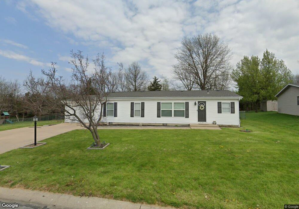
5180 N Burning Bush Rd Columbia, MO 65202
Estimated Value: $168,000 - $194,000
3
Beds
2
Baths
1,120
Sq Ft
$166/Sq Ft
Est. Value
About This Home
This home is located at 5180 N Burning Bush Rd, Columbia, MO 65202 and is currently estimated at $186,420, approximately $166 per square foot. 5180 N Burning Bush Rd is a home located in Boone County with nearby schools including Derby Ridge Elementary School, Smithton Middle School, and David H. Hickman High School.
Ownership History
Date
Name
Owned For
Owner Type
Purchase Details
Closed on
May 11, 2021
Sold by
Reeser Timothy M and Reeser Virginia A
Bought by
Curry Tracey
Current Estimated Value
Purchase Details
Closed on
May 16, 2017
Sold by
Trenhaile Kevin L
Bought by
Reeser Timothy M and Reeser Virginia A
Home Financials for this Owner
Home Financials are based on the most recent Mortgage that was taken out on this home.
Original Mortgage
$81,000
Interest Rate
4.1%
Mortgage Type
New Conventional
Purchase Details
Closed on
Jun 16, 2014
Sold by
Richardson Faye V
Bought by
Trenhaile Kevin L
Home Financials for this Owner
Home Financials are based on the most recent Mortgage that was taken out on this home.
Original Mortgage
$63,822
Interest Rate
4.4%
Mortgage Type
FHA
Create a Home Valuation Report for This Property
The Home Valuation Report is an in-depth analysis detailing your home's value as well as a comparison with similar homes in the area
Home Values in the Area
Average Home Value in this Area
Purchase History
| Date | Buyer | Sale Price | Title Company |
|---|---|---|---|
| Curry Tracey | -- | Boone Central Title Company | |
| Reeser Timothy M | -- | Boone Central Title Co | |
| Trenhaile Kevin L | -- | Boone Central Title Co |
Source: Public Records
Mortgage History
| Date | Status | Borrower | Loan Amount |
|---|---|---|---|
| Previous Owner | Reeser Timothy M | $81,000 | |
| Previous Owner | Trenhaile Kevin L | $63,822 |
Source: Public Records
Tax History Compared to Growth
Tax History
| Year | Tax Paid | Tax Assessment Tax Assessment Total Assessment is a certain percentage of the fair market value that is determined by local assessors to be the total taxable value of land and additions on the property. | Land | Improvement |
|---|---|---|---|---|
| 2025 | $1,100 | $15,637 | $2,622 | $13,015 |
| 2024 | $1,028 | $14,212 | $2,622 | $11,590 |
| 2023 | $1,019 | $14,212 | $2,622 | $11,590 |
| 2022 | $979 | $13,661 | $2,622 | $11,039 |
| 2021 | $980 | $13,661 | $2,622 | $11,039 |
| 2020 | $999 | $13,140 | $2,622 | $10,518 |
| 2019 | $999 | $13,140 | $2,622 | $10,518 |
| 2018 | $967 | $0 | $0 | $0 |
| 2017 | $956 | $12,635 | $2,622 | $10,013 |
| 2016 | $954 | $12,635 | $2,622 | $10,013 |
| 2015 | $881 | $12,635 | $2,622 | $10,013 |
| 2014 | -- | $12,635 | $2,622 | $10,013 |
Source: Public Records
Map
Nearby Homes
- 5261 N Burning Bush Rd
- 4981 N Burning Bush Ct
- 201 Copper Mountain Dr
- 576 E Clearview Dr
- 5 Copper Mountain Dr
- LOT 70 Aspen Ridge Dr
- L401-L430 Forest Ridge Plat 4
- LOT 18 Lookout Peak Dr
- LOT 23 Lookout Peak Dr
- LOT 22 Lookout Peak Dr
- 401 Harold Ct
- 235 E Murphy Dr
- 107 Snow Peak Ct
- 5335 N Rocky Fork Dr
- 1405 Raleigh Dr
- 5105 Hatteras Dr
- 5103 Hatteras Dr
- 6083 N Wagon Trail Rd
- 5385 N Clearview Rd
- LOT 502 Sullivan St
- 5160 N Burning Bush Rd
- LOT 122 Burning Bush Rd
- 5200 N Burning Bush Rd
- 5171 N Burning Bush Rd
- 1051 E Chenar Ct
- 5141 N Burning Bush Rd
- 5141 N Lotus Loop
- 5220 N Burning Bush Rd
- 5221 N Burning Bush Rd
- 1071 E Chenar Ct
- 5130 N Lotus Loop
- 5111 N Burning Bush Rd
- 5240 N Burning Bush Rd
- 981 E Quince Ct
- 5121 N Lotus Loop
- 5241 N Burning Bush Rd
- 1050 E Chenar Ct
- 1070 E Chenar Ct
- 991 E Quince Ct
- 5250 N Burning Bush Rd