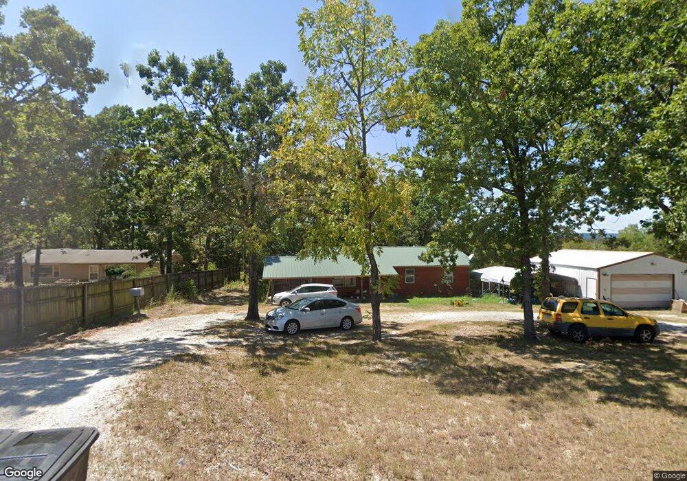
5183 State Highway 39 Shell Knob, MO 65747
Estimated Value: $137,106 - $458,000
Studio
--
Bath
1,056
Sq Ft
$272/Sq Ft
Est. Value
About This Home
This home is located at 5183 State Highway 39, Shell Knob, MO 65747 and is currently estimated at $286,777, approximately $271 per square foot. 5183 State Highway 39 is a home with nearby schools including Blue Eye Elementary School, Blue Eye Middle School, and Blue Eye High School.
Ownership History
Date
Name
Owned For
Owner Type
Purchase Details
Closed on
Jul 29, 2024
Sold by
Wire Road Properties Llc
Bought by
Dool Ko Brandon Charles
Current Estimated Value
Purchase Details
Closed on
Apr 14, 2006
Sold by
Hayes Bobby Ray and Hayes Emily K
Bought by
Reynolds Ricky N and Reynolds Janice R
Home Financials for this Owner
Home Financials are based on the most recent Mortgage that was taken out on this home.
Original Mortgage
$18,580
Interest Rate
6.32%
Mortgage Type
Stand Alone Second
Create a Home Valuation Report for This Property
The Home Valuation Report is an in-depth analysis detailing your home's value as well as a comparison with similar homes in the area
Purchase History
| Date | Buyer | Sale Price | Title Company |
|---|---|---|---|
| Dool Ko Brandon Charles | -- | None Listed On Document | |
| Reynolds Ricky N | -- | -- |
Source: Public Records
Mortgage History
| Date | Status | Borrower | Loan Amount |
|---|---|---|---|
| Previous Owner | Reynolds Ricky N | $18,580 | |
| Previous Owner | Reynolds Ricky N | $74,320 |
Source: Public Records
Tax History
| Year | Tax Paid | Tax Assessment Tax Assessment Total Assessment is a certain percentage of the fair market value that is determined by local assessors to be the total taxable value of land and additions on the property. | Land | Improvement |
|---|---|---|---|---|
| 2025 | $641 | $11,910 | -- | -- |
| 2024 | $640 | $11,910 | -- | -- |
| 2023 | $640 | $11,910 | $0 | $0 |
| 2022 | $637 | $11,910 | $0 | $0 |
| 2021 | $644 | $11,910 | $0 | $0 |
| 2020 | $651 | $11,880 | $0 | $0 |
| 2019 | $650 | $11,880 | $0 | $0 |
| 2018 | $620 | $11,880 | $0 | $0 |
| 2017 | $551 | $11,340 | $0 | $0 |
| 2016 | $539 | $11,340 | $0 | $0 |
| 2015 | $541 | $11,340 | $0 | $0 |
| 2014 | $543 | $11,340 | $0 | $0 |
| 2012 | $543 | $11,340 | $0 | $0 |
Source: Public Records
Map
Nearby Homes
- 25173 Farm Road 1266
- 000 Tomahawk Hills St Unit Lot 1-14, 19-33 Blk
- 27376 Timber Springs Rd
- 000 Tomahawk Hills Unit Lot 21 Blk 12
- 000 Tomahawk Hills Unit Lot 1-2, 4-9, 12-13,
- 000 Tomahawk Hills Unit Lots 1-2, Blk 13
- 000 Tomahawk Hills Unit Lots 17-23, Blk 14
- 000 Tomahawk Hills Unit Lot 4-5, Blk 13
- 000 Tomahawk Hills
- 000 Tomahawk Hills Unit Lot 9, Blk 4
- 000 Tomahawk Hills Unit Lot 29 Blk 8
- 000 Tomahawk Hills Unit Lots 89-91, Blk 16
- 000 Tomahawk Hills Unit Lots 15-17, Blk 1
- 000 Tomahawk Hills Unit Lot 7, Blk 13
- 000 Tomahawk Hills Unit Lot 6, Blk 1
- 000 Tomahawk Hills Unit Lots 11-24, 38-43 Bl
- 000 Tomahawk Hills Unit Lot 16, Blk 4
- 000 Tomahawk Hills Unit Lots 96-98, Blk 16
- 000 Tomahawk Hills Unit Lots 12-18 Blk 13
- 000 Tomahawk Hills Lots Unit Lots 1-16 Blk 12
- 5181 State Highway 39
- 5167 State Highway 39
- 5199 State Highway 39
- 5225 State Highway 39
- 5165 State Highway 39
- 5165 State Highway 39
- 5245 State Highway 39
- 5228 State Highway 39
- 5252 State Highway 39
- 24928 Farm Road 1266
- 0 Farm Road 1266
- 000 Farm Road 1266
- 24719 Farm Road 1266
- 0 Hwy 39s Unit 30324018
- 0 Hwy 39s Unit 30324546
- 0 Hwy 39s Unit 30326924
- 24726 Farm Road 1266
- 4931 State Highway 39
- Lot 9 Three ''R'' Acres
- 25260 Farm Road 1266
Your Personal Tour Guide
Ask me questions while you tour the home.