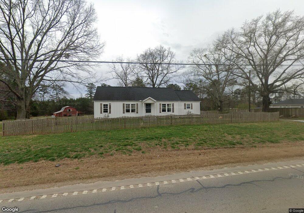
5183 U S Highway 78 Bremen, GA 30110
Estimated Value: $275,881 - $318,000
2
Beds
1
Bath
1,307
Sq Ft
$225/Sq Ft
Est. Value
About This Home
This home is located at 5183 U S Highway 78, Bremen, GA 30110 and is currently estimated at $293,470, approximately $224 per square foot. 5183 U S Highway 78 is a home located in Haralson County with nearby schools including Haralson County High School.
Ownership History
Date
Name
Owned For
Owner Type
Purchase Details
Closed on
Mar 3, 2020
Sold by
Sapp Dud Investment Llc
Bought by
Smoak Catherine
Current Estimated Value
Home Financials for this Owner
Home Financials are based on the most recent Mortgage that was taken out on this home.
Original Mortgage
$144,000
Outstanding Balance
$127,011
Interest Rate
3.4%
Mortgage Type
New Conventional
Estimated Equity
$166,459
Purchase Details
Closed on
Oct 25, 2019
Sold by
Sapp Dud Investments Llc
Bought by
Golden Anthony S and Golden April R
Home Financials for this Owner
Home Financials are based on the most recent Mortgage that was taken out on this home.
Original Mortgage
$148,000
Interest Rate
3.6%
Mortgage Type
New Conventional
Purchase Details
Closed on
Mar 20, 2019
Sold by
Gober J L
Bought by
Sapp Dud Investments Llc
Purchase Details
Closed on
Mar 5, 1999
Sold by
Allen William Y
Bought by
Gober J L
Create a Home Valuation Report for This Property
The Home Valuation Report is an in-depth analysis detailing your home's value as well as a comparison with similar homes in the area
Home Values in the Area
Average Home Value in this Area
Purchase History
| Date | Buyer | Sale Price | Title Company |
|---|---|---|---|
| Smoak Catherine | $160,000 | -- | |
| Golden Anthony S | $185,000 | -- | |
| Sapp Dud Investments Llc | $161,000 | -- | |
| Gober J L | $90,000 | -- |
Source: Public Records
Mortgage History
| Date | Status | Borrower | Loan Amount |
|---|---|---|---|
| Open | Smoak Catherine | $144,000 | |
| Previous Owner | Golden Anthony S | $148,000 | |
| Previous Owner | Golden Anthony S | $27,700 |
Source: Public Records
Tax History Compared to Growth
Tax History
| Year | Tax Paid | Tax Assessment Tax Assessment Total Assessment is a certain percentage of the fair market value that is determined by local assessors to be the total taxable value of land and additions on the property. | Land | Improvement |
|---|---|---|---|---|
| 2024 | $2,193 | $86,592 | $12,374 | $74,218 |
| 2023 | $2,249 | $85,863 | $9,402 | $76,461 |
| 2022 | $1,828 | $70,165 | $9,402 | $60,763 |
| 2021 | $1,845 | $66,035 | $8,550 | $57,485 |
| 2020 | $1,888 | $67,301 | $8,550 | $58,751 |
| 2019 | $1,045 | $35,873 | $17,213 | $18,660 |
| 2018 | $1,060 | $35,873 | $17,213 | $18,660 |
| 2017 | $1,045 | $34,075 | $17,213 | $16,862 |
| 2016 | $1,281 | $41,801 | $15,806 | $25,995 |
| 2015 | -- | $41,429 | $15,806 | $25,624 |
| 2014 | -- | $41,756 | $15,806 | $25,950 |
Source: Public Records
Map
Nearby Homes
- 586 Old Bushmill Rd
- 381 King St
- 67 Depot St
- 145 Wall St
- 163 Atlantic Ave
- 0 Nitra Rd Unit 9546245
- 2659 Jacksonville Rd
- 101 Bush Creek Way
- 707 Mill Stone Way
- 273 Sewell Rd
- 0 Stonebridge Blvd Unit 143588
- 0 Mt Zion St Unit 7399245
- 6315 Highway 78
- 3765 U S 78
- 610 Old Pleasant Hill Rd
- 522 Atlantic Ave
- 330 Kensington Cir
- 311 Kensington Cir
- 319 Stonebridge Blvd
- 321 Stonebridge Blvd
- 5183 Us Highway 78
- 5183 Us Highway 78
- 20 Reese Crawford Rd
- 5169 U S 78
- 0 Tract 2 Reese Crawford Rd
- 5176 U S Highway 78
- 5194 Us Highway 78
- 5215 U S 78
- 37 Reese Crawford Rd
- 5169 Us Highway 78
- 5137 Us Highway 78
- 39 Reese Crawford Rd
- 5137 U S Highway 78
- 5137 U S 78
- 5224 U S 78
- 5224 Us Highway 78
- 5224 U S Highway 78
- 32 Woodland Cir
- 20 Woodland Cir
- 42 Woodland Cir