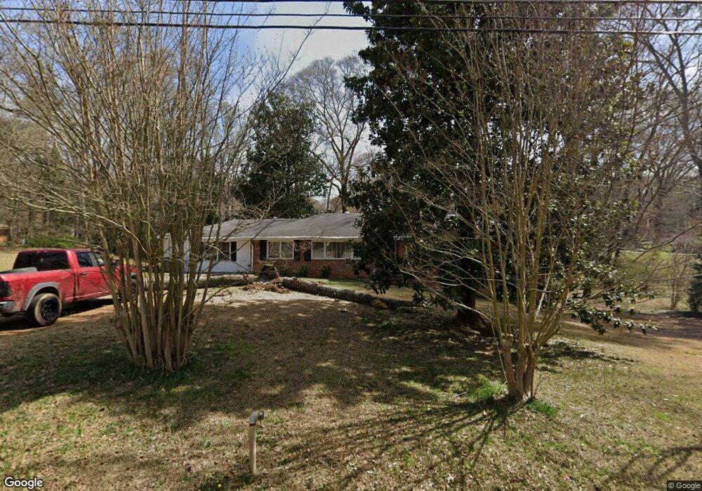
5185 Flint Hill Rd Austell, GA 30106
Estimated Value: $282,000 - $309,000
3
Beds
2
Baths
1,796
Sq Ft
$165/Sq Ft
Est. Value
About This Home
This home is located at 5185 Flint Hill Rd, Austell, GA 30106 and is currently estimated at $296,393, approximately $165 per square foot. 5185 Flint Hill Rd is a home located in Cobb County with nearby schools including Austell Elementary School, Garrett Middle School, and South Cobb High School.
Ownership History
Date
Name
Owned For
Owner Type
Purchase Details
Closed on
Aug 19, 2016
Sold by
Mack Deborah M
Bought by
Daniel Henry
Current Estimated Value
Home Financials for this Owner
Home Financials are based on the most recent Mortgage that was taken out on this home.
Original Mortgage
$122,637
Outstanding Balance
$100,405
Interest Rate
4.4%
Mortgage Type
FHA
Estimated Equity
$195,988
Create a Home Valuation Report for This Property
The Home Valuation Report is an in-depth analysis detailing your home's value as well as a comparison with similar homes in the area
Home Values in the Area
Average Home Value in this Area
Purchase History
| Date | Buyer | Sale Price | Title Company |
|---|---|---|---|
| Daniel Henry | $124,900 | -- |
Source: Public Records
Mortgage History
| Date | Status | Borrower | Loan Amount |
|---|---|---|---|
| Open | Daniel Henry | $122,637 |
Source: Public Records
Tax History
| Year | Tax Paid | Tax Assessment Tax Assessment Total Assessment is a certain percentage of the fair market value that is determined by local assessors to be the total taxable value of land and additions on the property. | Land | Improvement |
|---|---|---|---|---|
| 2025 | $486 | $104,312 | $37,240 | $67,072 |
| 2024 | $488 | $104,312 | $37,240 | $67,072 |
| 2023 | $215 | $81,956 | $37,240 | $44,716 |
| 2022 | $374 | $66,276 | $21,560 | $44,716 |
| 2021 | $347 | $57,160 | $19,600 | $37,560 |
| 2020 | $341 | $55,200 | $17,640 | $37,560 |
| 2019 | $1,110 | $51,280 | $13,720 | $37,560 |
| 2018 | $869 | $40,284 | $7,840 | $32,444 |
| 2017 | $951 | $45,456 | $6,272 | $39,184 |
| 2016 | -- | $30,808 | $6,272 | $24,536 |
| 2015 | -- | $30,808 | $6,272 | $24,536 |
| 2014 | -- | $30,808 | $0 | $0 |
Source: Public Records
Map
Nearby Homes
- 0 Lakeview Ct Unit 10711020
- 2232 Warren Dr
- 2334 Perkerson Mill Rd SW
- 2136 Perkerson Mill Rd SW
- 2650 Park Ave
- 3045 Sunlight Dr
- 5164 Medford Ln
- 1 Perkerson Mill Rd SW
- 2220 Sweetwater Ln
- 2125 Clay Rd SW
- 1213 Farmers Loop Unit 44
- 4975 Brawner Lake Dr
- 5025 Bishops Row SW
- 0 Clay Rd
- 1959 Oakbluff Dr
- 1943 Arnold Dr
- 2573 Chimney Hill Place
- 4747 Nelda Dr
- 4809 Hemlock Dr
- 2717 Flintlock Place
- 5185 Flint Hill Rd SW
- 2292 Warren Dr
- 5180 Flint Hill Rd
- 5171 Flint Hill Rd
- 5198 Flint Hill Rd
- 2316 Warren Dr
- 5212 Flint Hill Rd
- 5149 Jones Rd
- 2276 Warren Dr
- 5135 Jones Rd Unit C
- 5135 Jones Rd Unit A
- 5135 Jones Rd
- 5121 Lakeview Ct
- 5170 Jones Rd
- 5123 Lakeview Ct
- 2301 Warren Dr
- 2293 Warren Dr
- 5232 Flint Hill Rd
- 5201 Jones Rd Unit 5211
- 2285 Warren Dr
Your Personal Tour Guide
Ask me questions while you tour the home.