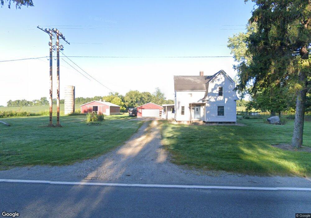
51850 Decatur Rd Decatur, MI 49045
Estimated Value: $160,693 - $237,000
3
Beds
1
Bath
1,350
Sq Ft
$139/Sq Ft
Est. Value
About This Home
This home is located at 51850 Decatur Rd, Decatur, MI 49045 and is currently estimated at $187,923, approximately $139 per square foot. 51850 Decatur Rd is a home located in Cass County with nearby schools including Marcellus Elementary School and Marcellus High School.
Ownership History
Date
Name
Owned For
Owner Type
Purchase Details
Closed on
Apr 27, 2021
Sold by
Aardema Charlia
Bought by
Davis Brandon and Davis Jennifer
Current Estimated Value
Home Financials for this Owner
Home Financials are based on the most recent Mortgage that was taken out on this home.
Original Mortgage
$97,206
Outstanding Balance
$87,955
Interest Rate
3%
Mortgage Type
FHA
Estimated Equity
$99,968
Purchase Details
Closed on
Feb 11, 2005
Sold by
Vantilburg Patricia Sue and Hunsberger Patricia Sue
Bought by
Porath Charlia
Home Financials for this Owner
Home Financials are based on the most recent Mortgage that was taken out on this home.
Original Mortgage
$122,000
Interest Rate
5.8%
Create a Home Valuation Report for This Property
The Home Valuation Report is an in-depth analysis detailing your home's value as well as a comparison with similar homes in the area
Home Values in the Area
Average Home Value in this Area
Purchase History
| Date | Buyer | Sale Price | Title Company |
|---|---|---|---|
| Davis Brandon | $99,000 | Patrick Abtract & Ttl Office | |
| Porath Charlia | $122,000 | Meridian Title Corp |
Source: Public Records
Mortgage History
| Date | Status | Borrower | Loan Amount |
|---|---|---|---|
| Open | Davis Brandon | $97,206 | |
| Previous Owner | Porath Charlia | $122,000 |
Source: Public Records
Tax History Compared to Growth
Tax History
| Year | Tax Paid | Tax Assessment Tax Assessment Total Assessment is a certain percentage of the fair market value that is determined by local assessors to be the total taxable value of land and additions on the property. | Land | Improvement |
|---|---|---|---|---|
| 2025 | $2,099 | $93,400 | $51,800 | $41,600 |
| 2024 | $736 | $87,500 | $45,100 | $42,400 |
| 2023 | $702 | $73,600 | $0 | $0 |
| 2022 | $668 | $83,700 | $0 | $0 |
| 2021 | $1,308 | $59,900 | $0 | $0 |
| 2020 | $533 | $58,300 | $0 | $0 |
| 2019 | $2,171 | $55,900 | $0 | $0 |
| 2018 | $511 | $52,800 | $0 | $0 |
| 2017 | $501 | $46,600 | $0 | $0 |
| 2016 | $504 | $47,100 | $0 | $0 |
| 2015 | -- | $46,800 | $0 | $0 |
| 2011 | -- | $62,900 | $0 | $0 |
Source: Public Records
Map
Nearby Homes
- 23221 Morton St
- 19264 Marcellus Hwy
- 19315 Church St
- 24369 Morton St
- 24674 Gage St
- V/L Twin Shore Dr
- 53075 Maple St
- 24948 Lakeshore Dr
- 88080 Old Swamp Rd
- 57765 O Keefe Rd
- 53027 Twin Lakes Rd
- 16937 Marcellus Hwy
- 0 Twin Lakes Rd
- 24984 Marcellus Hwy
- 51907 Atwood Rd
- 46132 86th Ave
- 45523 Eleanor Dr
- 0 E Beers St
- 25544 Gage St
- 208 W Saint Marys St
- 51967 Decatur Rd
- 51960 Decatur Rd
- 52083 Decatur Rd
- 21036 Fosdick St
- 21036 Fosdick St
- 20936 Fosdick St
- 21138 Fosdick St
- 21200 Fosdick St
- 21200 Fosdick St
- 52975 Decatur Rd
- 52975 Decatur Rd
- 51545 Decatur Rd
- 21306 Fosdick St
- 0 Decatur Rd
- 51401 Decatur Rd
- 51401 Decatur Rd
- 21665 Graham St
- 52075 Halverson Rd
- 51897 Halverson Rd
- 51897 Halverson Rd