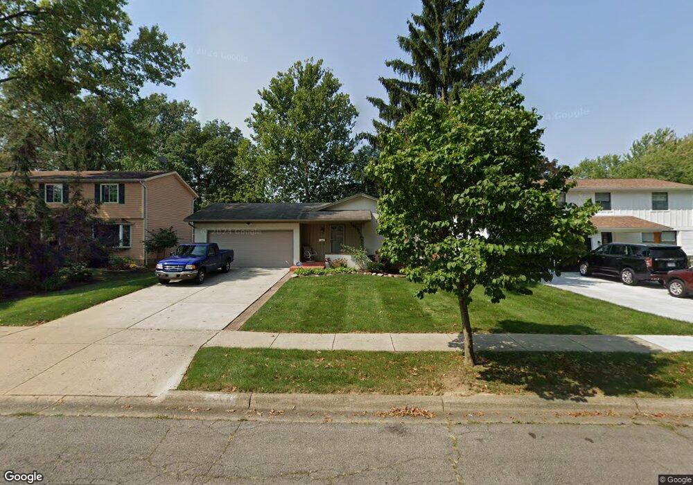
5187 Paw Paw Rd Columbus, OH 43229
Forest Park East NeighborhoodEstimated Value: $247,983 - $285,000
3
Beds
2
Baths
1,100
Sq Ft
$249/Sq Ft
Est. Value
About This Home
This home is located at 5187 Paw Paw Rd, Columbus, OH 43229 and is currently estimated at $273,746, approximately $248 per square foot. 5187 Paw Paw Rd is a home located in Franklin County with nearby schools including Avalon Elementary School, Northgate Intermediate, and Woodward Park Middle School.
Ownership History
Date
Name
Owned For
Owner Type
Purchase Details
Closed on
Mar 29, 2004
Sold by
Madison Stuart E and Madison Shannon M
Bought by
Lee Carol Ann
Current Estimated Value
Home Financials for this Owner
Home Financials are based on the most recent Mortgage that was taken out on this home.
Original Mortgage
$129,400
Outstanding Balance
$60,852
Interest Rate
5.65%
Mortgage Type
Purchase Money Mortgage
Estimated Equity
$212,894
Purchase Details
Closed on
Jun 27, 1997
Sold by
Rinkoski Wynona M
Bought by
Madison Stuart E and Madison Shannon M
Home Financials for this Owner
Home Financials are based on the most recent Mortgage that was taken out on this home.
Original Mortgage
$104,291
Interest Rate
8.01%
Mortgage Type
VA
Purchase Details
Closed on
Feb 1, 1987
Create a Home Valuation Report for This Property
The Home Valuation Report is an in-depth analysis detailing your home's value as well as a comparison with similar homes in the area
Home Values in the Area
Average Home Value in this Area
Purchase History
| Date | Buyer | Sale Price | Title Company |
|---|---|---|---|
| Lee Carol Ann | $129,400 | -- | |
| Madison Stuart E | $101,500 | Chicago Title | |
| -- | -- | -- |
Source: Public Records
Mortgage History
| Date | Status | Borrower | Loan Amount |
|---|---|---|---|
| Open | Lee Carol Ann | $129,400 | |
| Previous Owner | Madison Stuart E | $104,291 |
Source: Public Records
Tax History Compared to Growth
Tax History
| Year | Tax Paid | Tax Assessment Tax Assessment Total Assessment is a certain percentage of the fair market value that is determined by local assessors to be the total taxable value of land and additions on the property. | Land | Improvement |
|---|---|---|---|---|
| 2024 | $2,648 | $68,810 | $18,130 | $50,680 |
| 2023 | $2,642 | $68,810 | $18,130 | $50,680 |
| 2022 | $2,066 | $48,580 | $11,550 | $37,030 |
| 2021 | $2,069 | $48,580 | $11,550 | $37,030 |
| 2020 | $2,072 | $48,580 | $11,550 | $37,030 |
| 2019 | $1,669 | $36,270 | $8,580 | $27,690 |
| 2018 | $1,654 | $36,270 | $8,580 | $27,690 |
| 2017 | $1,738 | $36,270 | $8,580 | $27,690 |
| 2016 | $1,808 | $36,050 | $8,050 | $28,000 |
| 2015 | $1,642 | $36,050 | $8,050 | $28,000 |
| 2014 | $1,646 | $36,050 | $8,050 | $28,000 |
| 2013 | $868 | $37,940 | $8,470 | $29,470 |
Source: Public Records
Map
Nearby Homes
- 5204 Honeytree Loop W
- 5056 Northtowne Blvd Unit 5054
- 2058 Northcliff Dr
- 2158 Kilbourne Ave
- 2294 Teakwood Dr
- 2550 Minerva Ave
- 2166 Waldorf Rd
- 2500 Maplewood Dr
- 4885 Northtowne Blvd
- 5124 Northcliff Loop W
- 2134 Trent Rd
- 4849 Heatherton Dr
- 2033 Brittany Rd
- 1914 Walden Dr
- 2084 Brookfield Rd
- 5522 Parkshire Dr Unit 5522
- 5556 Parkshire Dr Unit 5556
- 5578 Parkshire Dr Unit 5578
- 2244 Balmoral Rd
- 5485 Tamarack Blvd