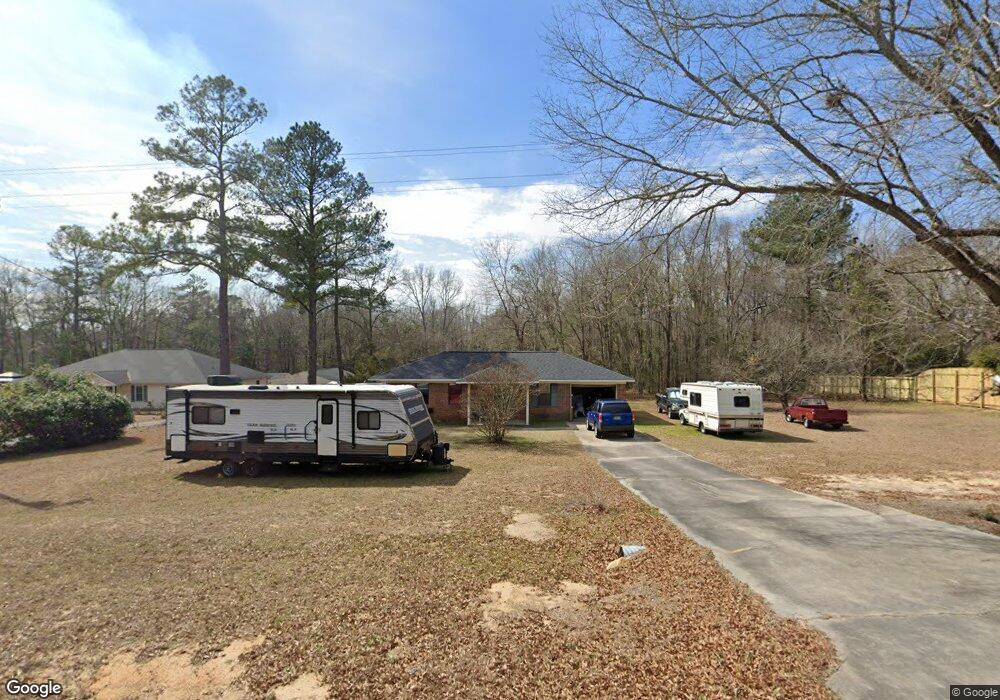
5189 Neals Mill Rd Dearing, GA 30808
Estimated Value: $103,000 - $182,000
3
Beds
2
Baths
912
Sq Ft
$137/Sq Ft
Est. Value
About This Home
This home is located at 5189 Neals Mill Rd, Dearing, GA 30808 and is currently estimated at $124,700, approximately $136 per square foot. 5189 Neals Mill Rd is a home located in McDuffie County with nearby schools including Thomson High School.
Ownership History
Date
Name
Owned For
Owner Type
Purchase Details
Closed on
Jul 14, 2021
Sold by
Ponton Jennifer N
Bought by
Swierczynski Charles V
Current Estimated Value
Purchase Details
Closed on
Feb 18, 2005
Sold by
Greene Roger Daren
Bought by
Stewart Jennifer N
Home Financials for this Owner
Home Financials are based on the most recent Mortgage that was taken out on this home.
Original Mortgage
$67,671
Interest Rate
5.61%
Mortgage Type
New Conventional
Purchase Details
Closed on
May 30, 1999
Sold by
Greene Ila R
Bought by
Greene Roger D
Purchase Details
Closed on
Feb 15, 1988
Bought by
Greene Ila R
Create a Home Valuation Report for This Property
The Home Valuation Report is an in-depth analysis detailing your home's value as well as a comparison with similar homes in the area
Home Values in the Area
Average Home Value in this Area
Purchase History
| Date | Buyer | Sale Price | Title Company |
|---|---|---|---|
| Swierczynski Charles V | $49,000 | -- | |
| Stewart Jennifer N | $67,671 | -- | |
| Greene Roger D | $55,000 | -- | |
| Greene Ila R | -- | -- |
Source: Public Records
Mortgage History
| Date | Status | Borrower | Loan Amount |
|---|---|---|---|
| Previous Owner | Stewart Jennifer N | $67,671 |
Source: Public Records
Tax History Compared to Growth
Tax History
| Year | Tax Paid | Tax Assessment Tax Assessment Total Assessment is a certain percentage of the fair market value that is determined by local assessors to be the total taxable value of land and additions on the property. | Land | Improvement |
|---|---|---|---|---|
| 2024 | $398 | $29,798 | $2,178 | $27,620 |
| 2023 | $398 | $28,756 | $2,178 | $26,578 |
| 2022 | $171 | $26,438 | $2,178 | $24,260 |
| 2021 | $602 | $21,494 | $2,114 | $19,380 |
| 2020 | $678 | $24,051 | $1,736 | $22,315 |
| 2019 | $685 | $24,051 | $1,736 | $22,315 |
| 2018 | $685 | $24,051 | $1,736 | $22,315 |
| 2017 | $661 | $24,051 | $1,736 | $22,315 |
| 2016 | $661 | $24,051 | $1,736 | $22,315 |
| 2015 | $629 | $25,115 | $2,800 | $22,315 |
| 2014 | $630 | $25,115 | $2,800 | $22,315 |
| 2013 | -- | $27,158 | $2,800 | $24,358 |
Source: Public Records
Map
Nearby Homes
- 0 Whitaker Rd Unit 540660
- 2786 Tudor Rd
- 0 Adams-Reeves Rd Unit 523648
- 5801 Hobbs Rd
- 0 Hobbs Rd
- 3999 Mccorkle Dr
- 0 Adams Chapel Rd
- 4327 Iron Hill Rd
- 3445 Deerfield Rd
- 4089 Adams Chapel Rd
- 290 Neals Mill Rd
- 2135 Fort Creek Rd
- 2111 Fort Creek Rd
- 259 S Main St
- 122 First St
- 835 Sweet Grass Cir
- 832 Sweet Grass Cir
- 830 Sweet Grass Cir
- 864 Sweet Grass Cir
- 868 Sweet Grass Cir
- 5199 Neals Mill Rd
- 5171 Neals Mill Rd
- 5212 Neals Mill Rd
- 5231 Neals Mill Rd
- 5178 Neals Mill Rd
- 6201 Mattie Harrison Rd
- 5238 Neals Mill Rd
- 6125 Mattie Harrison Rd
- 6164 Mattie Harrison Rd
- 4993 Washington Dr
- 0 SE Washington Dr
- 6112 Mattie Harrison Rd
- 4998 Washington Dr
- 5124 Jones Rd
- 6065 Mattie Harrison Rd
- 4923 Washington Dr
- 5343 Neals Mill Rd
- 5035 Neals Mill Rd
- 6043 Mattie Harrison Rd
- 5042 Washington Dr