Estimated Value: $116,000 - $133,000
2
Beds
1
Bath
906
Sq Ft
$140/Sq Ft
Est. Value
About This Home
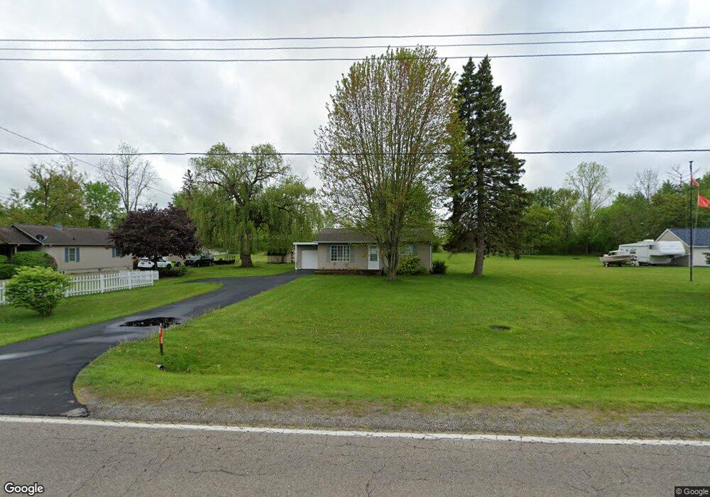
This home is located at 5189 W Court St, Flint, MI 48532 and is currently estimated at $126,726, approximately $139 per square foot. 5189 W Court St is a home located in Genesee County with nearby schools including Carman-Ainsworth High School, Genesee STEM Academy, and St. Paul Lutheran School.
Ownership History
Date
Name
Owned For
Owner Type
Purchase Details
Closed on
Jun 24, 2003
Sold by
Delong Jason Russell and Delong Jason R
Bought by
Wilkins Cathy E
Current Estimated Value
Purchase Details
Closed on
Sep 15, 2000
Sold by
Stevens Nicole L
Bought by
Delong Jason Russell
Purchase Details
Closed on
May 16, 2000
Sold by
Frank Erik and Frank Amie
Bought by
Delong Jason R and Stevens Nicole L
Create a Home Valuation Report for This Property
The Home Valuation Report is an in-depth analysis detailing your home's value as well as a comparison with similar homes in the area
Home Values in the Area
Average Home Value in this Area
Purchase History
| Date | Buyer | Sale Price | Title Company |
|---|---|---|---|
| Wilkins Cathy E | $85,000 | Cislo Title Company | |
| Delong Jason Russell | -- | -- | |
| Delong Jason R | $79,000 | Sargents Title Company |
Source: Public Records
Tax History Compared to Growth
Tax History
| Year | Tax Paid | Tax Assessment Tax Assessment Total Assessment is a certain percentage of the fair market value that is determined by local assessors to be the total taxable value of land and additions on the property. | Land | Improvement |
|---|---|---|---|---|
| 2025 | $1,236 | $40,200 | $0 | $0 |
| 2024 | $1,171 | $39,000 | $0 | $0 |
| 2023 | $950 | $35,000 | $0 | $0 |
| 2022 | $563 | $26,400 | $0 | $0 |
| 2021 | $1,092 | $23,800 | $0 | $0 |
| 2020 | $521 | $23,500 | $0 | $0 |
| 2019 | $519 | $23,300 | $0 | $0 |
| 2018 | $1,075 | $25,300 | $0 | $0 |
| 2017 | $1,034 | $25,300 | $0 | $0 |
| 2016 | $1,064 | $24,100 | $0 | $0 |
| 2015 | $927 | $24,100 | $0 | $0 |
| 2014 | $550 | $23,200 | $0 | $0 |
| 2012 | -- | $24,200 | $24,200 | $0 |
Source: Public Records
Map
Nearby Homes
- 5345 Birchtree Ct
- 1460 S Dye Rd
- 0000 Reuben Reuben St
- 3.9 Acres W Court St
- 4480 Corunna Rd
- 5325 N Dyewood Dr
- 1417 Grassmere Ave
- 4474 Corunna Rd
- 0 Charter Dr Unit 50153638
- 5406 Litchfield Dr
- 1455 S Linden Rd
- 5323 Elmsford Dr
- 2 Charter Dr
- 1442 Mintola Ave
- 5297 Oaktree Dr
- 10 Acres T A Mansour Blvd
- 6007 Corunna Rd
- 2462 Valley Oaks Cir
- 5503 Westchester Dr
- 1193 Normandy Terrace Dr
- 5177 W Court St
- 5203 W Court St
- 5169 W Court St
- 5209 W Court St
- 5165 W Court St
- 5215 W Court St
- 5166 W Court St
- 5202 W Court St
- 5221 W Court St
- 5214 W Court St
- 1404 Eggleston Ave
- 5229 W Court St
- 5222 W Court St
- 1397 S Dye Rd
- 1372 Eggleston Ave
- 1390 Eggleston Ave
- 1410 Eggleston Ave
- 1401 S Dye Rd
- 5237 W Court St
- 1372 Eggleston St