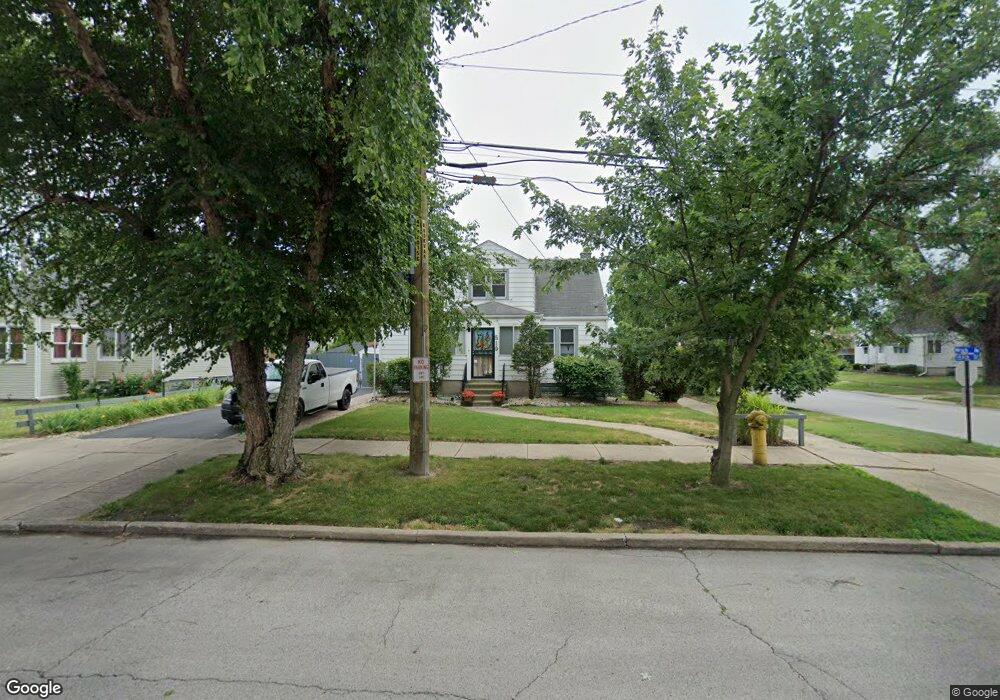
519 159th St Calumet City, IL 60409
Estimated Value: $133,000 - $153,000
2
Beds
1
Bath
896
Sq Ft
$157/Sq Ft
Est. Value
About This Home
This home is located at 519 159th St, Calumet City, IL 60409 and is currently estimated at $140,517, approximately $156 per square foot. 519 159th St is a home located in Cook County with nearby schools including Hoover Elementary School, Schrum Memorial Middle School, and Thornton Fractional North High School.
Ownership History
Date
Name
Owned For
Owner Type
Purchase Details
Closed on
Jul 16, 2002
Sold by
Graff Mark A and Graff Carol M
Bought by
Graff Mark A and Graff Carol M
Current Estimated Value
Purchase Details
Closed on
Jun 11, 1998
Sold by
Wujek Nancy
Bought by
Graff Mark A and Piech Carol M
Home Financials for this Owner
Home Financials are based on the most recent Mortgage that was taken out on this home.
Original Mortgage
$52,000
Interest Rate
7.32%
Purchase Details
Closed on
May 24, 1996
Sold by
Johnson Lucille C
Bought by
Johnson Lucille C and Lucille C Johnson Living Trust
Create a Home Valuation Report for This Property
The Home Valuation Report is an in-depth analysis detailing your home's value as well as a comparison with similar homes in the area
Home Values in the Area
Average Home Value in this Area
Purchase History
| Date | Buyer | Sale Price | Title Company |
|---|---|---|---|
| Graff Mark A | -- | -- | |
| Graff Mark A | $65,000 | -- | |
| Johnson Lucille C | -- | -- |
Source: Public Records
Mortgage History
| Date | Status | Borrower | Loan Amount |
|---|---|---|---|
| Closed | Graff Mark A | $52,000 |
Source: Public Records
Tax History Compared to Growth
Tax History
| Year | Tax Paid | Tax Assessment Tax Assessment Total Assessment is a certain percentage of the fair market value that is determined by local assessors to be the total taxable value of land and additions on the property. | Land | Improvement |
|---|---|---|---|---|
| 2024 | $2,651 | $10,000 | $2,806 | $7,194 |
| 2023 | $884 | $10,000 | $2,806 | $7,194 |
| 2022 | $884 | $7,194 | $2,476 | $4,718 |
| 2021 | $1,003 | $7,193 | $2,476 | $4,717 |
| 2020 | $2,891 | $7,193 | $2,476 | $4,717 |
| 2019 | $3,872 | $8,638 | $2,311 | $6,327 |
| 2018 | $3,892 | $8,638 | $2,311 | $6,327 |
| 2017 | $3,739 | $8,638 | $2,311 | $6,327 |
| 2016 | $3,330 | $7,438 | $2,145 | $5,293 |
| 2015 | $3,196 | $7,438 | $2,145 | $5,293 |
| 2014 | $3,109 | $7,438 | $2,145 | $5,293 |
| 2013 | $3,150 | $7,962 | $2,145 | $5,817 |
Source: Public Records
Map
Nearby Homes
- 1051 Burnham Ave
- 305 River Oaks Dr
- 1272 Burnham Ave
- 1295 Hirsch Ave
- 1040 Hirsch Blvd Unit 204
- 302 161st St
- 1262 Greenbay Ave
- 550 Michigan City Rd Unit 3A
- 1295 Greenbay Ave
- 1304 Freeland Ave
- 1313 Gordon Ave
- 1317 Mackinaw Ave
- 1341 Gordon Ave
- 1354 Hirsch Ave
- 1351 Gordon Ave
- 306 Elizabeth St
- 1366 Price Ave
- 826 Williams St
- 836 Williams St
- 243 Waltham St
- 513 159th St
- 1207 Hirsch Ave
- 1211 Hirsch Ave
- 507 159th St
- 1200 Hirsch Ave
- 1200 Hirsch Ave
- 1206 Hirsch Ave
- 1215 Hirsch Ave
- 1206 Price Ave
- 1210 Hirsch Ave
- 1210 Price Ave
- 1219 Hirsch Ave
- 1214 Price Ave
- 1218 Hirsch Ave
- 1223 Hirsch Ave
- 1218 Price Ave
- 313 159th St
- 1224 Hirsch Ave
- 1224 Hirsch Ave
- 1222 Price Ave