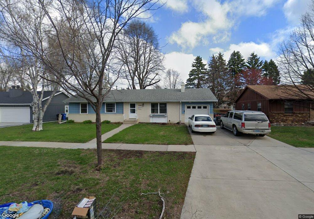
519 23rd Ave S Fargo, ND 58103
Lincoln NeighborhoodEstimated Value: $293,000 - $353,000
3
Beds
2
Baths
2,729
Sq Ft
$114/Sq Ft
Est. Value
About This Home
This home is located at 519 23rd Ave S, Fargo, ND 58103 and is currently estimated at $311,207, approximately $114 per square foot. 519 23rd Ave S is a home located in Cass County with nearby schools including Lincoln Elementary School, Carl Ben Eielson Middle School, and South High School.
Ownership History
Date
Name
Owned For
Owner Type
Purchase Details
Closed on
May 18, 2020
Sold by
Paltzner Heather L and Paltzner Bradley A
Bought by
Morell Samantha A and Groberg Jeffrey
Current Estimated Value
Home Financials for this Owner
Home Financials are based on the most recent Mortgage that was taken out on this home.
Original Mortgage
$228,288
Outstanding Balance
$202,295
Interest Rate
3.3%
Mortgage Type
FHA
Estimated Equity
$108,912
Purchase Details
Closed on
Jul 27, 2014
Sold by
Hunter Jeffrey P and Hunter Roxanne M
Bought by
Hanson Heather L and Patzner Bradley A
Home Financials for this Owner
Home Financials are based on the most recent Mortgage that was taken out on this home.
Original Mortgage
$182,631
Interest Rate
4.4%
Mortgage Type
FHA
Create a Home Valuation Report for This Property
The Home Valuation Report is an in-depth analysis detailing your home's value as well as a comparison with similar homes in the area
Home Values in the Area
Average Home Value in this Area
Purchase History
| Date | Buyer | Sale Price | Title Company |
|---|---|---|---|
| Morell Samantha A | $232,500 | Regency Title Fargo | |
| Hanson Heather L | $186,000 | Fm Title |
Source: Public Records
Mortgage History
| Date | Status | Borrower | Loan Amount |
|---|---|---|---|
| Open | Morell Samantha A | $228,288 | |
| Previous Owner | Hanson Heather L | $182,631 |
Source: Public Records
Tax History Compared to Growth
Tax History
| Year | Tax Paid | Tax Assessment Tax Assessment Total Assessment is a certain percentage of the fair market value that is determined by local assessors to be the total taxable value of land and additions on the property. | Land | Improvement |
|---|---|---|---|---|
| 2024 | $4,027 | $138,300 | $36,000 | $102,300 |
| 2023 | $4,112 | $123,500 | $36,000 | $87,500 |
| 2022 | $4,167 | $123,500 | $36,000 | $87,500 |
| 2021 | $3,806 | $112,250 | $38,000 | $74,250 |
| 2020 | $3,626 | $106,900 | $38,000 | $68,900 |
| 2019 | $3,629 | $106,900 | $23,750 | $83,150 |
| 2018 | $2,892 | $106,900 | $23,750 | $83,150 |
| 2017 | $2,862 | $106,900 | $23,750 | $83,150 |
| 2016 | $2,674 | $108,600 | $23,750 | $84,850 |
| 2015 | $2,235 | $84,350 | $16,150 | $68,200 |
| 2014 | $2,128 | $78,100 | $16,150 | $61,950 |
| 2013 | $2,130 | $78,100 | $16,150 | $61,950 |
Source: Public Records
Map
Nearby Homes
- 2309 9th St S
- 2208 10th St S
- 1008 24th Ave S
- 2458 W Country Club Dr S
- 2517 W Country Club Dr S Unit 10
- 1401 25th Ave S Unit B204
- 2318 15th St S Unit C11
- 2440 15th St S Unit B14
- 2650 15th St S Unit 203
- 1629 10th St S
- 1614 10th St S
- 415 Brook Ave
- 3150 Rivershore Dr
- 2802 Brookdale Rd
- 2532 37th Ave S
- 2519 37th Ave S