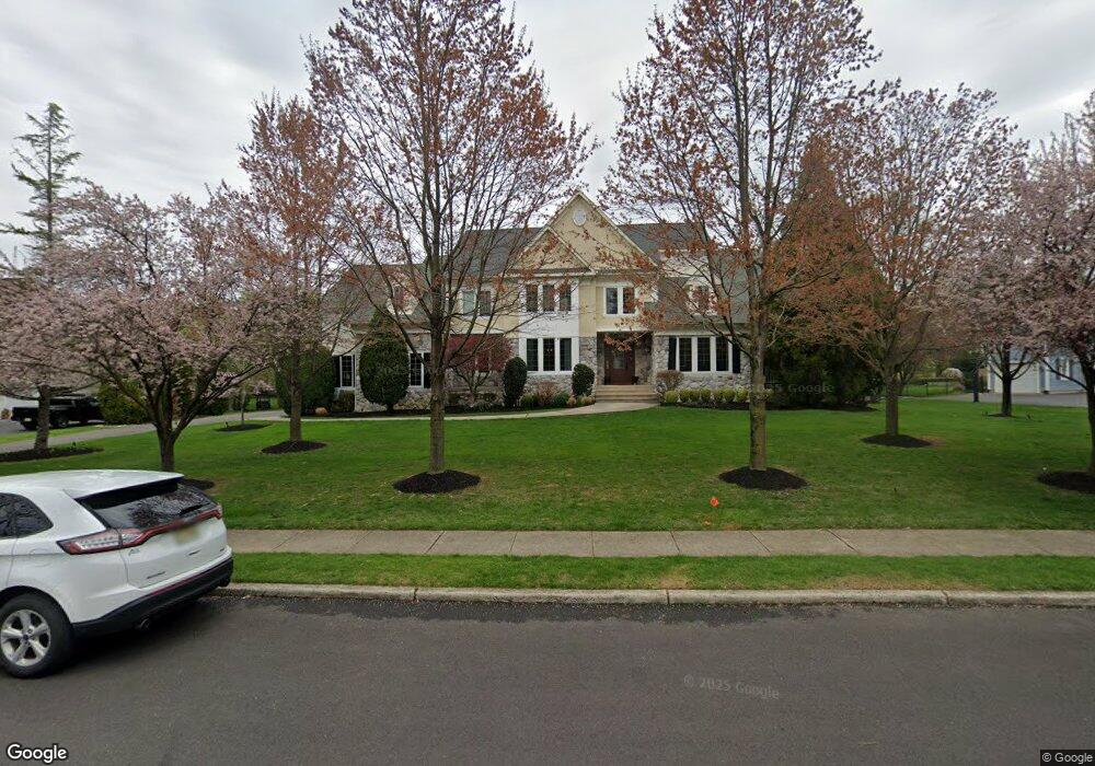
519 Bartram Rd Moorestown, NJ 08057
Estimated Value: $964,000 - $1,779,000
Studio
--
Bath
4,957
Sq Ft
$292/Sq Ft
Est. Value
About This Home
This home is located at 519 Bartram Rd, Moorestown, NJ 08057 and is currently estimated at $1,447,692, approximately $292 per square foot. 519 Bartram Rd is a home located in Burlington County with nearby schools including George C. Baker Elementary School, Moorestown Upper Elementary School, and William Allen Middle School.
Ownership History
Date
Name
Owned For
Owner Type
Purchase Details
Closed on
Apr 15, 2008
Sold by
Luthy William H and Luthy Terri L
Bought by
Stokes Samuel C and Stokes Judith
Current Estimated Value
Home Financials for this Owner
Home Financials are based on the most recent Mortgage that was taken out on this home.
Original Mortgage
$762,000
Outstanding Balance
$498,804
Interest Rate
6.62%
Mortgage Type
Purchase Money Mortgage
Estimated Equity
$948,888
Purchase Details
Closed on
Jan 13, 1999
Sold by
Luthy William H and Luthy Terri L
Bought by
Luthy Terri L
Purchase Details
Closed on
Jun 2, 1998
Sold by
Macaluso Michael A
Bought by
Luthy William H and Luthy Terri L
Home Financials for this Owner
Home Financials are based on the most recent Mortgage that was taken out on this home.
Original Mortgage
$374,000
Interest Rate
7.25%
Create a Home Valuation Report for This Property
The Home Valuation Report is an in-depth analysis detailing your home's value as well as a comparison with similar homes in the area
Home Values in the Area
Average Home Value in this Area
Purchase History
| Date | Buyer | Sale Price | Title Company |
|---|---|---|---|
| Stokes Samuel C | $952,500 | Weichert Title Agency | |
| Luthy Terri L | -- | -- | |
| Luthy William H | $399,900 | Settlers Title Agency Lp |
Source: Public Records
Mortgage History
| Date | Status | Borrower | Loan Amount |
|---|---|---|---|
| Open | Stokes Samuel C | $762,000 | |
| Previous Owner | Luthy William H | $374,000 |
Source: Public Records
Tax History
| Year | Tax Paid | Tax Assessment Tax Assessment Total Assessment is a certain percentage of the fair market value that is determined by local assessors to be the total taxable value of land and additions on the property. | Land | Improvement |
|---|---|---|---|---|
| 2025 | $24,770 | $873,100 | $180,600 | $692,500 |
| 2024 | $24,019 | $873,100 | $180,600 | $692,500 |
| 2023 | $24,019 | $873,100 | $180,600 | $692,500 |
| 2022 | $23,775 | $873,100 | $180,600 | $692,500 |
| 2021 | $23,460 | $873,100 | $180,600 | $692,500 |
| 2020 | $23,312 | $873,100 | $180,600 | $692,500 |
| 2019 | $22,901 | $873,100 | $180,600 | $692,500 |
| 2018 | $22,282 | $873,100 | $180,600 | $692,500 |
| 2017 | $22,474 | $873,100 | $180,600 | $692,500 |
| 2016 | $22,395 | $873,100 | $180,600 | $692,500 |
| 2015 | $22,124 | $873,100 | $180,600 | $692,500 |
| 2014 | $21,007 | $851,400 | $180,600 | $670,800 |
Source: Public Records
Map
Nearby Homes
- 705 Iron Post Rd
- 611 New Albany Rd
- 700 Lippincott Ave
- 543 Bethel Ave
- 2 Oriole Way
- 500 Chester Ave
- 17 Cardinal Dr
- 2801 Riverton Rd
- 307 Fairview Ave
- 401 W 3rd St
- 863 Golf View Rd
- 66 E 3rd St
- 80 E 3rd St
- 140 E Central Ave
- 205 E Central Ave
- 133 Plum St Unit 6
- 504 Wellfleet Rd
- 129 S Church St
- 15 W Close Unit 15
- 744 Signal Light Rd
- 521 Bartram Rd
- 517 Bartram Rd
- 541 Bartram Rd
- 516 Bartram Rd
- 539 Bartram Rd
- 525 Bartram Rd
- 543 Bartram Rd
- 520 Bartram Rd
- 570 New Albany Rd
- 531 Bartram Rd
- 1 Bartram Ct
- 524 Bartram Rd
- 512 Bartram Rd
- 540 Bartram Rd
- 528 Bartram Rd
- 548 Bartram Rd
- 727 Iron Post Rd
- 530 Bartram Rd
- 2 Bartram Ct
- 536 Bartram Rd
Your Personal Tour Guide
Ask me questions while you tour the home.