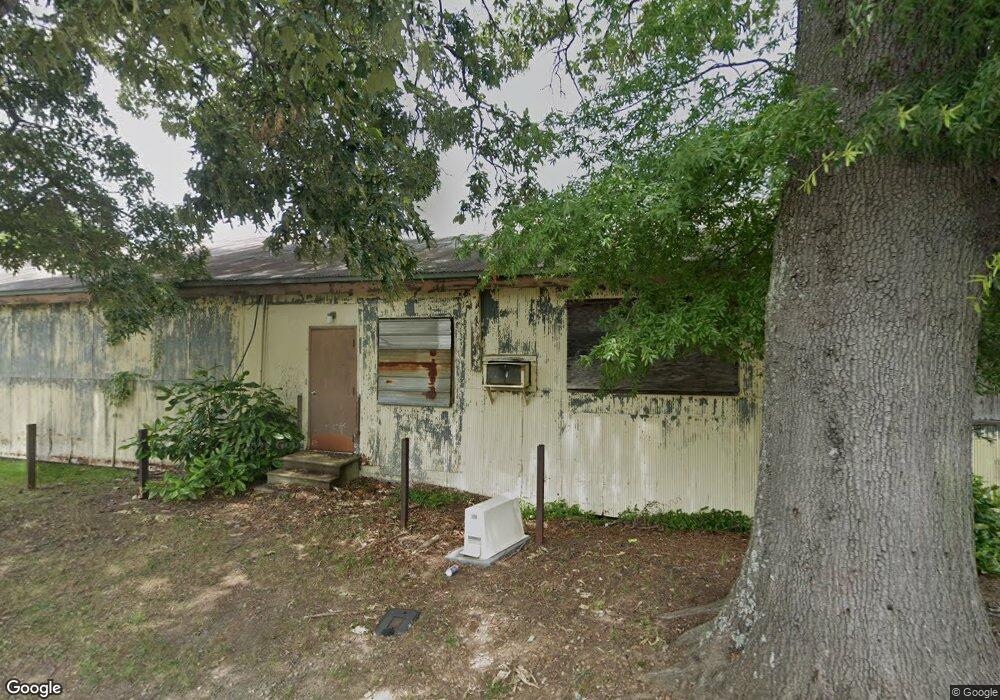
519 Bond St Statesville, NC 28677
--
Bed
5
Baths
11,200
Sq Ft
10.78
Acres
About This Home
This home is located at 519 Bond St, Statesville, NC 28677. 519 Bond St is a home located in Iredell County with nearby schools including East Iredell Elementary School, East Iredell Middle School, and Statesville High School.
Ownership History
Date
Name
Owned For
Owner Type
Purchase Details
Closed on
Oct 1, 2025
Sold by
Cjk Company Lp
Bought by
Bond Opal Holdings Llc
Home Financials for this Owner
Home Financials are based on the most recent Mortgage that was taken out on this home.
Original Mortgage
$1,198,925
Outstanding Balance
$1,198,925
Interest Rate
6.58%
Mortgage Type
New Conventional
Purchase Details
Closed on
Sep 13, 2019
Sold by
Monroe Street Commercial Group Llc
Bought by
Cjk Company Lp
Purchase Details
Closed on
Dec 1, 1988
Create a Home Valuation Report for This Property
The Home Valuation Report is an in-depth analysis detailing your home's value as well as a comparison with similar homes in the area
Home Values in the Area
Average Home Value in this Area
Purchase History
| Date | Buyer | Sale Price | Title Company |
|---|---|---|---|
| Bond Opal Holdings Llc | -- | Stewart Title Guaranty Company | |
| Bond Opal Holdings Llc | $1,410,500 | Stewart Title Guaranty Company | |
| Cjk Company Lp | $375,000 | None Available | |
| -- | $184,000 | -- |
Source: Public Records
Mortgage History
| Date | Status | Borrower | Loan Amount |
|---|---|---|---|
| Open | Bond Opal Holdings Llc | $1,198,925 |
Source: Public Records
Tax History Compared to Growth
Tax History
| Year | Tax Paid | Tax Assessment Tax Assessment Total Assessment is a certain percentage of the fair market value that is determined by local assessors to be the total taxable value of land and additions on the property. | Land | Improvement |
|---|---|---|---|---|
| 2024 | $4,313 | $423,810 | $129,430 | $294,380 |
| 2023 | $4,313 | $423,810 | $129,430 | $294,380 |
| 2022 | $3,977 | $366,410 | $129,430 | $236,980 |
| 2021 | $3,977 | $366,410 | $129,430 | $236,980 |
| 2020 | $3,977 | $366,410 | $129,430 | $236,980 |
| 2019 | $3,940 | $366,410 | $129,430 | $236,980 |
| 2018 | $3,570 | $354,000 | $129,430 | $224,570 |
| 2017 | $3,496 | $354,000 | $129,430 | $224,570 |
| 2016 | $3,496 | $354,000 | $129,430 | $224,570 |
| 2015 | $799 | $354,000 | $129,430 | $224,570 |
| 2014 | $1,193 | $375,220 | $172,570 | $202,650 |
Source: Public Records
Map
Nearby Homes
- 695 S Elm St
- 638 Old Salisbury Rd
- 689 S Elm St
- 1118 Lerain Ct
- 0 Dorset Place
- 1005 Suncrest Ave
- 538 Salisbury Rd
- 825 Coventry Ln Unit 825
- 603 Harmony Dr
- 539 Margaret Dr Unit 163+PT164
- 537 Falls St
- 520 Margaret Dr
- 245 Garfield St
- 1006 Wall St
- 221, 225, & 227 Garfield St
- 533 Broadway Ct
- 537 & 539 Broadway Ct
- 000 Broadway Ct
- 445 Newton Ave
- 506 Broadway Ct