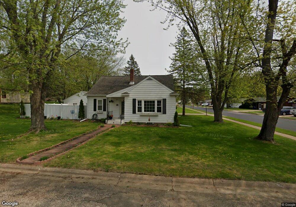
519 Kamke St Rothschild, WI 54474
Estimated Value: $231,000 - $287,000
4
Beds
2
Baths
2,056
Sq Ft
$121/Sq Ft
Est. Value
About This Home
This home is located at 519 Kamke St, Rothschild, WI 54474 and is currently estimated at $248,815, approximately $121 per square foot. 519 Kamke St is a home located in Marathon County with nearby schools including Rothschild Elementary School, D.C. Everest Junior High School, and D.C. Everest Middle School.
Ownership History
Date
Name
Owned For
Owner Type
Purchase Details
Closed on
Mar 15, 2018
Sold by
Perkins Gary L and Perkins Kathy A
Bought by
Loden Will C and Kislow Kayle L
Current Estimated Value
Home Financials for this Owner
Home Financials are based on the most recent Mortgage that was taken out on this home.
Original Mortgage
$127,546
Outstanding Balance
$112,037
Interest Rate
5.5%
Mortgage Type
FHA
Estimated Equity
$136,778
Purchase Details
Closed on
Apr 24, 2015
Sold by
Hovden Christopher and Hovden Amy
Bought by
Perkins Gary L and Perkisn Kathy A
Home Financials for this Owner
Home Financials are based on the most recent Mortgage that was taken out on this home.
Original Mortgage
$82,400
Interest Rate
3.85%
Mortgage Type
New Conventional
Purchase Details
Closed on
Dec 1, 2005
Sold by
Lemke Carol and Nest Clifford
Bought by
Hovden Christopher and Hovden Amy
Create a Home Valuation Report for This Property
The Home Valuation Report is an in-depth analysis detailing your home's value as well as a comparison with similar homes in the area
Home Values in the Area
Average Home Value in this Area
Purchase History
| Date | Buyer | Sale Price | Title Company |
|---|---|---|---|
| Loden Will C | $129,900 | None Available | |
| Perkins Gary L | $103,000 | Wisconsin Title | |
| Hovden Christopher | $102,000 | None Available |
Source: Public Records
Mortgage History
| Date | Status | Borrower | Loan Amount |
|---|---|---|---|
| Open | Loden Will C | $127,546 | |
| Previous Owner | Perkins Gary L | $82,400 |
Source: Public Records
Tax History Compared to Growth
Tax History
| Year | Tax Paid | Tax Assessment Tax Assessment Total Assessment is a certain percentage of the fair market value that is determined by local assessors to be the total taxable value of land and additions on the property. | Land | Improvement |
|---|---|---|---|---|
| 2024 | $2,681 | $187,900 | $25,400 | $162,500 |
| 2023 | $2,525 | $127,800 | $25,400 | $102,400 |
| 2022 | $2,524 | $127,800 | $25,400 | $102,400 |
| 2021 | $2,621 | $127,800 | $25,400 | $102,400 |
| 2020 | $2,492 | $97,100 | $18,300 | $78,800 |
| 2019 | $2,409 | $97,100 | $18,300 | $78,800 |
| 2018 | $2,191 | $97,100 | $18,300 | $78,800 |
| 2017 | $2,184 | $97,100 | $18,300 | $78,800 |
| 2016 | $2,160 | $97,100 | $18,300 | $78,800 |
| 2015 | $2,102 | $97,100 | $18,300 | $78,800 |
| 2014 | $2,061 | $96,900 | $21,900 | $75,000 |
Source: Public Records
Map
Nearby Homes
- 210 Leroy St
- 24.88 acres James Ave
- 1106 Arnold St
- 805 Weston Ave
- 30 Wilson Ave
- 105 Yawkey Ave
- 221545 Azalea Rd
- 228 Greenwood Dr
- Lot 2 Buttercup Rd
- 213 Greenwood Dr
- 7410 Whitespire Rd Unit 14
- 7410 Whitespire Rd
- 7614 Stonefield Trail
- 2102 Edgewood Dr
- 153318 Shoreland Ln
- 2008 Cedar Creek Dr
- 2003 Berlik St
- 1850 Grand Ave
- 2602 Parkway Ln
- 301 Pine Island Ln