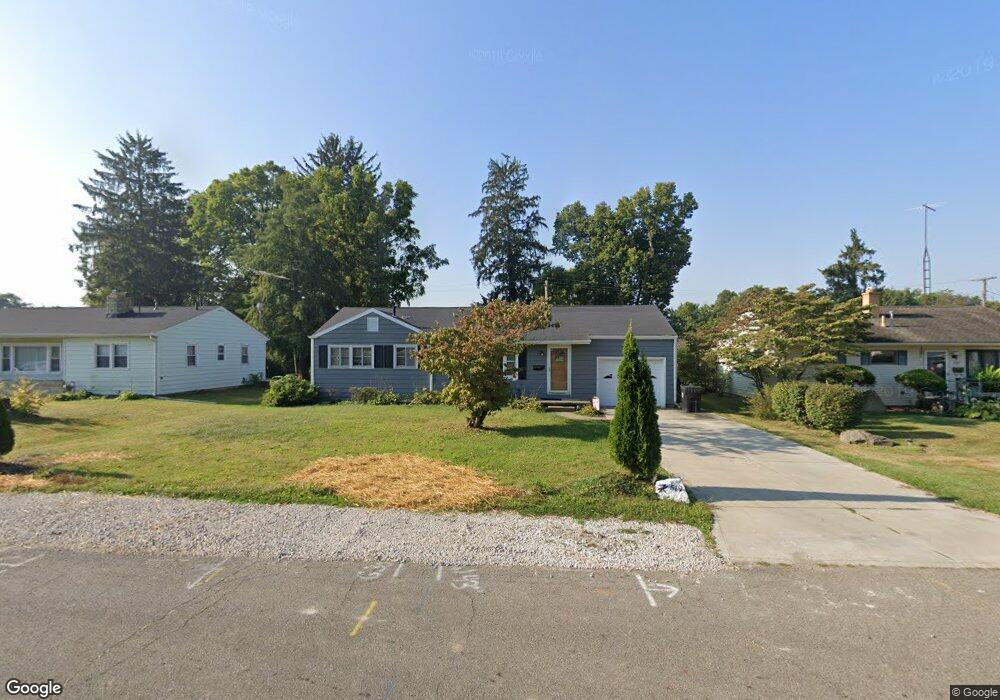
519 Leslie Dr Newark, OH 43055
Estimated Value: $196,000 - $218,000
3
Beds
1
Bath
960
Sq Ft
$213/Sq Ft
Est. Value
About This Home
This home is located at 519 Leslie Dr, Newark, OH 43055 and is currently estimated at $204,429, approximately $212 per square foot. 519 Leslie Dr is a home located in Licking County with nearby schools including John Clem Elementary School, Liberty Middle School, and Newark High School.
Ownership History
Date
Name
Owned For
Owner Type
Purchase Details
Closed on
Jul 26, 2021
Sold by
Pond Dianna B and Pond David Lee
Bought by
Pond Dianna B
Current Estimated Value
Home Financials for this Owner
Home Financials are based on the most recent Mortgage that was taken out on this home.
Original Mortgage
$80,000
Outstanding Balance
$72,745
Interest Rate
2.9%
Mortgage Type
New Conventional
Estimated Equity
$131,684
Purchase Details
Closed on
Jan 12, 2017
Sold by
Oder Scott E and Oder Dianna B
Bought by
Oder Dianna B
Create a Home Valuation Report for This Property
The Home Valuation Report is an in-depth analysis detailing your home's value as well as a comparison with similar homes in the area
Home Values in the Area
Average Home Value in this Area
Purchase History
| Date | Buyer | Sale Price | Title Company |
|---|---|---|---|
| Pond Dianna B | -- | None Available | |
| Oder Dianna B | $75,100 | None Available |
Source: Public Records
Mortgage History
| Date | Status | Borrower | Loan Amount |
|---|---|---|---|
| Open | Pond Dianna B | $80,000 |
Source: Public Records
Tax History Compared to Growth
Tax History
| Year | Tax Paid | Tax Assessment Tax Assessment Total Assessment is a certain percentage of the fair market value that is determined by local assessors to be the total taxable value of land and additions on the property. | Land | Improvement |
|---|---|---|---|---|
| 2024 | $1,767 | $49,460 | $18,970 | $30,490 |
| 2023 | $1,766 | $49,460 | $18,970 | $30,490 |
| 2022 | $1,758 | $43,820 | $10,920 | $32,900 |
| 2021 | $1,844 | $43,820 | $10,920 | $32,900 |
| 2020 | $1,875 | $43,580 | $10,680 | $32,900 |
| 2019 | $1,546 | $34,590 | $9,280 | $25,310 |
| 2018 | $1,547 | $0 | $0 | $0 |
| 2017 | $1,353 | $0 | $0 | $0 |
| 2016 | $1,197 | $0 | $0 | $0 |
| 2015 | $1,223 | $0 | $0 | $0 |
| 2014 | $1,566 | $0 | $0 | $0 |
| 2013 | $1,291 | $0 | $0 | $0 |
Source: Public Records
Map
Nearby Homes
- 533 Leslie Dr
- 565 Granville St
- 562 Jutlew Rd
- 594 N 21st St
- 188 Meadow Dr
- 184 Meadow Dr
- 632 Granville Rd
- 408 Granville St
- 361 Granville St
- 752 Maxola Ave
- 830 Walker St
- 584 Moull St Unit A
- 425 N 11th St
- 473 Meadowbrook Dr
- 855 E Village Dr
- 440 Reverie Place
- 370 Meadowbrook Dr
- 64 N 10th St
- 188 Neal Ave
- 218 Granville St
- 513 Leslie Dr
- 527 Leslie Dr
- 505 Leslie Dr
- 524 Granville St
- 496 Granville St
- 632 Karen Pkwy
- 526 Granville St
- 499 Leslie Dr
- 526 Leslie Dr
- 528 Granville St
- 620 Meadow Dr
- 534 Leslie Dr
- 640 Karen Pkwy
- 627 Euclid Ave
- 543 Leslie Dr
- 532 Granville St
- 494 Granville St
- 609 Euclid Ave
- 633 Euclid Ave
- 492 Granville St