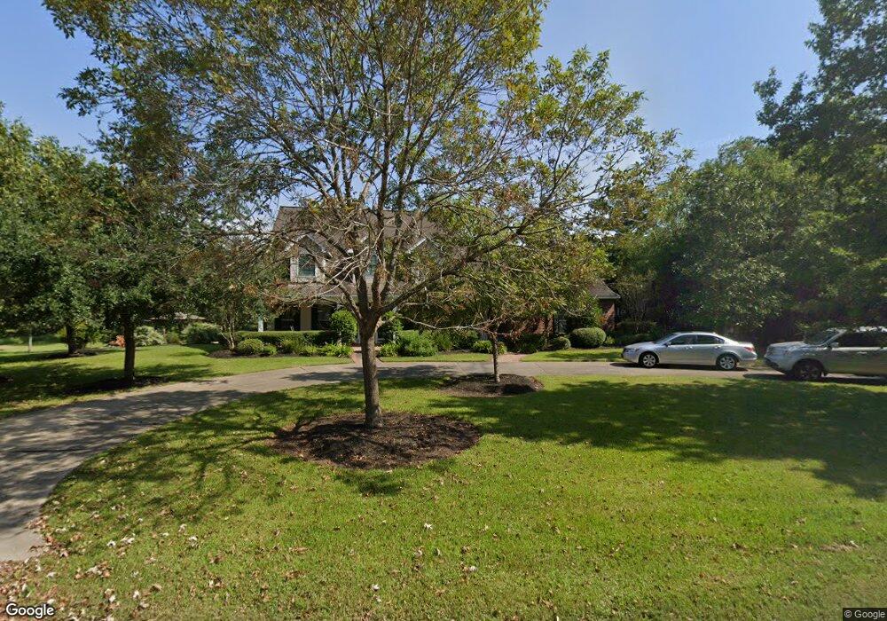
519 Linson Ln Friendswood, TX 77546
Estimated Value: $852,000 - $924,000
--
Bed
4
Baths
3,676
Sq Ft
$238/Sq Ft
Est. Value
About This Home
This home is located at 519 Linson Ln, Friendswood, TX 77546 and is currently estimated at $876,181, approximately $238 per square foot. 519 Linson Ln is a home located in Galveston County with nearby schools including Westwood Elementary School, Zue S. Bales Intermediate School, and Friendswood Junior High School.
Ownership History
Date
Name
Owned For
Owner Type
Purchase Details
Closed on
May 29, 1998
Sold by
Willowbrook Farm
Bought by
Mckitrick Kent Richard and Mckitrick Edith Ann
Current Estimated Value
Home Financials for this Owner
Home Financials are based on the most recent Mortgage that was taken out on this home.
Original Mortgage
$45,500
Outstanding Balance
$9,277
Interest Rate
7.27%
Mortgage Type
Purchase Money Mortgage
Estimated Equity
$866,904
Create a Home Valuation Report for This Property
The Home Valuation Report is an in-depth analysis detailing your home's value as well as a comparison with similar homes in the area
Home Values in the Area
Average Home Value in this Area
Purchase History
| Date | Buyer | Sale Price | Title Company |
|---|---|---|---|
| Mckitrick Kent Richard | -- | -- |
Source: Public Records
Mortgage History
| Date | Status | Borrower | Loan Amount |
|---|---|---|---|
| Open | Mckitrick Kent Richard | $45,500 |
Source: Public Records
Tax History Compared to Growth
Tax History
| Year | Tax Paid | Tax Assessment Tax Assessment Total Assessment is a certain percentage of the fair market value that is determined by local assessors to be the total taxable value of land and additions on the property. | Land | Improvement |
|---|---|---|---|---|
| 2025 | $5,218 | $593,054 | -- | -- |
| 2024 | $5,218 | $539,140 | -- | -- |
| 2023 | $5,218 | $490,127 | $0 | $0 |
| 2022 | $9,814 | $445,570 | $0 | $0 |
| 2021 | $9,461 | $494,580 | $146,190 | $348,390 |
| 2020 | $8,872 | $368,240 | $146,190 | $222,050 |
| 2019 | $10,083 | $397,070 | $146,190 | $250,880 |
| 2018 | $10,142 | $397,070 | $146,190 | $250,880 |
| 2017 | $10,312 | $397,070 | $146,190 | $250,880 |
| 2016 | $10,336 | $398,000 | $146,190 | $251,810 |
| 2015 | $3,616 | $398,000 | $146,190 | $251,810 |
| 2014 | $3,444 | $366,080 | $146,190 | $219,890 |
Source: Public Records
Map
Nearby Homes
- 1002 Cowards Creek Ct
- 912 Falling Leaf Dr
- 1204 Cowards Creek Dr
- 1208 Cowards Creek Dr
- 1004 Tall Pines Dr
- 607 Fernwood Dr
- 803 Greenbriar Ave
- 205 Del Monte Dr
- 807 Evergreen Dr
- 1115 W Castlewood Ave
- 904 W Castlewood Ave
- 1404 Blueberry Ln
- 1305 Buttonwood Dr
- 1114 W Castlewood Ave
- 1101 Killarney Ave
- 805 W Edgewood Dr
- 607 Misty Ln
- 1412 Cambridge Dr
- 702 Pine Hollow Dr
- 524 Fairdale St
- 603 Linson Ln
- 1008 Cowards Creek Ct
- 514 Linson Ln
- 518 Linson Ln
- 607 Linson Ln
- 15 Falling Leaf Ct
- 13 Falling Leaf Ct
- 1007 Cowards Creek Ct
- 1006 Cowards Creek Ct
- 19 Falling Leaf Ct
- 11 Falling Leaf Ct
- 9 Falling Leaf Ct
- 510 Linson Ln
- 1010 Falling Leaf Dr
- 1103 Cowards Creek Dr
- 1005 Cowards Creek Ct
- 1007 Cowards Creek Dr
- 1105 Cowards Creek Dr
- 7 Falling Leaf Ct
- 1005 Cowards Creek Dr