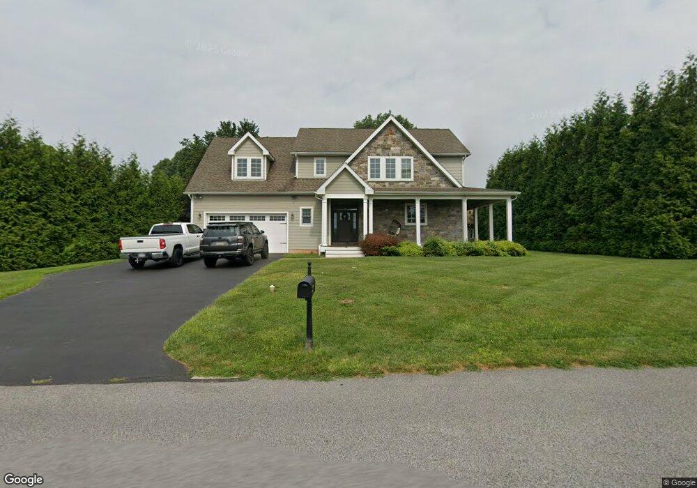
519 Port Indian Rd West Norriton, PA 19403
West Norriton Township NeighborhoodEstimated Value: $501,000 - $565,283
3
Beds
3
Baths
2,074
Sq Ft
$256/Sq Ft
Est. Value
About This Home
This home is located at 519 Port Indian Rd, West Norriton, PA 19403 and is currently estimated at $531,821, approximately $256 per square foot. 519 Port Indian Rd is a home with nearby schools including Charles Blockson Middle School, Paul V Fly Elementary School, and East Norriton Middle School.
Ownership History
Date
Name
Owned For
Owner Type
Purchase Details
Closed on
Dec 1, 2008
Sold by
Durante Edward J
Bought by
Springer George Chad and Springer Kori
Current Estimated Value
Home Financials for this Owner
Home Financials are based on the most recent Mortgage that was taken out on this home.
Original Mortgage
$60,000
Interest Rate
6.49%
Create a Home Valuation Report for This Property
The Home Valuation Report is an in-depth analysis detailing your home's value as well as a comparison with similar homes in the area
Home Values in the Area
Average Home Value in this Area
Purchase History
| Date | Buyer | Sale Price | Title Company |
|---|---|---|---|
| Springer George Chad | -- | None Available |
Source: Public Records
Mortgage History
| Date | Status | Borrower | Loan Amount |
|---|---|---|---|
| Closed | Springer George Chad | $60,000 |
Source: Public Records
Tax History Compared to Growth
Tax History
| Year | Tax Paid | Tax Assessment Tax Assessment Total Assessment is a certain percentage of the fair market value that is determined by local assessors to be the total taxable value of land and additions on the property. | Land | Improvement |
|---|---|---|---|---|
| 2025 | $8,501 | $174,000 | -- | -- |
| 2024 | $8,501 | $174,000 | -- | -- |
| 2023 | $8,405 | $174,000 | $0 | $0 |
| 2022 | $8,351 | $174,000 | $0 | $0 |
| 2021 | $8,300 | $174,000 | $0 | $0 |
| 2020 | $8,052 | $174,000 | $0 | $0 |
| 2019 | $7,872 | $174,000 | $0 | $0 |
| 2018 | $6,177 | $174,000 | $0 | $0 |
| 2017 | $7,432 | $174,000 | $0 | $0 |
| 2016 | $7,365 | $174,000 | $0 | $0 |
| 2015 | $6,823 | $174,000 | $0 | $0 |
| 2014 | $6,823 | $174,000 | $0 | $0 |
Source: Public Records
Map
Nearby Homes
- 2044 Mill Rd
- 0 Roosevelt Blvd
- 2017 Yorktown S
- 526 Bassett Ln
- 2012 Yorktown S
- 1924 Juniata Rd
- 1905 Yorktown N
- 1914 Yorktown S
- 37 Burnside Ave
- 307 Brandon Rd
- 402 Brandon Rd
- 533 Brandon Rd
- 143 Riversedge Dr Unit CONDO 143
- 167 Woodstream Dr Unit CONDO 167
- 365 Norris Hall Ln
- 176 Riversedge Dr
- 121 Woodstream Dr Unit CONDO 121
- 123 Glenwood Ave
- 1503 Reagan Ct
- 2504 Grant Ct
- 513 Port Indian Rd
- 220 Egypt Rd
- 525 Port Indian Rd
- 210 Egypt Rd
- 206 Egypt Rd
- 224 Egypt Rd
- 200 Egypt Rd
- 226 Egypt Rd Unit 7
- 533 Port Indian Rd
- 537 Port Indian Rd
- 207 Egypt Rd
- 215 Egypt Rd
- 230 Egypt Rd
- 219 Egypt Rd
- 223 Egypt Rd Unit 10
- 198 Egypt Rd
- 234 Egypt Rd
- 541 Port Indian Rd
- 116 Golf Cart Dr
- 236 Egypt Rd