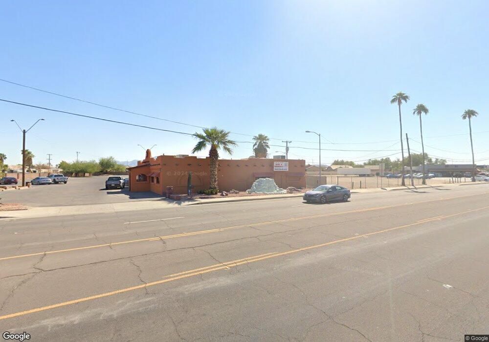
519 W Main St Avondale, AZ 85323
Old Town Neighborhood
--
Bed
--
Bath
10,500
Sq Ft
1.99
Acres
About This Home
This home is located at 519 W Main St, Avondale, AZ 85323. 519 W Main St is a home located in Maricopa County with nearby schools including Michael Anderson School, Desert Edge High School, and Estrella High School.
Ownership History
Date
Name
Owned For
Owner Type
Purchase Details
Closed on
Oct 19, 2015
Sold by
L H One Llc
Bought by
Indie Properties Inc
Purchase Details
Closed on
May 31, 2007
Sold by
Lantzman Mortgage Fund Llc
Bought by
Lh One Llc
Home Financials for this Owner
Home Financials are based on the most recent Mortgage that was taken out on this home.
Original Mortgage
$1,500,000
Interest Rate
6.14%
Mortgage Type
Assumption
Create a Home Valuation Report for This Property
The Home Valuation Report is an in-depth analysis detailing your home's value as well as a comparison with similar homes in the area
Home Values in the Area
Average Home Value in this Area
Purchase History
| Date | Buyer | Sale Price | Title Company |
|---|---|---|---|
| Indie Properties Inc | $105,000 | Fidelity National Title Co | |
| Lh One Llc | $1,400,000 | Transnation Title Ins Co | |
| Lantzman Mortgage Fund Llc | $500,000 | None Available |
Source: Public Records
Mortgage History
| Date | Status | Borrower | Loan Amount |
|---|---|---|---|
| Previous Owner | Lh One Llc | $1,500,000 |
Source: Public Records
Tax History Compared to Growth
Tax History
| Year | Tax Paid | Tax Assessment Tax Assessment Total Assessment is a certain percentage of the fair market value that is determined by local assessors to be the total taxable value of land and additions on the property. | Land | Improvement |
|---|---|---|---|---|
| 2025 | $18,468 | $163,481 | -- | -- |
| 2024 | $18,072 | $160,562 | -- | -- |
| 2023 | $18,072 | $234,770 | $93,466 | $141,304 |
| 2022 | $17,922 | $201,093 | $70,525 | $130,568 |
| 2021 | $19,430 | $206,766 | $72,540 | $134,226 |
| 2020 | $18,829 | $192,330 | $56,628 | $135,702 |
| 2019 | $18,713 | $185,742 | $53,640 | $132,102 |
| 2018 | $18,790 | $169,830 | $39,420 | $130,410 |
| 2017 | $18,324 | $161,046 | $38,268 | $122,778 |
| 2016 | $18,584 | $154,368 | $41,508 | $112,860 |
| 2015 | $17,860 | $132,757 | $43,420 | $89,337 |
Source: Public Records
Map
Nearby Homes
- 830 S Greenleaf Ln
- 127 W Main St Unit 6
- 300 W Lower Buckeye Rd Unit 26
- 0 Lower Buckeye -- Unit 12
- 110 W Main St
- 607 S 1st St
- 31 W Aragon Ln
- 629 S 4th St
- 400 E Main St Unit 23
- 448 E Main St Unit 18
- 622 E Elm Ln
- 1010 S 5th St
- 535 E Agua Fria Ln
- 823 E Agua Fria Ln
- 814 E Agua Fria Ln
- 831 E Agua Fria Ln
- 206 N 5th St
- 845 E Agua Fria Ln
- 12XX N Dysart Rd Unit 1 & 2
- 919 E Agua Fria Ln
- 315 W Main St
- 610 W Mountain View Dr
- 606 W Mountain View Dr
- 614 W Mountain View Dr
- 602 W Mountain View Dr
- 618 W Mountain View Dr
- 514 W Mountain View Dr
- 622 W Mountain View Dr
- 506 W Mountain View Dr
- 1002 S 7th Ave
- 826 S Greenleaf Ln
- 506 W Whyman Ave
- 822 S Greenleaf Ln
- 0 W Main St Unit 2
- 0 W Main St Unit 6587504
- 0 W Main St Unit 6176235
- 818 S Greenleaf Ln
- 502 W Mountain View Dr
- 1010 S 6th Ave
- 812 S Greenleaf Ln