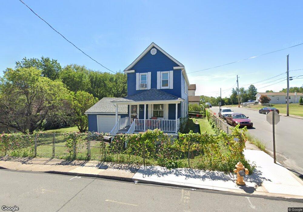
519 W Taylor St Taylor, PA 18517
Estimated Value: $134,312 - $283,000
--
Bed
--
Bath
--
Sq Ft
3,354
Sq Ft Lot
About This Home
This home is located at 519 W Taylor St, Taylor, PA 18517 and is currently estimated at $228,828. 519 W Taylor St is a home located in Lackawanna County with nearby schools including Willard Middle School, Riverside Junior/Senior High School, and Triboro Christian Academy.
Ownership History
Date
Name
Owned For
Owner Type
Purchase Details
Closed on
Feb 21, 2019
Sold by
Bowman Roberta L and Bowman David M
Bought by
Bowman Roberta L and Bowman David M
Current Estimated Value
Purchase Details
Closed on
Mar 8, 2007
Sold by
Bowman Roberta Crosby
Bought by
Bowman Robert L and Bowman David M
Home Financials for this Owner
Home Financials are based on the most recent Mortgage that was taken out on this home.
Original Mortgage
$75,000
Interest Rate
6.07%
Mortgage Type
New Conventional
Create a Home Valuation Report for This Property
The Home Valuation Report is an in-depth analysis detailing your home's value as well as a comparison with similar homes in the area
Home Values in the Area
Average Home Value in this Area
Purchase History
| Date | Buyer | Sale Price | Title Company |
|---|---|---|---|
| Bowman Roberta L | -- | Velocity Abstract Llc | |
| Bowman Robert L | -- | None Available |
Source: Public Records
Mortgage History
| Date | Status | Borrower | Loan Amount |
|---|---|---|---|
| Closed | Bowman Robert L | $75,000 |
Source: Public Records
Tax History Compared to Growth
Tax History
| Year | Tax Paid | Tax Assessment Tax Assessment Total Assessment is a certain percentage of the fair market value that is determined by local assessors to be the total taxable value of land and additions on the property. | Land | Improvement |
|---|---|---|---|---|
| 2025 | $2,169 | $9,000 | $1,500 | $7,500 |
| 2024 | $1,935 | $9,000 | $1,500 | $7,500 |
| 2023 | $1,935 | $9,000 | $1,500 | $7,500 |
| 2022 | $1,935 | $9,000 | $1,500 | $7,500 |
| 2021 | $1,935 | $9,000 | $1,500 | $7,500 |
| 2020 | $1,897 | $9,000 | $1,500 | $7,500 |
| 2019 | $1,807 | $9,000 | $1,500 | $7,500 |
| 2018 | $1,775 | $9,000 | $1,500 | $7,500 |
| 2017 | $1,724 | $9,000 | $1,500 | $7,500 |
| 2016 | $871 | $9,000 | $1,500 | $7,500 |
| 2015 | -- | $9,000 | $1,500 | $7,500 |
| 2014 | -- | $9,000 | $1,500 | $7,500 |
Source: Public Records
Map
Nearby Homes
- 701-703 Union St
- 0 Union St Unit GSBSC251501
- Parcel B Davis Ct
- 115 W High St
- 112 E Taylor St
- 136 E Grove St
- 0 Cooper St Unit GSBSC255606
- Lot 02 Sibley Ave
- 0 Oak St Unit GSBSC255768
- Lot 02 Casey Ave
- 103 Davis St
- 736 Oak St
- 448-450 N Main St
- 2932 Penman St
- 133 Corcoran St
- 170 2nd St
- 3742 Laurel Ave
- 307 Charles St
- 0 William St Unit GSBSC253642
- 710 Maple St
- 405 Harrison St
- 601 W 603 Taylor L 624 St
- 601 W Taylor St Unit 603
- 513 W Taylor St
- 605-607 W Taylor St
- 605 W Taylor St Unit 607
- 524 W Taylor St
- 605 W 607 Taylor St
- 509-511 W Taylor St
- 520 W Taylor St
- 509 W Taylor St Unit 511
- 604 W Taylor St
- 407 Harrison St
- 516 W Taylor St
- 505 W Taylor St Unit 507
- 512 W Taylor St
- 610 W Taylor St
- 409 Harrison St
- 612 W Taylor St
- 508 W Taylor St