Estimated Value: $264,000 - $291,000
2
Beds
2
Baths
1,396
Sq Ft
$198/Sq Ft
Est. Value
About This Home
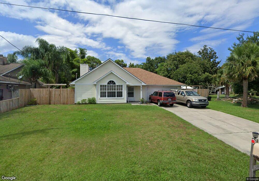
This home is located at 5190 Fruitport St, Cocoa, FL 32927 and is currently estimated at $275,895, approximately $197 per square foot. 5190 Fruitport St is a home located in Brevard County with nearby schools including Challenger 7 Elementary School, Space Coast Junior/Senior High School, and Sculptor Charter School.
Ownership History
Date
Name
Owned For
Owner Type
Purchase Details
Closed on
Jun 1, 2000
Sold by
Bunge Franklin M
Bought by
Wall David C and Wall Nancy J
Current Estimated Value
Home Financials for this Owner
Home Financials are based on the most recent Mortgage that was taken out on this home.
Original Mortgage
$66,400
Outstanding Balance
$23,275
Interest Rate
8.14%
Estimated Equity
$252,620
Purchase Details
Closed on
Mar 30, 1998
Sold by
Mcbride Darcella H and Hoxie Darcella Lynn
Bought by
Bunge Franklin M
Home Financials for this Owner
Home Financials are based on the most recent Mortgage that was taken out on this home.
Original Mortgage
$75,500
Interest Rate
6.95%
Create a Home Valuation Report for This Property
The Home Valuation Report is an in-depth analysis detailing your home's value as well as a comparison with similar homes in the area
Home Values in the Area
Average Home Value in this Area
Purchase History
| Date | Buyer | Sale Price | Title Company |
|---|---|---|---|
| Wall David C | $83,000 | -- | |
| Bunge Franklin M | $79,500 | -- |
Source: Public Records
Mortgage History
| Date | Status | Borrower | Loan Amount |
|---|---|---|---|
| Open | Wall David C | $66,400 | |
| Previous Owner | Bunge Franklin M | $75,500 |
Source: Public Records
Tax History Compared to Growth
Tax History
| Year | Tax Paid | Tax Assessment Tax Assessment Total Assessment is a certain percentage of the fair market value that is determined by local assessors to be the total taxable value of land and additions on the property. | Land | Improvement |
|---|---|---|---|---|
| 2025 | $1,041 | $77,290 | -- | -- |
| 2024 | $1,020 | $75,120 | -- | -- |
| 2023 | $1,020 | $72,940 | $0 | $0 |
| 2022 | $962 | $70,820 | $0 | $0 |
| 2021 | $964 | $68,760 | $0 | $0 |
| 2020 | $919 | $67,820 | $0 | $0 |
| 2019 | $866 | $66,300 | $0 | $0 |
| 2018 | $867 | $65,070 | $0 | $0 |
| 2017 | $869 | $63,740 | $0 | $0 |
| 2016 | $876 | $62,430 | $18,000 | $44,430 |
| 2015 | $883 | $62,000 | $15,000 | $47,000 |
| 2014 | $888 | $61,510 | $11,000 | $50,510 |
Source: Public Records
Map
Nearby Homes
- 5149 Arlington Rd Unit 104
- 00 Unknown
- 0000 Grissom Pkwy
- 6375 Cable Ave
- 6735 Grissom Pkwy
- 5145 Fay Blvd
- 6615 Dock Ave
- 5220 Holden Rd
- 6240 Grissom Pkwy
- 5275 Holden Rd
- 4975 Fay Blvd
- 5049 Jamaica Rd
- 6390 Depot Ave
- 5090 Market St
- 6840 Anecia Ave
- 5265 Fay Blvd
- 6581 Bancroft Ave
- 6175 Grissom Pkwy
- 6061 Banbury Ave
- 5155 Mayflower St
- 5200 Fruitport St
- 5210 Fruitport St
- 5170 Fruitport St
- 6470 Aberfoyle Ave
- 5143 Arlington Rd
- 5149 Arlington Rd
- 6475 Abisco Rd
- 5220 Fruitport St
- 5155 Arlington Rd
- 6460 Aberfoyle Ave
- 5165 Fruitport St
- 362 Akron St S
- 2401 N Highway 1 Hwy NW Unit 204
- 7240 N Highway 1 W Unit 103
- 5131 Arlington Rd
- 0 Arlington Rd
- 6465 Aberfoyle Ave
- 5230 Fruitport St
- 5150 Fruitport St
- 6465 Abisco Rd