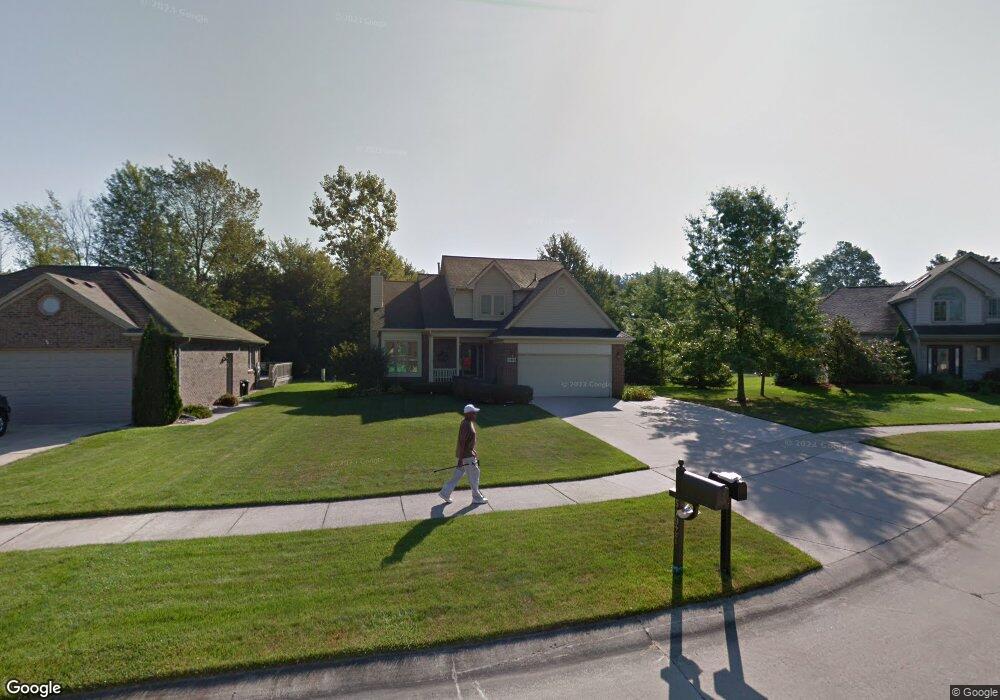
51928 Boland Rd Chesterfield, MI 48047
Estimated Value: $373,255 - $480,000
3
Beds
3
Baths
1,827
Sq Ft
$227/Sq Ft
Est. Value
About This Home
This home is located at 51928 Boland Rd, Chesterfield, MI 48047 and is currently estimated at $415,564, approximately $227 per square foot. 51928 Boland Rd is a home with nearby schools including Lottie M. Schmidt Elementary School, Anchor Bay Middle School South, and Anchor Bay High School.
Ownership History
Date
Name
Owned For
Owner Type
Purchase Details
Closed on
Oct 13, 2015
Sold by
Czostkowski Amy B
Bought by
Czostkowski Joseph M
Current Estimated Value
Home Financials for this Owner
Home Financials are based on the most recent Mortgage that was taken out on this home.
Original Mortgage
$167,000
Interest Rate
3.91%
Mortgage Type
New Conventional
Create a Home Valuation Report for This Property
The Home Valuation Report is an in-depth analysis detailing your home's value as well as a comparison with similar homes in the area
Home Values in the Area
Average Home Value in this Area
Purchase History
| Date | Buyer | Sale Price | Title Company |
|---|---|---|---|
| Czostkowski Joseph M | -- | Attorney |
Source: Public Records
Mortgage History
| Date | Status | Borrower | Loan Amount |
|---|---|---|---|
| Closed | Czostkowski Joseph M | $167,000 |
Source: Public Records
Tax History Compared to Growth
Tax History
| Year | Tax Paid | Tax Assessment Tax Assessment Total Assessment is a certain percentage of the fair market value that is determined by local assessors to be the total taxable value of land and additions on the property. | Land | Improvement |
|---|---|---|---|---|
| 2025 | $3,879 | $169,800 | $0 | $0 |
| 2024 | $2,234 | $162,800 | $0 | $0 |
| 2023 | $2,117 | $150,700 | $0 | $0 |
| 2022 | $3,510 | $132,200 | $0 | $0 |
| 2021 | $3,413 | $117,100 | $0 | $0 |
| 2020 | $1,946 | $115,200 | $0 | $0 |
| 2019 | $3,025 | $112,300 | $0 | $0 |
| 2018 | $3,095 | $108,000 | $19,400 | $88,600 |
| 2017 | $3,031 | $101,700 | $19,400 | $82,300 |
| 2016 | $3,025 | $101,700 | $0 | $0 |
| 2015 | $1,406 | $95,550 | $0 | $0 |
| 2014 | $1,406 | $86,750 | $19,400 | $67,350 |
| 2012 | -- | $0 | $0 | $0 |
Source: Public Records
Map
Nearby Homes
- 51300 Kirby Dr
- 34276 Cherry Hill Ln
- 34697 E Wilma Ct
- 51553 Baker Rd
- 51413 Baker Rd
- 51385 Baker Rd
- 51118 Courtyard Dr
- 52657 Huntley Ave
- 52742 S Weathervane Dr
- 35786 Walden Ct
- 52966 Trailside Dr
- 34300 W Hill Dr
- 35260 Bradford Dr
- 51635 Laurel Oak Ln
- 51316 Johns Dr Unit 14
- 35037 Windsor Dr
- 50578 Woodbury Dr Unit 73
- 51433 Fox Hill Trail Unit NO
- 55060 Baker Rd
- 34735 Joel St
- 51960 Boland Rd
- 34626 Gillies Rd
- 34594 Gillies Rd
- 51719 Leshan Dr
- 51713 Leshan Dr
- 51927 Boland Rd
- 51725 Leshan Dr
- 51707 Leshan Dr
- 51959 Boland Rd Unit Bldg-Unit
- 51959 Boland Rd
- 34562 Gillies Rd
- 51701 Leshan Dr
- 51991 Boland Rd
- 34530 Gillies Rd
- 52014 Boland Rd
- 52013 Boland Rd
- 51926 Kristen
- 51958 Kristen
- 51731 Leshan Dr
- 34498 Gillies Rd