Estimated Value: $318,141 - $341,000
3
Beds
2
Baths
1,568
Sq Ft
$210/Sq Ft
Est. Value
About This Home
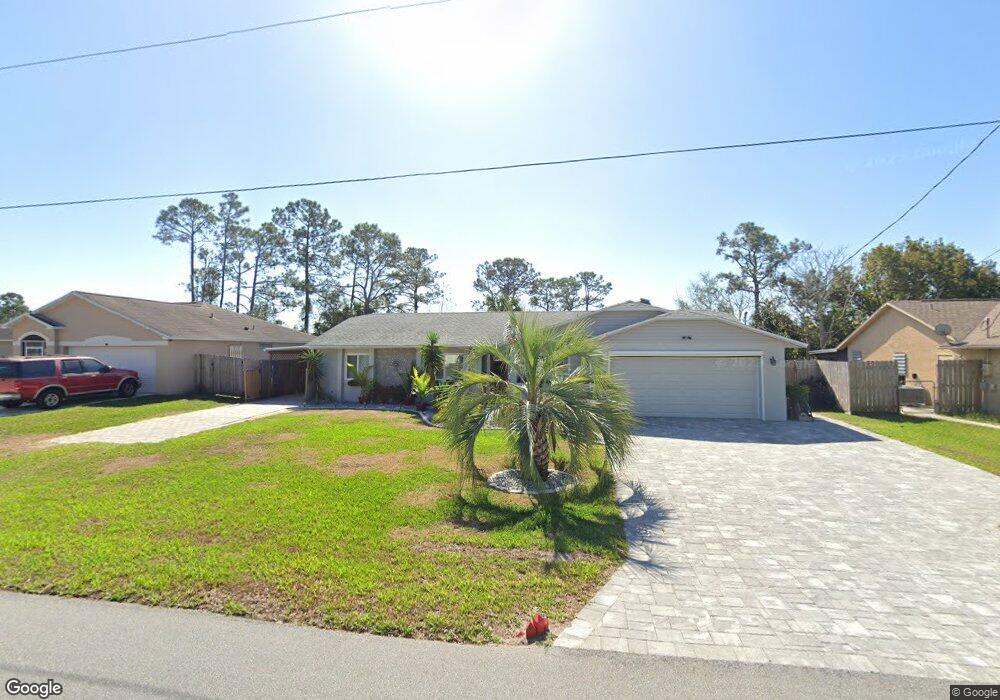
This home is located at 5193 Bridge Rd, Cocoa, FL 32927 and is currently estimated at $329,285, approximately $210 per square foot. 5193 Bridge Rd is a home located in Brevard County with nearby schools including Challenger 7 Elementary School, Space Coast Junior/Senior High School, and East Atlantic Prep of Brevard County.
Ownership History
Date
Name
Owned For
Owner Type
Purchase Details
Closed on
Dec 23, 1997
Sold by
Statlick James S
Bought by
Statlick James S and Statlick Harold Debra
Current Estimated Value
Home Financials for this Owner
Home Financials are based on the most recent Mortgage that was taken out on this home.
Original Mortgage
$69,200
Outstanding Balance
$11,656
Interest Rate
7.18%
Estimated Equity
$317,629
Create a Home Valuation Report for This Property
The Home Valuation Report is an in-depth analysis detailing your home's value as well as a comparison with similar homes in the area
Home Values in the Area
Average Home Value in this Area
Purchase History
| Date | Buyer | Sale Price | Title Company |
|---|---|---|---|
| Statlick James S | $34,000 | -- |
Source: Public Records
Mortgage History
| Date | Status | Borrower | Loan Amount |
|---|---|---|---|
| Open | Statlick James S | $69,200 |
Source: Public Records
Tax History
| Year | Tax Paid | Tax Assessment Tax Assessment Total Assessment is a certain percentage of the fair market value that is determined by local assessors to be the total taxable value of land and additions on the property. | Land | Improvement |
|---|---|---|---|---|
| 2025 | $1,359 | $103,530 | -- | -- |
| 2024 | $1,320 | $100,620 | -- | -- |
| 2023 | $1,320 | $97,690 | $0 | $0 |
| 2022 | $1,283 | $94,850 | $0 | $0 |
| 2021 | $1,279 | $92,090 | $0 | $0 |
| 2020 | $1,216 | $90,820 | $0 | $0 |
| 2019 | $1,151 | $88,780 | $0 | $0 |
| 2018 | $1,142 | $87,130 | $0 | $0 |
| 2017 | $1,133 | $85,340 | $0 | $0 |
| 2016 | $1,140 | $83,590 | $18,000 | $65,590 |
| 2015 | $1,151 | $83,010 | $15,000 | $68,010 |
| 2014 | $1,151 | $82,360 | $11,000 | $71,360 |
Source: Public Records
Map
Nearby Homes
- 5950 Ackard Ave
- 5945 Coker Ave
- 6020 Cannon Ave
- 5946 Deer Ln
- 5221 Carrick Rd
- 6094 Cardiff Ave
- 5914 Stillwater Ave
- 5215 Holden Rd
- 5220 Holden Rd
- 4905 Bridge Rd
- 4975 Fay Blvd
- 6210 Stillwater Ave
- 5265 Fay Blvd
- 6375 Cable Ave
- 6438 Hudson Rd
- 000 Port Saint John Pkwy
- 5720 Flint Rd
- 6450 Ember Ave
- No Access Port Saint John Pkwy
- 6310 Depot Ave
- 5181 Bridge Rd Unit 4
- 5205 Bridge Rd
- 5169 Bridge Rd
- 5217 Bridge Rd
- 5186 Bridge Rd
- 5198 Bridge Rd
- 5910 Cannon Ave
- 5210 Bridge Rd
- 5157 Bridge Rd
- 5229 Bridge Rd
- Tbd Bridge Rd
- 5222 Bridge Rd
- 5211 Sanbourne St
- 5915 Cannon Ave
- 5145 Bridge Rd
- 5241 Bridge Rd
- 5201 Sanbourne St
- 5231 Sanbourne St
- 5234 Bridge Rd
- 5241 Sanbourne St
Your Personal Tour Guide
Ask me questions while you tour the home.