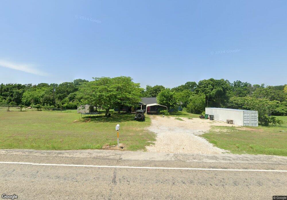
5193 Zion Hill Rd Weatherford, TX 76088
Estimated Value: $367,805 - $561,000
--
Bed
--
Bath
1,894
Sq Ft
$226/Sq Ft
Est. Value
About This Home
This home is located at 5193 Zion Hill Rd, Weatherford, TX 76088 and is currently estimated at $427,451, approximately $225 per square foot. 5193 Zion Hill Rd is a home located in Parker County with nearby schools including Peaster Elementary School, Peaster Middle School, and Peaster High School.
Ownership History
Date
Name
Owned For
Owner Type
Purchase Details
Closed on
Oct 16, 2006
Sold by
Clepper Betty Jean
Bought by
Furr Mark and Furr Janeie
Current Estimated Value
Purchase Details
Closed on
Apr 25, 2002
Sold by
Blair Janeie Merle
Bought by
Furr Mark and Furr Janeie
Purchase Details
Closed on
Dec 2, 1993
Bought by
Furr Mark and Furr Janeie
Purchase Details
Closed on
Dec 15, 1983
Bought by
Furr Mark and Furr Janeie
Create a Home Valuation Report for This Property
The Home Valuation Report is an in-depth analysis detailing your home's value as well as a comparison with similar homes in the area
Home Values in the Area
Average Home Value in this Area
Purchase History
| Date | Buyer | Sale Price | Title Company |
|---|---|---|---|
| Furr Mark | -- | None Available | |
| Furr Mark | -- | -- | |
| Furr Mark | -- | -- | |
| Furr Mark | -- | -- |
Source: Public Records
Tax History Compared to Growth
Tax History
| Year | Tax Paid | Tax Assessment Tax Assessment Total Assessment is a certain percentage of the fair market value that is determined by local assessors to be the total taxable value of land and additions on the property. | Land | Improvement |
|---|---|---|---|---|
| 2025 | $5,247 | $330,590 | $70,000 | $260,590 |
| 2024 | $5,247 | $303,080 | $54,000 | $249,080 |
| 2023 | $5,247 | $303,080 | $54,000 | $249,080 |
| 2022 | $4,917 | $246,510 | $40,000 | $206,510 |
| 2021 | $3,523 | $246,510 | $40,000 | $206,510 |
| 2020 | $3,267 | $185,610 | $24,990 | $160,620 |
| 2019 | $3,121 | $185,610 | $24,990 | $160,620 |
| 2018 | $2,845 | $142,870 | $13,000 | $129,870 |
| 2017 | $2,574 | $142,870 | $13,000 | $129,870 |
| 2016 | $2,340 | $111,930 | $13,000 | $98,930 |
| 2015 | $1,746 | $111,930 | $13,000 | $98,930 |
| 2014 | $1,929 | $89,920 | $13,000 | $76,920 |
Source: Public Records
Map
Nearby Homes
- 5197 Zion Hill Rd
- 2687 Mcclendon Rd
- 5009 Glenoaks Ct
- 5005 Glenoaks Ct
- 3024 Greg Allen Dr
- 1068 Glenoaks Dr
- 2085 Glenhollow Dr
- 2081 Glenhollow Dr
- 127 Jamar Dr
- 1055 Glenoaks Dr
- 2061 Glenhollow Dr
- 235 Rock Springs Rd
- 1961 Mcclendon Rd
- 1723 Mcclendon Rd
- 1019 Glenoaks Dr
- 1059 Glenoaks Dr
- 1046 Glenoaks Dr
- 1087 Glenoaks Dr
- 1018 Glenoaks Dr
- 1005 Spring Ranch Dr
- 5189 Zion Hill Rd
- 2690 Mcclendon Rd
- 5145 Zion Hill Rd
- 5151 Zion Hill Rd
- 2688 Mcclendon Rd
- 2686 Mcclendon Rd
- 2680 Mcclendon Rd
- 172 La Arroya Dr
- 2691 Mcclendon Rd
- 5401 Zion Hill Rd
- 5401 Zion Hill Rd
- 5401 Zion Hill Rd
- 5401 Zion Hill Rd
- 5401A Zion Hill Rd
- 5401 Zion Hill Rd
- 5401 Zion Hill Rd
- 5401 Zion Hill Rd
- 5401 Zion Hill Rd
- 4801 Zion Hill Rd
- 301 Frank Plumlee Ln