Estimated Value: $516,000 - $611,000
3
Beds
2
Baths
2,503
Sq Ft
$223/Sq Ft
Est. Value
About This Home
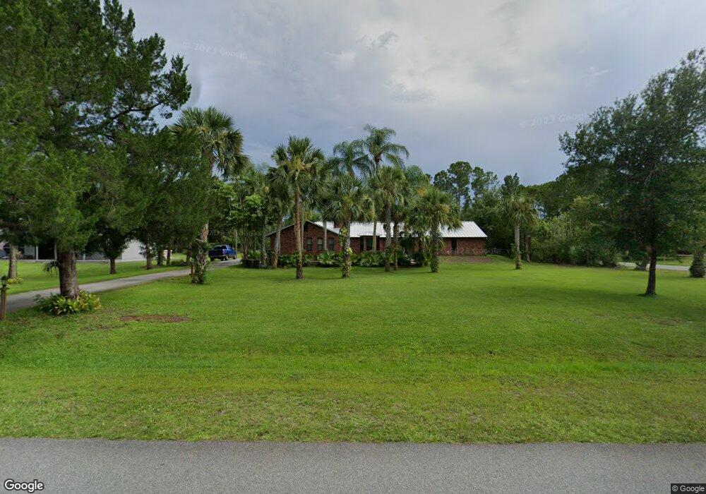
This home is located at 5195 Dalehurst Dr Unit 2, Cocoa, FL 32926 and is currently estimated at $558,803, approximately $223 per square foot. 5195 Dalehurst Dr Unit 2 is a home located in Brevard County with nearby schools including Saturn Elementary School and Cocoa High School.
Ownership History
Date
Name
Owned For
Owner Type
Purchase Details
Closed on
Oct 14, 2003
Sold by
Vanvuren Dirk L and Vanvuren Frances R
Bought by
Euziere Carter M and Euziere Morella L
Current Estimated Value
Home Financials for this Owner
Home Financials are based on the most recent Mortgage that was taken out on this home.
Original Mortgage
$159,000
Outstanding Balance
$75,418
Interest Rate
6.45%
Estimated Equity
$483,385
Purchase Details
Closed on
Feb 14, 2001
Sold by
Carlsen Daniel Joseph
Bought by
Vanburen Dirk L and Vanvuren Frances R
Home Financials for this Owner
Home Financials are based on the most recent Mortgage that was taken out on this home.
Original Mortgage
$172,900
Interest Rate
7.03%
Create a Home Valuation Report for This Property
The Home Valuation Report is an in-depth analysis detailing your home's value as well as a comparison with similar homes in the area
Home Values in the Area
Average Home Value in this Area
Purchase History
| Date | Buyer | Sale Price | Title Company |
|---|---|---|---|
| Euziere Carter M | $269,000 | -- | |
| Vanburen Dirk L | $192,200 | -- |
Source: Public Records
Mortgage History
| Date | Status | Borrower | Loan Amount |
|---|---|---|---|
| Open | Euziere Carter M | $159,000 | |
| Previous Owner | Vanburen Dirk L | $172,900 |
Source: Public Records
Tax History Compared to Growth
Tax History
| Year | Tax Paid | Tax Assessment Tax Assessment Total Assessment is a certain percentage of the fair market value that is determined by local assessors to be the total taxable value of land and additions on the property. | Land | Improvement |
|---|---|---|---|---|
| 2025 | $2,586 | $195,170 | -- | -- |
| 2024 | $2,540 | $189,670 | -- | -- |
| 2023 | $2,540 | $184,150 | $0 | $0 |
| 2022 | $2,378 | $178,790 | $0 | $0 |
| 2021 | $2,414 | $173,590 | $0 | $0 |
| 2020 | $2,333 | $171,200 | $0 | $0 |
| 2019 | $2,276 | $167,360 | $0 | $0 |
| 2018 | $2,275 | $164,240 | $0 | $0 |
| 2017 | $2,285 | $160,870 | $0 | $0 |
| 2016 | $2,311 | $157,570 | $35,350 | $122,220 |
| 2015 | $2,338 | $156,480 | $35,350 | $121,130 |
| 2014 | $2,342 | $155,240 | $27,780 | $127,460 |
Source: Public Records
Map
Nearby Homes
- 5175 Dalehurst Dr
- 2190 Winston Dr
- 2524 Trotters Trail
- 931 Unknown
- 4901 Talbot Blvd
- 4412 Talbot Blvd
- 5011 Dalehurst Dr
- 6341 Pony Cir
- 2635 Wagon Rd
- 4655 Rector Rd
- 1821 Saxton Rd
- 4900 Hidden Pine Place
- 365 Outer Dr
- 344 Outer Dr Unit 323
- 495 Outer Dr Unit 201
- 336 Horseshoe Bend Cir Unit 197
- 436 Horseshoe Bend Cir Unit 192
- 595 Outer Dr Unit 129
- 694 Outer Dr Unit 184
- 634 Outer Dr
- 5185 Dalehurst Dr
- Devonshire
- 5205 Dalehurst Dr
- 2065 Devonshire Ave
- 5190 Dalehurst Dr
- 5200 Dalehurst Dr
- 5215 Dalehurst Dr
- 5180 Dalehurst Dr
- 2070 Devonshire Ave
- 5210 Dalehurst Dr
- 2055 Devonshire Ave
- 2060 Devonshire Ave
- 5165 Dalehurst Dr
- 2050 Devonshire Ave
- 2125 Dale Ln
- 5225 Dalehurst Dr
- 2045 Devonshire Ave
- 2225 Winston Dr
- 2235 Winston Dr
- 2135 Dale Ln