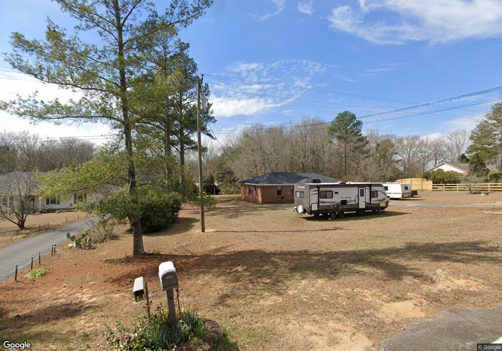
5199 Neals Mill Rd Dearing, GA 30808
Estimated Value: $104,000 - $350,636
1
Bed
1
Bath
650
Sq Ft
$380/Sq Ft
Est. Value
About This Home
This home is located at 5199 Neals Mill Rd, Dearing, GA 30808 and is currently estimated at $247,159, approximately $380 per square foot. 5199 Neals Mill Rd is a home located in McDuffie County with nearby schools including Thomson High School.
Ownership History
Date
Name
Owned For
Owner Type
Purchase Details
Closed on
Sep 5, 2003
Sold by
Klotz Chad Michael
Bought by
Green Carl Allen
Current Estimated Value
Purchase Details
Closed on
Mar 7, 2002
Sold by
Greene Roger
Bought by
Klotz Chad Michael
Purchase Details
Closed on
Sep 22, 1987
Bought by
Greene Roger
Create a Home Valuation Report for This Property
The Home Valuation Report is an in-depth analysis detailing your home's value as well as a comparison with similar homes in the area
Home Values in the Area
Average Home Value in this Area
Purchase History
| Date | Buyer | Sale Price | Title Company |
|---|---|---|---|
| Green Carl Allen | $172,900 | -- | |
| Klotz Chad Michael | $152,400 | -- | |
| Greene Roger | -- | -- |
Source: Public Records
Tax History Compared to Growth
Tax History
| Year | Tax Paid | Tax Assessment Tax Assessment Total Assessment is a certain percentage of the fair market value that is determined by local assessors to be the total taxable value of land and additions on the property. | Land | Improvement |
|---|---|---|---|---|
| 2024 | $3,250 | $126,918 | $9,740 | $117,178 |
| 2023 | $3,022 | $122,189 | $9,740 | $112,449 |
| 2022 | $2,823 | $108,382 | $9,740 | $98,642 |
| 2021 | $2,293 | $86,780 | $9,456 | $77,324 |
| 2020 | $2,130 | $79,541 | $8,620 | $70,921 |
| 2019 | $2,152 | $79,541 | $8,620 | $70,921 |
| 2018 | $2,152 | $79,541 | $8,620 | $70,921 |
| 2017 | $2,077 | $79,541 | $8,620 | $70,921 |
| 2016 | $2,077 | $79,541 | $8,620 | $70,921 |
| 2015 | $2,059 | $86,221 | $15,300 | $70,921 |
| 2014 | $2,063 | $86,221 | $15,300 | $70,921 |
| 2013 | -- | $88,647 | $15,300 | $73,347 |
Source: Public Records
Map
Nearby Homes
- 0 Whitaker Rd Unit 540660
- 2786 Tudor Rd
- 0 Adams-Reeves Rd Unit 523648
- 0 Adams Chapel Rd
- 4062 Horsham Trail
- 4327 Iron Hill Rd
- 3946 Radford Gay Rd
- 2135 Fort Creek Rd
- 290 Neals Mill Rd
- 2111 Fort Creek Rd
- 259 S Main St
- 122 First St
- 833 Sweet Grass Cir
- 832 Sweet Grass Cir
- 830 Sweet Grass Cir
- 854 Sweet Grass Cir
- 818 Sweet Grass Cir
- 864 Sweet Grass Cir
- 814 Sweet Grass Cir
- 812 Sweet Grass Cir
- 5189 Neals Mill Rd
- 5231 Neals Mill Rd
- 6201 Mattie Harrison Rd
- 5171 Neals Mill Rd
- 5212 Neals Mill Rd
- 5178 Neals Mill Rd
- 5238 Neals Mill Rd
- 6125 Mattie Harrison Rd
- 6164 Mattie Harrison Rd
- 0 SE Washington Dr
- 6112 Mattie Harrison Rd
- 4993 Washington Dr
- 4998 Washington Dr
- 5124 Jones Rd
- 6065 Mattie Harrison Rd
- 5343 Neals Mill Rd
- 6043 Mattie Harrison Rd
- 4923 Washington Dr
- 5035 Neals Mill Rd
- 5042 Washington Dr