Estimated Value: $549,720 - $777,000
Studio
--
Bath
1,408
Sq Ft
$492/Sq Ft
Est. Value
About This Home
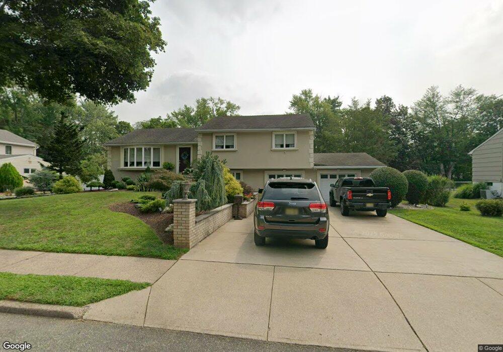
This home is located at 52 Andover Dr, Wayne, NJ 07470 and is currently estimated at $693,180, approximately $492 per square foot. 52 Andover Dr is a home located in Passaic County with nearby schools including Lafayette Elementary School, Anthony Wayne Middle School, and Wayne Valley High School.
Ownership History
Date
Name
Owned For
Owner Type
Purchase Details
Closed on
Jul 25, 2003
Sold by
Bonanni Irene
Bought by
Vlahos John
Current Estimated Value
Home Financials for this Owner
Home Financials are based on the most recent Mortgage that was taken out on this home.
Original Mortgage
$250,000
Interest Rate
5.89%
Purchase Details
Closed on
Apr 9, 1998
Sold by
Bonanni Rocco and Bonanni Irene M
Bought by
Bonanni Rocco and Bonanni Irene M
Create a Home Valuation Report for This Property
The Home Valuation Report is an in-depth analysis detailing your home's value as well as a comparison with similar homes in the area
Home Values in the Area
Average Home Value in this Area
Purchase History
| Date | Buyer | Sale Price | Title Company |
|---|---|---|---|
| Vlahos John | $460,000 | -- | |
| Bonanni Rocco | -- | -- |
Source: Public Records
Mortgage History
| Date | Status | Borrower | Loan Amount |
|---|---|---|---|
| Previous Owner | Vlahos John | $250,000 |
Source: Public Records
Tax History
| Year | Tax Paid | Tax Assessment Tax Assessment Total Assessment is a certain percentage of the fair market value that is determined by local assessors to be the total taxable value of land and additions on the property. | Land | Improvement |
|---|---|---|---|---|
| 2025 | $12,778 | $214,900 | $108,900 | $106,000 |
| 2024 | $12,288 | $214,900 | $108,900 | $106,000 |
| 2022 | $12,150 | $214,900 | $108,900 | $106,000 |
| 2021 | $12,138 | $214,900 | $108,900 | $106,000 |
| 2020 | $12,084 | $214,900 | $108,900 | $106,000 |
| 2019 | $11,850 | $214,900 | $108,900 | $106,000 |
| 2018 | $11,744 | $214,900 | $108,900 | $106,000 |
| 2017 | $11,637 | $214,900 | $108,900 | $106,000 |
| 2016 | $11,474 | $214,900 | $108,900 | $106,000 |
| 2015 | $11,336 | $214,900 | $108,900 | $106,000 |
| 2014 | $11,016 | $214,900 | $108,900 | $106,000 |
Source: Public Records
Map
Nearby Homes
- 16 Lawrence Rd
- 22 Woodlot Rd
- 116 Carol Place
- 20 Dwight St
- 20 Maljim Ct
- 14 Weinmanns Blvd
- 761 Valley Rd
- 18 Harwood Place
- 4 Highfield Ct
- 17 Clifford Dr
- 77 Garside Ave
- 70 Weinmanns Blvd
- 14 Louisa Ct
- 102 Garside Ave
- 4 Michele Ct
- 30 Corvair Place
- 15 Littlewood Ct
- 90 Birchwood Terrace
- 6 Sherry Ct
- 61 Carlisle Rd
Your Personal Tour Guide
Ask me questions while you tour the home.