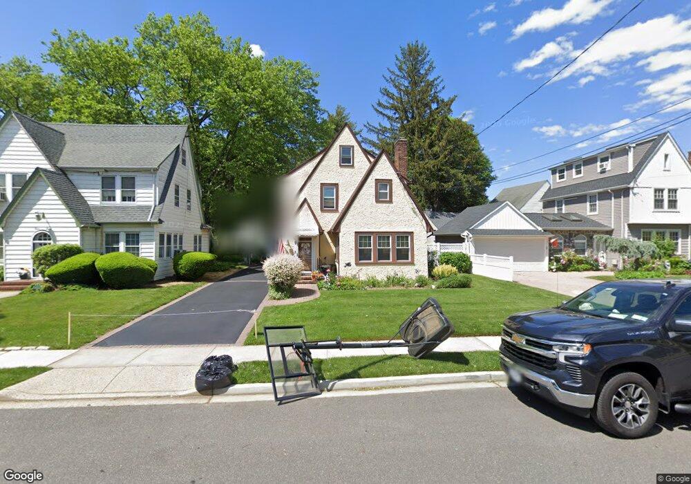
52 Argyle Rd West Hempstead, NY 11552
Estimated Value: $679,393 - $852,000
Studio
2
Baths
1,712
Sq Ft
$447/Sq Ft
Est. Value
About This Home
This home is located at 52 Argyle Rd, West Hempstead, NY 11552 and is currently estimated at $765,697, approximately $447 per square foot. 52 Argyle Rd is a home located in Nassau County with nearby schools including The Academy Charter School, Crescent School, and Sacred Heart Academy.
Ownership History
Date
Name
Owned For
Owner Type
Purchase Details
Closed on
Dec 7, 1999
Sold by
Patterson Rodney and Patterson Catrina
Bought by
Mcshea Christopher and Vonderlinden Stephanie R
Current Estimated Value
Home Financials for this Owner
Home Financials are based on the most recent Mortgage that was taken out on this home.
Original Mortgage
$189,000
Outstanding Balance
$54,949
Interest Rate
7.8%
Mortgage Type
Purchase Money Mortgage
Estimated Equity
$710,748
Purchase Details
Closed on
May 24, 1995
Sold by
Dieguez Richard and Dieguez Rita
Bought by
Patterson Rodney and Patterson Catrina
Home Financials for this Owner
Home Financials are based on the most recent Mortgage that was taken out on this home.
Original Mortgage
$143,450
Interest Rate
8.21%
Create a Home Valuation Report for This Property
The Home Valuation Report is an in-depth analysis detailing your home's value as well as a comparison with similar homes in the area
Home Values in the Area
Average Home Value in this Area
Purchase History
| Date | Buyer | Sale Price | Title Company |
|---|---|---|---|
| Mcshea Christopher | $220,000 | -- | |
| Patterson Rodney | $151,000 | -- |
Source: Public Records
Mortgage History
| Date | Status | Borrower | Loan Amount |
|---|---|---|---|
| Open | Mcshea Christopher | $189,000 | |
| Previous Owner | Patterson Rodney | $143,450 |
Source: Public Records
Tax History Compared to Growth
Tax History
| Year | Tax Paid | Tax Assessment Tax Assessment Total Assessment is a certain percentage of the fair market value that is determined by local assessors to be the total taxable value of land and additions on the property. | Land | Improvement |
|---|---|---|---|---|
| 2025 | $12,919 | $444 | $159 | $285 |
| 2024 | $3,860 | $452 | $162 | $290 |
Source: Public Records
Map
Nearby Homes
- 91 Bedell Ave
- 39 Hilbert St
- 170 Ivy St
- 60 Long Dr
- 30 Cathedral Ave Unit 6B
- 36 Cathedral Ave Unit 2C
- 22 Mulford Place Unit 2D
- 22 Mulford Place Unit 6C
- 181 Oak St
- 32 Cathedral Ave Unit 6c
- 197 Ivy St
- 24 Mulford Place Unit 4B
- 35 Mulford Place
- 179 Fairlawn Ave
- 253 William St
- 14 Parsons Dr
- 82 Hilton Ave
- 24 Parsons Dr
- 144 Hilton Ave
- 60 Parsons Dr